Monday, April 29, 2013

Another Round of Southerly Flow for Mid Week.

ANd you know what that means, don't ya?  Fog is in the forecast.  But we are expecting a carbon copy of today before that happens.  And how was today?  Kind of brilliant, I'd say.  Woke up to warm sun shine at 6:20 in the morning and made the quick decision that today would be a beach day.  With NW winds blowing on the open coast, we opted to hide behind Pleasure Point and spend the low tide morning on the beach in front of the hook.  While longboarders made the best of a meager, but very clean, swell, we focussed on our sandcastle techniques.  Tuesday should have a sunny morning, with highs back up in the mid 70s.  But hump day is looking a bit grey.


Looking down the Palm to Pine Highway near Palm Desert.  Can you tell were the irrigation begins?

South flow returns overnight on Tuesday, as another thermal trough pushes up from our south. bring with it a grey scape.  Highs will drop back down into the upper 60s.  But this one looks a bit more short lived than the last.  Only a day of the serious fog, and even that might not last through the late afternoon.  Good news for the surf crowd, as this weeks south swell looks to start to really show on Wednesday.  Currently, it looks like the sun and the upper 70s will return to finish out the week on Thursday and Friday.  Light winds last through Friday, but we could see a return to the stronger NW flow for the weekend.  Good news is the warmth sticks around for Saturday, then we move into a cooler pattern for Sunday and to start the following week.  So far so good as we begin fog season.  But it is still early.  Let's hope for a solid summer.

Saturday, April 27, 2013

Grey Matter.

Sure, yeah, I know, most people use that term to refer to the brain.  Still, here I am referring to the sky, which is far from blue.  Full summer pattern is here for the weekend.  At least for today.  And likely tomorrow.  That does not mean that things are not going to be pleasant this weekend.  Hell, it feels like summer.  Marine layer is for real, hugging most of the coast from the state's northern border, right down through at least Big Sur.  Some spill over is happening in the north and east bay, but over the hill should be warming up nicely with abundant sunshine.  This will break here around noon or so.  We should see upper 60s to low 70s today and Sunday.  Looks like next week is a winner though.


Okay, so it is still wintery in the high country.  But not for long.  Kirkwood Cirque from Caples Lake.

High pressure is a firmer footing over us for the work week and we begin to see rising temperatures and more sunshine.  Right now it looks like the fog will be held at bay starting Monday.  Mid 70s Monday moving into the upper 70s Tuesday.  A swift, moisture-less, cold front way to our north could push the highs back down to about 70 for Wednesday, but expect a quick up tick to finish out the work week.  Don't be surprised if we see 80F some point next week.  Again, a great period for getting your garden going.  Don't hesitate.  The long range shows no cold air pouring in.  Winter is basically over.  Lay your summer plans.

Thursday, April 25, 2013

Damned Fog

I pretty much got that fog report all wrong, so I'm not sure why you keep coming back here.  Honestly, in my defense, this is a hard thing to forecast, especially when we are right on the border between awesome sunshine and stagnant grey.  Tuesday stayed socked in through the day, with just a few breaks of blue here and there through town in the afternoon.  Around 4PM on Wednesday, the fog abruptly pulled out, and no winds built up from the north west giving way to a spectacular evening in Santa Cruz and up the coast.  The ocean was glass, allowing the small south swell to give up its best version of waves.  Thursday morning is crisp, clear and warming up already at 8AM.  Sun should persist through the day, but we will need to keep an eye on the winds.  While they are not forecast to build too much, we could see them develop out of the WNW this afternoon, giving us a slight chill.  High today of almost 70F, depending on that wind.


This desert bunnie is no dummy.  He and a few thousand of his buddies rule this golf course.  Palm Dessert, CA.

Fog is not completely out of the picture though, camped out just to our south.  We could see it develop this evening and linger on the coast Friday morning.  A little warmer tomorrow even with the moderate NW wind expected in the afternoon.  Beaches will feel chilly with the breeze.  The weekend is looking nice.  Mid to upper 70s in town, low 70s on the beaches.

more updated later today.  my boy is on my lap

9AM EDIT:  Fog hanging out in the bay.  Can't see Monterey.  Don't expect too much of a warm up today and decent chance that grey could inch back north just like on Monday.  More this afternoon.

Forecast Continued...

Okay.  I'm back and he is kind of napping.  Anyway, fog has moved around us and is clinging to the coast from Marin north.  The two pressure systems are still kicking this thing around, so winds are light to moderate with a southerly flow.  Cool moist air is just off our coast.  Expect the fog to move in tonight and then high pressure taking a firm grip on Friday kicking the marine layer to the curb for a few days.  Right now it looks like mostly sunshine with perhaps a few select areas seeing a touch of morning fog Saturday.  Low to mid 70s.  Sunny and mid 70s on Sunday, warming to upper 70s or even 80F by Wednesday.  Looks like a good run.  And a good time to get seeds or seedlings into the ground.    I know I bought two tomato plants yesterday.  Plan to pot up slowly and grow in a half barrel on my deck.  Yard is still not ready for planting this season, but I've got a nice sunny spot just outside the kitchen door that should provide.

Anyway, after another morning or two of fog, sun for the weekend and next week.  Enjoy this.

Monday, April 22, 2013

Battle for the Coast.

It may not seem like it, but there is a pretty good battle going on between a dominate high pressure to centered to our north driving in warm and dry air.  Feels nice, eh.  Gonna be in the 80's again today.  It feels a bit chillier than yesterday me, though it is expected to be warmer.  Regardless, it is pretty nice out there.  Down just a bit south of us a thermal trough is pushing north and building strength.  Instead of warm and dry, it is cool and damp.  Like marine layer damp.  On the satellite you can see the coast is socked in south of Pt. Sur, and you can see it sitting in the the middle of Monterey Bay when you look from West Cliff.  It is pretty much right there.  Right now, it looks like a little give and take over the next few days.


Heavenly is now closed for the season.  Nevada side.

Expect a little fog on the immediate coast Tuesday morning.  But our high pressure is not done yet, so we should see a quick burn off and decent warm up.  Just about 80F downtown.  Model runs suggest that Wednesday we could be spared the fog and warm back up to the low 80s.  But the trough wins out by Thursday morning with a decent dose of fog an a high struggling to reach 70.  By Friday and the weekend high pressure should bounce back, but with highs only in the mid to high 70s and a decent amount of afternoon breeze.  Kind of typical spring like weather.  All in all it could be a fun week for surfing with the winds mostly calm in the mornings and light in the afternoons.  Maybe I won't get out on that bike ot check the trails for ya'll this week.

Ski resorts in Tahoe pretty much closed down this Sunday.  Alpine is thinking of opening one more weekend.  Mammoth is going until Memorial Day.  Snow will pretty much be gone before then.  And if you are thinking of touring around KW this spring, they just announce that they are banning it.  So you might want to go else where.  Anyway, if you you still want to make turns this season, the window is closing.

I'll keep an eye on this week's trend and report back for ya.  If you are like me, you don't want to miss the better beach days.  My son and I hit up 4 Mile this morning and the beach combing was pretty awesome.

2PM EDIT:  That fog has now rolled into town in Santa Cruz.  It filled in across the bay, and is now up to about Mission Street on the West Side.  Looks a little less foggy on the East Side.  Would not be surprised if Pleasure Point is still sunny.  But it should fill in the nooks and crannies this evening.  And I knew it felt a bit chillier than yesterday.  Bet it was just that cool air pouring up the coast.  Interesting weather.  Anyway, doubt this stuff will spill over the hill, so you folks should be toasty through the week regardless.

Friday, April 19, 2013

The Last Hurrah.

We had a decent little system come through California last Tuesday.  Down here in Southern California is was very windy in the desert.  Pulling into Palm Springs on Sunday evening, we could barely see 30 yards ahead of us due to blowing dust.  That same wind ushered in cool and wet airmass to some parts of the state.  Kirkwood got a foot of snow Monday night into Tuesday.  I was walking down to the beach in the rain just south of San Clemente early on Tuesday morning.  It was not too much suffering, as the sun soon came out, and a decent south swell was hitting the cobblestones.  That decent little system may have been the final throes of a winter that really dies out just after the start of the new year. Bottom line is that you best begin watching your water usage and conserve as much as possible.  Expect restrictions come summer.


Still snow up at Kirkwood.  The Cirque is always closed, but still looks fun.

Looking ahead things are looking fairly placid.  The winds from early in the week have mellowed, and air temperatures are on the increase.  The north west winds will see a bump up on Saturday, so expect gusty conditions returning along the coast and across ridge tops.  Still, not quite like Monday and Tuesday.  That should subside a bit Sunday and more so on Tuesday.  We are clearly in a spring mode now, so you can expect a fair amount of afternoon see breeze on any given day.  Sunshine and warmth will be the name of the game.  In town, expect low to mid 70s today, building to the upper 70s by Sunday.  We could very well hit 85F on Monday, which will be the peak for the period.  Based on what I am seeing on the charts, the marine layer should be held at bay.  Still, I'll be in SoCal until Sunday, so I can't really look out my window to get any visual clues.  After Monday, things begin to cool off back into the 70s for mid week and the upper 60s by the end of next work week.  Pleasant weather through out with sun being the name of the game.  Wear some sunblock if you go out to play.

The decent south swell we saw arrive earlier this week will be gone ofter today's small remnents pass through.  Not much on tap for the weekend other than some small weak wind swell and some very small and very steep south.  By Monday things should start to get a bit better with a series of small to moderate souths filling in.  Wednesday is looking to be the peak day with chest to head high surf at southerly exposures.  The north Pacific is shutting down for the most part, but there are still some smaller, weaker systems moving through that could end up sending us some mid period swell.  Don't hold your breath though.  Try to get out early if you plan to hit the exposed coast, as those spring time winds will be picking up early most days.  Ski resorts close down after this weekend in Tahoe, but if you feel a need to get some lift served turns in, Mammoth will be open until Memorial Day.  And those mountain passes should open up soon.  And finally, word is that the mountain biking is really good in Tahoe right now with the snow melting off and the trails smooth and tacky.  I'll try to get out next week around Wilder and get some first hand opinions on the single track near home.

Thursday, April 11, 2013

Get those Plants in the Ground.

So much, so much.  Remember that chance for a rainy week starting around the 15th?  Just like every storm this year, that scenario has shifted north.  More fair warm weather in our future.  Here are the details folks.  So yesterday was toasty for sure with a super warm morning before the afternoon breeze kicked up.  Even with the wind if was nice out there.  What a day.  Temps drop a tiny bit today with highs hovering in the upper 60s.  Slight rebound on Friday and expecting a good 70 in town and 80 up by Felton.  Inland empire should be starting to heat up.  Saturday looks like a real nice one, hanging out near Friday's high, if just a touch south.  Sunday we could see some more strong winds developing as another storm sets up an inside slider system.


Duck Camo.  Neary Lagoon, Santa Cruz.

Right now it looks like the precip will be east and north of us, but cooler air moves in Sunday with highs dropping into the mid or even low 60s.  With that added wind we will feel the chill.  The Tahoe region could see light snow showers late Sunday into Monday and even Tuesday morning.  In Santa Cruz expect highs in the low 60s with maybe some over riding clouds.  But expect some sun as well.  As we move into the week we see the start of more warmth, and then maybe a early summer like pattern.  I think, as of now, that weak low pressures spinning off the high up into the Gulf of Alaska will keep the marine layer from forming just yet.  Fingers crossed on no fog.  It does not look like we will have prolonged rain event.  Heck, it does not look like we will have a rain event at all on the coast.

Even if the rain comes, it looks to be mild and light.  Now is a great time to get some plants in the ground.  Nights are still cool, in the mid 40s, so hold off on the eggplant and peppers and even tomatoes, unless you have some sort of floating row cover.  But the ground is not yet completely dry.  Well, at least it is the wettest it will be all season.  But days are warm, and the sun not yet in high burn mode.  Seedlings can love this weather, and it looks like we may have two weeks of it on tap.

Surf is going into spring mode as is snow.  Smaller surf in the chest/head high range, getting smaller through the first part of the weekend.  Some more moderate swell arrives on Sunday with a decent long period south filling in Monday or Tuesday.  Strong north west winds.  Great if you like holding on to a kite.  Get out of the wind next Wednesday to get the most of the south swell.  Expect head high plus in town.  Snow is still holding up, but the resorts are closing down.  A lot finish up this weekend.  Snow is solid above 8000 feet, so choose your route accordingly.  I lucked into some nice powder on Tuesday, but expect spring conditions on tap this Saturday, though Sunday could see some icy conditions with the winds.  Get out before its gone.

Monday, April 8, 2013

Easy Breezy.

Actually, very strong breezy.  I'm sure you feel it.  Sorry I did not warn you, but I just did not get up to post once I saw it coming.  Came up yesterday afternoon around 2PM.  Within in an hour it went from a light wow coastal breeze to a gale force nnw wind.  Geez.  Not much rain fell last night and on the west side we had exactly none as of 4AM when I drove up to the Sierra.  Snow in the hills and that lasted most of the day with the sun coming out around 4PM or so.  Strong NE wind up here and strong NNW wind down there should continue through Tuesday.  But it is not cold with mid 60s today and low 70s Tuesday.  Yeah, low 70s even with a 25 knot wind.  That ain't half bad.


Wednesday point forecast for downtown is reading at 76F.  Should be toasty as the winds should be lighter.  That will be the peak of the heat, but low 70s and upper 60s will fill out the week.  Looks like spring is here folks.  Models are starting to back away from the wet solution for next week, so this could be the end.  Not a spectacular winter, and had we not had the torrents of December we would be in a serious drought.  Start thinking about conserving water this summer.  And stay tuned, as we could see a change at any time.  There was even hints of some showers for Thursday, but that has moved on. Get ready for some great weather.  Even the weekend is looking to shape out nice.

Thursday, April 4, 2013

Hanger-ons, then, could I please get a Warm Up?

If you ever frequented diners in the north east, and someone at your table was drinking coffee, I am sure you must have been asked if you'd like a warm up.  Well it is on its way perhaps, but we need to get through a few days of hanger ons.  Clouds that is.  And some showers.  Today arrived wet and we even had a few hours of moderate rain out there this morning.  It felt pretty good.  And it was a warm rain.  Clouds linger through the day today and it does not look like we will see much of the sun.  The hope for sunshine on Friday is mostly hope.  Sure, we will see some, but bet on a good deal of morning clouds, with slow clearing.  Not quite as nice as I was expecting earlier this week.  Still, we should not see any rain on Friday, just lingering clouds.  Saturday looks about the same and actually may turn out to be mostly sunny.  Keep the fingers crossed.

Derby Park Grind.  Just another day in Santa Cruz.

Another system will be upon us Sunday.  Actually, it will be upon the PNW who will again get a hefty helping of snow.  Tahoe should only see a few inches and with a lot of luck, select spots could get a foot.  Today it is mostly rain below 8K, so go up high if you are seeking the fresh on Friday.  Sure feels like spring is upon us folks.  What ever happened to winter.  I know some folks are saying the long term is suggesting a chance for low pressure dominating, but we have been hearing that all winter.  I don't trust the long term very much this year as the models have been pretty much off the mark.  Anyway Sunday should see some drizzle and slightly cooler temps.  That could linger into Monday morning before clearing.  And here is the ringer.  Warmth is coming.  Tuesday could be in the 70s and there is talk of breaking into the 80s in certain spots around the bay on Wednesday.  Seriously.  Get your gardens ready folks.

Wednesday, April 3, 2013

Rain Coming Overnight. Weekend still has Variable Forecasts.

Everyone is pretty much on board with rain filling in over night around the region.  This one is coming in from the west, so everyone should see rain around the same time.  I'd expect it just after night fall, but watch that sky.  We could see some as early as late afternoon, or for your evening commute.  Get out today to play around though, as it should be another wonderful day with sun once the fog burns off with a high in the mid 60s.  Thursday should be a wet morning, so make plans to get inside some where, or put one your stompers and a rain coat.  Still, it stays pretty warm, with highs around 60.  Clearing by afternoon along the coast, and evening inland.  The weekend is starting to look to start out pleasant, with chance of showers by Sunday.


Turns out this here is an American Coot.  Now I have more words to teach my son.  He was saying "duck."

Sunny on Friday with some high clouds clearing out.  Highs return to the mid 60s.  Currently Saturday is expected to be the same.  Clouds fill back in through the evening with showery weather expected for Sunday.  By Monday we should be returning to sunshine and high pressure that looks to last the week. Just want to note that both these systems are closed off lows and have little to no jet influence, meaning they can wander and shift directions pretty easily.  The weekend system approaches from the north, so Marin could be seeing rain as early as Saturday and pick quite a bit more up.  Also, with a shift of a few hundred miles in one direction or the other, we could skip the showers all together or get a hell of a lot more, and cold air to boot.  Keep an eye on it.

Tuesday, April 2, 2013

A Challenging Week for Weather, Actually...


As I look out over to the Santa Cruz mountains behind Aptos, thick, puffy, yet wet looking clouds are all piled up.  Above me it is clear blue sky.  And relatively warm.  Not like the pumped up warmth of awesomeness we saw back in February, but like the spring sun warming up an otherwise mild air mass.  Note, it is not a cold airmass.  And we won't see something like that through at least the duration of the work week.  In fact, most recent runs of the mid terms keep us from feeling much of any cool down, even though we will see dropping storms by Sunday.  Today, Monday, we have another great day on tap.  Again we had rain over night, but like Easter, the day itself is pretty dry.  At least here in Santa Cruz.  Over the hill, and inland, showers are still popping up.  We did have a little grey to start today, and that is going to be the theme through Wednesday.  Foggy mornings, with a slight warming trend. Mid 60s today, High 60s, and maybe a 70 for humpday.  Then Thursday, things return back to that wet weather.


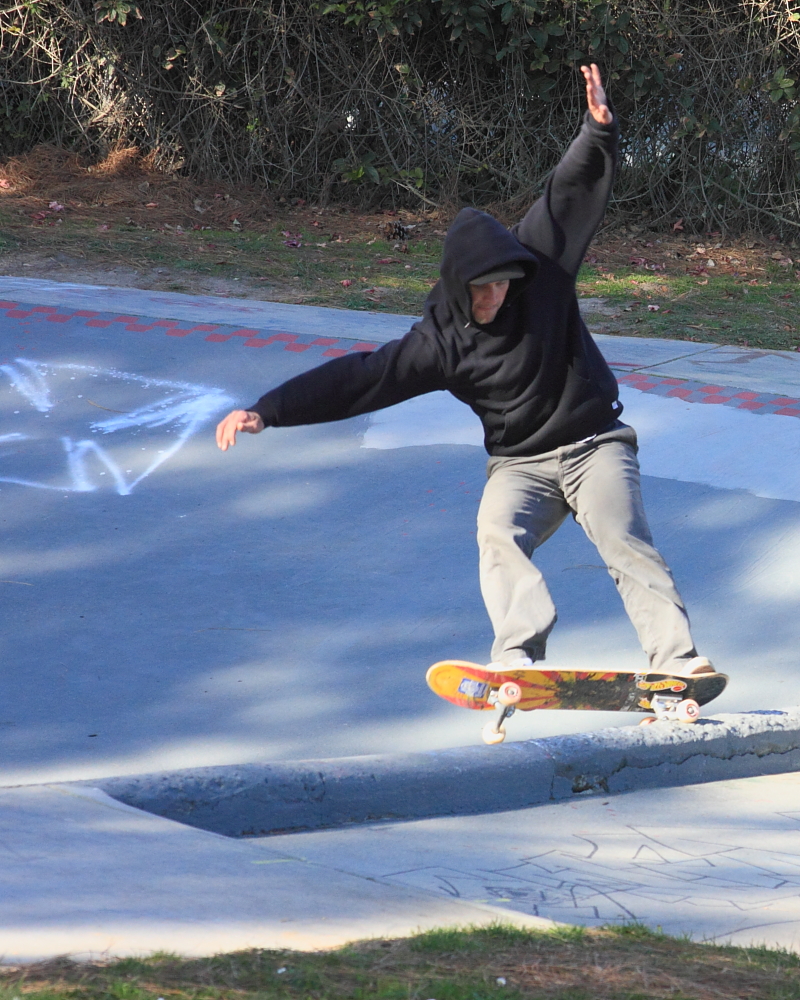
Had an Easter stroll in Neary Lagoon.  What a great place to hide from the spring wind and enjoy the sun's warmth.

If we keep having the same luck that would be great.  I could handle overnight rains for a few months, keeping the soil moist, but giving way to sunshine and warmth for the day.  But hey, you can't order that.  Warm storm for Thursday, with light to moderate rain showers into the evening.  Right now, Friday looks like a clear day between system, but I would bet on a chance of showers.  For the coming weekend, a storm tries to push its way south from BC.  Depending on how this works out for it, we could see anything from high passing clouds and chance of showers, to cold, moderate to heavy rain.  Today's run leans toward the first scenario.  Regardless, this system to be watch for the weekend into Monday.  As it stands now, a rebound of high pressure for Tuesday.  Eerily similar to last week's forecast.  Seriously.

Kirkwood got some snow.  A foot or so.  Same for Sierra.  Much less north of the lake.  Won't really make a difference, as that will all get baked in this week.  Might get a refresh with these next systems, or just sucky  weather.  Let's hope for the first, some more snow and water reserves.  Out on the ocean, small waves this week.  First a northwest swell and then a south for Friday and the weekend.  If you are learning, this is a great week to be out there.  Just enough waves to figure it out, but not so much to beat you up.  Too much.  And if you garden, it is good time to get on it.  Sorry, I have not posted much about this the past year, but I am in transition.  Moved to a new home last April, and am still in the (slow) process of preparing the land.  Hope to get at least a small bed going this summer.  But you best start thinking about your tomatoes if you plan to have some.  Find some seedlings, acclimate them to you locale, and prepare your ground.  We may have a cold April, but my guess is we are solidly into spring.  I saw geese last week.  Going north.