Santa Cruz had clouds by late morning yesterday and light drizzle began in the early afternoon. Heavier rains came in late in the evening and it got a bit heavy over night. This slider came from a pretty perfect angle to maximize moisture, hanging just over the coast and shifting inland right over the Bay Area. The mountains did get them selves a bit more than a resurfacing, and Kirkwood is reporting 10-14" of new snow. A little more on the way today. Not a bad day to be up in Tahoe.
This morning is dark and gloomy here on the coast, and it has been lightly raining most of the morning so far. Rain should decrease as the day goes on, and perhaps those clouds will begin to break a bit and offer up a nice sunset. Not a bad day to get some work done inside, go to a matinee or just cozy up. If we are lucky, we may have nice weather in the late afternoon for a stroll. This could be a great time to go for a walk in the Pogonip or Muir Woods. You really get that red wood coastal mist forest feel.
Tomorrow we expect to wake to clear skies and cooler temperatures. The week will very slowly warm up. There is the expectation for cold weather to remain in the mountains with day time highs in the low 30s most of the week. This is the result of cold arctic air pushing in from the east. This air should not effect the coast too much, as the crest will keep it to our east. Unless, of course, it does not. Regardless, this cold air mass so close to us will slow any warming trend. Winter is back. At least it will be mostly sunny this week.
The PNA is moving picking up speed in moving negative, and our lovely high pressure is to retrograde through this week. Some time next week we can expect the jet to punch through and bring back our steady tap of rain and snow. The January thaw is coming to a close. I hope you enjoyed it while it lasted.
Sunday, January 30, 2011
Saturday, January 29, 2011
Rain is a Coming. Cooler and Wetter with each Model Run. Fair Next Week. For a While.
Just as stated. Expect a cool and wet day for tomorrow. This morning's run brings up to an inch of water over the Bay Area hills, heaviest in Marin. Still 3-6" of snow at lake level, up to 9" above 7000 feet and a bit more at the crest. Temperatures have already begun to cool, with yesterday's high much lower than earlier in the week. Today, Saturday, should be even cooler. Clouds move in this evening, with a slight chance of showers. Heaviest rain should be before noon on Sunday. You may be able to sneak in an afternoon walk.
 Sunday should be the coldest day of the coming week, with highs in the mid 50s at the coast and just about 32F in the high Sierra. This storm system is still fairly small and swift moving; we should begin to see clearing as early as Sunday evening. Monday and the rest of the week should remain clear. The high pressure ridge we have had for the past few weeks will have a difficult time setting back up though, and the week will remain cool through at least Wednesday, with only a slight increase in temperatures. Thursday and Friday should see Bay Area temperatures move back into the low to mid 60s. Once again, warmest in spectacular Santa Cruz.
 It looks like the following weekend should remain fair and warm. We will need to keep an eye on the models, as the teleconnections and patterns are beginning to change. We should be in a different pattern by mid month. Get out side and enjoy our nice weather while you can. Forecasters are expecting for us to make up for the recent lack of winter. Typical for a La Nina year is colder than average temperatures. While we got a feel for that in November and December, we have been in a reprieve this entire month. Get ready to buckle down.
 Sunday should be the coldest day of the coming week, with highs in the mid 50s at the coast and just about 32F in the high Sierra. This storm system is still fairly small and swift moving; we should begin to see clearing as early as Sunday evening. Monday and the rest of the week should remain clear. The high pressure ridge we have had for the past few weeks will have a difficult time setting back up though, and the week will remain cool through at least Wednesday, with only a slight increase in temperatures. Thursday and Friday should see Bay Area temperatures move back into the low to mid 60s. Once again, warmest in spectacular Santa Cruz.
 Speaking of Santa Cruz, you can still enjoy the surf and butterflies this coming week. If you find your self down this way, I do suggest a stop at Lighthouse Field. You can take a stroll, get some fresh air, see the Monarchs and watch the surfers. Not bad for a twenty minute outing before dinner. Time it right and you may even be able to enjoy a spectacular sunset this evening with the incoming storm.
 It looks like the following weekend should remain fair and warm. We will need to keep an eye on the models, as the teleconnections and patterns are beginning to change. We should be in a different pattern by mid month. Get out side and enjoy our nice weather while you can. Forecasters are expecting for us to make up for the recent lack of winter. Typical for a La Nina year is colder than average temperatures. While we got a feel for that in November and December, we have been in a reprieve this entire month. Get ready to buckle down.
You still have a good window for getting some lettuce (or kale) in the ground, as next week will not be all that cold; there will still be plenty of sun as well. But your window may be closing. The PNA is still forecast to go negative and the NOA positive; if that comes to pass, the storm doors will open. No young plant really enjoys an open storm door. And in general, get your yard and outdoor projects in order over the coming week.
Friday, January 28, 2011
Rain and Snow Likely on Sunday. Sun Returns for Monday.

Now I do not want to get anyone too excited. This is not part of a pattern change, rather just an insider slider. Starting to look like a hefty one at that. The late morning models are suggesting up to 3/4" of rain in the Santa Cruz mountains and an 1" along portions of the Sierra Crest. This is a big increase since yesterday's models and Thursday's suggested we would stay dry. The how far south it dives along the coast, before shifting inland, will determine amounts of precipitation and how cold the air gets. Expect about a 10 degree drop in temperatures, perhaps a bit more. A pretty solid rebound is expected on Monday and Tuesday, but it will not warm up as much as this past week. As for the central valley, fog looks to get knocked out on Sunday and Monday, but fill back in on Tuesday. They are having a rough winter; it was 39F and foggy at the Sacramento airport this morning. Brrrr.

 This past week was some very nice weather surfing indeed. Waves were going off all over Santa Cruz county. Steamer Lane attracted the usual crowd of rippers putting on a show and viewers enjoying every minute of it. Up the coast, the waves were a bi bigger, a bit meaner and a bit of paradise. The blessed combination of good swell and calm winds has come to an end though. A NW breeze started picking up today around noon. Swell is still overhead today, and continues to settle. A new, potentially larger swell is due to arrive Sunday evening into Monday, but will be plagued by strong NW winds as the high pressure moves back into the area. Winds and swell moderate through the week as day time highs move back into the mid 60s.
 Chance of snow. How much is still up in the air. The reasonable talk is for 3-6" of the white stuff, starting late on Saturday and snowing more steadily Sunday and Sunday night. Saturday morning will still be above freezing, and how soft the snow gets before the cold air arrives all depends on timing. Sunday may ski well, but it will pretty solid under a light layer of new snow. Stick to some groomed runs, or gullies that will capture a bit more snow. We would need a good foot of snow to make a legitimate powder day, but even a few inches could set us up with a nice resurfacing.
Pattern change still looks likely around the 7-9th of the month. There have been a few systems showing up on the charts, but no real break through of the jet. The long range keeps changing in details, but some variation of a low pressure system is looking to take form. It may be our turn and the East can get a little reprieve from the cold an snow. They are having the winter of a decade over there right now. And that has afforded us our great winter weather.
Interesting finds at the local market. Tomatoes. Not like the pinnacle of summer tomato, but a nice find indeed. Great on pizza. I also tried a greenhouse tomato the was grown in Pioneer, in the Motherlode. Sweet enough for a salad. I was impressed. Cedar Mills Ecofarm has an interesting set up, heating their greenhouses with low value forest clippings (read branches and stuff). Pretty cool. Still found a few nice apples, a cucumber (I mean, come on!) and some nice dates. Along with the usual winter fare.

Wednesday, January 26, 2011
The Week Remains Warm and Clear. Cooling for the Weekend.
 Did you get outside yesterday? I sure hope you did. It was toasty. More of the same (and perhaps a bit warmer) today and tomorrow. If you really want to get into some heat, head into the Santa Cruz mountains around Felton. They are expecting mid to high 70s today. Santa Cruz is forecasted for the low 70s the next two days. Slightly cooler in SF and around the bay. And get it while it lasts. Because all good things do come to an end. And besides, we need some rain.
Cooling should begin on Friday, which the real change occurring over the weekend. Still, it is remain warm and sunny for the most part, with high temperatures dropping 5-10 degrees through the weekend. A slight rebound is expected through the first half of next week. Low temperatures hover in the high 30s to low 40s throughout the bay area. In the interior, fog continues through this week, but may be displaced by sun by next Monday.
The next system of interest is scheduled for Sunday afternoon into Monday. Currently the track is for the storm to remain well north of our forecast area. We will continue to watch closely, as a slight shift in our high pressure to the west will allow this system to slide over us and bring rain and additional cooling. We can expect to see at least a few high clouds over the area late Sunday. Greatest chance of precipitation is to the north east. Tahoe and the mountains have a slight chance of precipitation and perhaps a dusting of new snow.
 Surf continued well over head on Monday and dropped significantly on Tuesday. Yet, it did not go away completely. We are expecting the arrival of a new overhead swell today that will fill in and remain through Friday. Winds continue light through Friday morning, then a NW wind kicks up for the weekend. Up in the mountains, the snow is expected to be soft mid week, with firmer conditions over the weekend. No need to get out early. Enjoy your coffee and hit those sunny slopes mid morning.
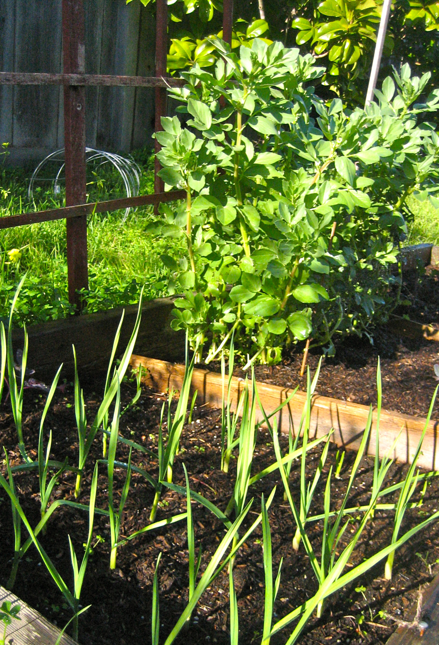
We are still keeping an eye on the long term and late in the first week of February. We are seeing signs of a pattern change, but it is still too early to tell. The PNA forecast is trending negative and the NOA forecast is trending positive. If this comes to pass, the storm doors will open and winter will return. Stay tuned.
In summary, continued beautiful weather this week. Some cooling and possible clouds for the weekend. Nice weather again early next week. And remember, a very slight chance of rain for Sunday evening.
Monday, January 24, 2011
More Sun. More Warmth. A Nice Week Ahead.
This past weekend was beautiful in the city, with a very warm day in the inner Richmond. A perfect morning for Dim Sum on Clement Street and a play in the park. Similar weather is to continue through next weekend. You may begin to wonder if winter is over. Bets are on "not yet."
We are in the midst of what many refer to as the January thaw. Not all that unusual of an occurrence, where we get an extended period of clear and warm weather after the holidays. What is making this year so notable is the period of very wet and cold weather we had from November through January 3rd. The latter part of autumn and early winter came in with a bang this season. Now we are in the midst of a 25 day plus period that has had no more than a sprinkle of rain and a dusting of snow. As it looks now, sun is to continue through at least this week. Enjoy it while it is here.
There is a slight chance of light precipitation, mainly to our north, beginning some time on Sunday the 30th. Chances increase on Monday and Tuesday. There is also just as good of a chance that this system will stay completely to our north and affect the CA/OR border area. We will need to monitor as the week goes on. This system should usher in some cooling, and we could begin to see effects of that as early as Friday, with lower temperatures and increasing breezes over hills and ridge tops. Currently we are expecting less than 1/4" of rain.
The work week looks beautiful with a peak in temperatures onTuesday and Wednesday. Slight cooling through the week's end. Santa Cruz can expect highs reaching 70F through Thursday, then a 10 degree drop by Sunday. Overnight lows in the low 40s. The Peninsula is to be slightly cooler and San Francisco expecting temperatures to top in the low 60s and drop to the high 50s over the weekend. Overnight lows in the city are to remain warmer, in the low 50s and high 40s. The Sierra is also expecting a great week, with daily highs around 50F at 7000 feet, cooling a bit on Saturday and down into the high 30s by Sunday. Freezing temperatures over night will help set up fantastic corn. Sun across the board on the coast and in the hills. Unfortunately for the central valley, thick fog is to persist. If they are lucky, this system on Sunday will knock out the inversion.
The skiing was warm and sunny this weekend. Reports of epic corn are coming in from the back country. This is a great time to get out there, especially if you are new to winter travel in the mountains. You still need to use caution, but the snowpack right now is as stable as it gets. And the sun is warm. As they say though - know before you go. Or travel with an experienced partner. Follow the sun for great corn skiing. Reports from this past weekend are that south aspects were skiing great from 11AM to 1PM, with west aspects softening just a bit later.
 The real news right now is the surf. We did not quite get the XXL swell needed to run the Maverick contest, but there was plenty of surf out there this weekend, with Friday and Saturday the biggest. Areas just north of Santa Cruz saw waves in the 10-15 foot range, with some bigger sets. In town the waves ranges from waist high east of Capitola to well overhead. These shots came from a few spots up the coast and reminded me that I really need to get a real camera. Regardless, some beautiful weather for mid winter surfing. The swell began to moderate on Sunday and will continue through mid week.

Another swell is brewing out in the Pacific and should be upon us on Wednesday. This one to be a bit more moderate in size, but still starting off in the 8-14 foot range. While the swell has been nice, it is the clam to off shore winds that made it all come together. Light winds to continue through the end of the work week, with some mild NW winds picking up late Friday. A great week to get out there if you have a chance.
Still some great garden weather even will the over night chill down in Santa Cruz. Watch the outlook for freezing lows later in the weekend and early next week, especially if we don't get rain and cloud over. The clear skies allow for radiational cooling. If you are like me, with some young plants out there, you may want a cover to protect your babies. As for the market, I am sad to report that I missed it this weekend. Bummer. We are still seeing some local apples available, along with the usual winter fare of roots, leafs, and hardy vegetables. I noticed that the local Brussels sprout fields (of the conventional fumigated variety) were recently harvested - so road side stands should be in abundance.
Longterm: We have seen a few models runs in a row suggest that by the second week of February we should have a low pressure squarely over us, having displaced this lovely high to the east. If that is to come to pass, would should expect significant cooling and at least several days of wet weather. This is still too far out to say with any certainty, but this is the first major shift in the models in several weeks. This will be monitored. Again, enjoy this fine weather while we have it.
In short - more great weather. Chance of cold and wet weather late in the weekend and early next week. Expected return of sun for several more days, and then...
We are in the midst of what many refer to as the January thaw. Not all that unusual of an occurrence, where we get an extended period of clear and warm weather after the holidays. What is making this year so notable is the period of very wet and cold weather we had from November through January 3rd. The latter part of autumn and early winter came in with a bang this season. Now we are in the midst of a 25 day plus period that has had no more than a sprinkle of rain and a dusting of snow. As it looks now, sun is to continue through at least this week. Enjoy it while it is here.
There is a slight chance of light precipitation, mainly to our north, beginning some time on Sunday the 30th. Chances increase on Monday and Tuesday. There is also just as good of a chance that this system will stay completely to our north and affect the CA/OR border area. We will need to monitor as the week goes on. This system should usher in some cooling, and we could begin to see effects of that as early as Friday, with lower temperatures and increasing breezes over hills and ridge tops. Currently we are expecting less than 1/4" of rain.
The work week looks beautiful with a peak in temperatures onTuesday and Wednesday. Slight cooling through the week's end. Santa Cruz can expect highs reaching 70F through Thursday, then a 10 degree drop by Sunday. Overnight lows in the low 40s. The Peninsula is to be slightly cooler and San Francisco expecting temperatures to top in the low 60s and drop to the high 50s over the weekend. Overnight lows in the city are to remain warmer, in the low 50s and high 40s. The Sierra is also expecting a great week, with daily highs around 50F at 7000 feet, cooling a bit on Saturday and down into the high 30s by Sunday. Freezing temperatures over night will help set up fantastic corn. Sun across the board on the coast and in the hills. Unfortunately for the central valley, thick fog is to persist. If they are lucky, this system on Sunday will knock out the inversion.
The skiing was warm and sunny this weekend. Reports of epic corn are coming in from the back country. This is a great time to get out there, especially if you are new to winter travel in the mountains. You still need to use caution, but the snowpack right now is as stable as it gets. And the sun is warm. As they say though - know before you go. Or travel with an experienced partner. Follow the sun for great corn skiing. Reports from this past weekend are that south aspects were skiing great from 11AM to 1PM, with west aspects softening just a bit later.


Another swell is brewing out in the Pacific and should be upon us on Wednesday. This one to be a bit more moderate in size, but still starting off in the 8-14 foot range. While the swell has been nice, it is the clam to off shore winds that made it all come together. Light winds to continue through the end of the work week, with some mild NW winds picking up late Friday. A great week to get out there if you have a chance.
Still some great garden weather even will the over night chill down in Santa Cruz. Watch the outlook for freezing lows later in the weekend and early next week, especially if we don't get rain and cloud over. The clear skies allow for radiational cooling. If you are like me, with some young plants out there, you may want a cover to protect your babies. As for the market, I am sad to report that I missed it this weekend. Bummer. We are still seeing some local apples available, along with the usual winter fare of roots, leafs, and hardy vegetables. I noticed that the local Brussels sprout fields (of the conventional fumigated variety) were recently harvested - so road side stands should be in abundance.
Longterm: We have seen a few models runs in a row suggest that by the second week of February we should have a low pressure squarely over us, having displaced this lovely high to the east. If that is to come to pass, would should expect significant cooling and at least several days of wet weather. This is still too far out to say with any certainty, but this is the first major shift in the models in several weeks. This will be monitored. Again, enjoy this fine weather while we have it.
In short - more great weather. Chance of cold and wet weather late in the weekend and early next week. Expected return of sun for several more days, and then...
Friday, January 21, 2011
Nice Weekend Ahead; Possible Darkness(or Rain) at the End of the Tunnel
A great weekend is in store for us Bay Area folks. In fact the entire Central California zone looks to be pretty darn nice. Even the valley looks like it may be fog free on Sunday. But I can't say this enough - Santa Cruz continues to have the best weather around. I am nearly positive we will see 70F over the next few days. SF looks to be just a bit cooler with highs topping out in the low to mid 60s. Sunny weather should be the case in areas around the bay. Sunny and fog mix as you head to the central valley. Highs should be around 60F, but if the fog sticks around, it may be a bit cooler. Up in the mountains expect around 40F, sun and little wind. If you really want to find the warmth, go for a hike in Pinnacles National Park near Soledad. They are expecting highs in the mid 70s.
 This could be a great weekend for a drive down the coast. Be careful if you plan to do any beach combing, as the swells are expected to be in the 10 foot range with long periods. Great for surfing (in the right spots), but this is the kind of swell that offers up some rogue waves and surges that pull unsuspecting people from the rocks. The hiking is pretty prime right now. The hills are green. The creeks and waterfalls are still flowing - and you don't need to deal with too much mud. Another great activity is to visit a farm, pick some kiwis and eat some pie.
Surfers rejoice. Decent swell is filling in this morning, with wave heights expected to reach to 15' plus at the best locales. More protected zones, such as in toasty and magical Santa Cruz, will help moderate the size and make it more manageable for the mere mortals among us. Still, expect decent energy and strong currents. Be careful out there and enjoy the best of our California winter. Winds expected to stay light and easterly through at least Tuesday. Swell to linger through mid week as well.
I have not been out to inspect the bike trails anytime recently, but word is that they are in prime condition. The rains helped settle the dust and tack up the surface. Now they have dried to near perfection. Wilder, Nisene and Demonstration are all great areas. This will also be a big weekend for cycling on Route 1, with near perfect temperatures and light winds. And the views will be pretty nice as well.
The models are beginning to pick up on the influence of the MJO and forecasts for the NAO. The Hudson Bay low is to dissipate, and the jet is looking to sneak under the west coast amplification some time around the Super Bowl. Some models are showing a week storm hitting our area between the 2nd and 4th of next month. While this is not yet forecasted as a strong storm it would mean rain - and after about a month of little rain, you can expect are the normal driving mayhem of a downpour. Also, keep in mind that these models are for over a week out, so significant changes are expected. We will keep an eye on this and post more details as they come into focus.
I have to say that, I for one, am looking forward to more rain. This stint of dry warm weather has been nice, but we are still in need of water in the state. It will also help freshen up that snow pack and hopefully return us to a mid winter (soft) surface condition. Also, our waterfalls need a refill to stay at the top of their game. As a note, you gardeners, check on your winter crops. You may need to give a little watering this week, as the soils are much much dryer than they were at the turn of the new year.
Great weekend ahead. Continued warmth and sun, with a chance for a change late next week into early next month. More details to follow.
Thursday, January 20, 2011
Continued Spectacular Weather for the Central Coast
Seriously, this is getting kind of boring. More of the same with the foreseeable future. Daily highs range from the high 50s to the high 60s. Still continuing with the warmest temperatures in Santa Cruz. We have been seeing mid to high 60s all week, and can expect another bump for Friday and the weekend. We will keep an eye out for that 70F mark. Night time lows are to stay in the low to mid 40s, allowing us those mid winter crisp mornings.
There is still no clear end to this pattern of fine, fine weather. The MJO is in the Western Pacific and showing some signs of a slow move to the east. It may be too little, too late. We will have to see if it gets strong enough to over power the positive PNA that has set up for most of January. When positive, we tend to get a large blocking high sitting over California. Generally, a strong MJO near, or east of the dateline with allow for the jet to bust through this high and send storms into California. For now, it looks like smooth and sunny sailing.
The other factor contributing to our great weather is the Hudson Bay Low sitting on the east coast, driving cold and wet weather as far south as Georgia. While Atlanta was getting snow by the foot, we have been working on our tans. The North American Oscillation, or NAO, strongly influences this feature. When negative, the low stays in place on the east coast, blocking movement of our ridge or even storms. When combined with a positive PNA, though, we can see our ridge shift north, and the jet stream drop south, and the doors open. We will monitor, as the PNA looks like it may move negetive the before the Super Bowl.

Essentially, the pattern we have been in has storms tracking across the Pacific, and being driven north by the high protecting the California coast. These storms then cross western Canada before being driven south east, along with very cold arctic air, by the low in north eastern Canada. Great for us sun loving, garden building, bike riding and trail hiking Californians. Not so hot for the folks in the east, and especially for the airports south of Philly. Another group that should be loving the current pattern are the west coast surfers. And a treat for the spectators as well is coming on Saturday.
Today, the winds (strong at times) are to come from the north east and a moderate Santa Anna is setting up in the southern part of the state. We are seeing the swell that arrived on Tuesday beginning to fade, but still offering head high plus mid period swells. The big news is the large swell that is to begin arriving on Friday and peaking in the early morning pre dawn hours of Saturday. There is a possibility that the Mavericks contest will be called. If not, you can still head over to Half Moon Bay and watch the folks ride the meager 15-20 foot waves in perfect wind conditions. Today, the Eddie Aikau may go if the surf is at the 20 foot minimum. Waste some time at work and watch the live feed. As for the mere mortal surfers, the weekend begins XXLarge, but areas in Santa Cruz will moderate the swell. Expect decent size large waves to continue on Sunday and moderate swell through the first half of next week

As for the surf over the last few days.... not too shabby. Tuesday night had some great lineups along West Cliff with just me and 500 or so of my best friends out. Plenty to go around though and the weather and sunset were about as good as they get for mid winter. Lots of folks out and enjoying the late afternoon. Part Two coming this weekend.
Yesterday, we planted some mid winter sprouting broccoli and Brussels sprouts. We are also putting in some lettuce starts and planting pea (snap and shelling) seeds. I will be sure to let you know how it goes, but obviously I am optimistic about the weather for the coming 10 days. I think if we can get two weeks of continued warmth, my plants will not stunt, and my peas will sprout. I also put two potato starts in the ground in a well drained area. We are in the midst of a perfect winter growing period, and I would not be (too) surprised if my strawberry plants started to grow. Another great weekend is ahead for yard work. Have you pruned your fruit trees recently? What about those rose bushes or berry briars. Get at them while they are dormant to avoid damage.
There is plenty of snow in the Sierra, but conditions range from 'chatter your teeth out of their sockets" firm to sun softened goodness. In the right spots, during the right time of the day, we can expect to see some pretty fantastic corn conditions. At the resorts it is mostly bumps and groomers. Night time temperatures are dropping below freezing at lake level and highs are in the 40s. If you are headed to Kirkwood, you can get $45 tickets for between now and the Super Bowl. Not a bad deal.
In short, continues beautiful weather through early next week. We will need to check in with the models over the next few days to see if the MJO influences our weather or any inside sliders slip through. Otherwise, not much change expected at this time through February. Check back here for updates.
Monday, January 17, 2011
Sunny California January Dreamin'
Well, it has been a pretty spectacular holiday weekend here in central California. At least if you weren't stuck in valley fog. Santa Cruz was sunny and calm with quite warm temperatures. I never did find the elusive 70F mark, but I did manage get to within a degree. Sunday was much better than anticipated, and may have even been the warmest of the past three days. Hard to say, as today was very nice. I really do notice how the short the day is though, as it seems to have been warmest just before sunset.
The Sierra had record breaking temperatures from Tahoe to Mammoth. The clouds seemed to have been held at bay, and certainly any precipitation was kept to the north. A strong inversion has set in, and temperatures above 7000F have been quite mild. Overnight lows on Saturday night stayed in the 40s for much of the high alpine. While this is not an unusual occurrence for January, it is notable.
Over the next few days, we should see temperatures drop a bit, and then moderate. The high pressure that has settled in upon us, and provided us with warmth, has also continued to deflect storms to the north. This bubble will shift west over the next few days, and as a result, a storm will drive by our northeast on Wednesday. This will usher in much colder air, especially for the mountains. The crest may block much of this cold air from spilling into the central valley. At the coast, we could see just a slight cooling of air, but a quick rebound is expected by Friday. In Tahoe, we could see night time lows dipping as far down as the teens, with highs struggling to get above freezing on Wednesday. Slight moderating trend through the weekend. As far as precipitation goes, we can expect to stay dry through at least next weekend.
The MJO is in the Western Pacific, and still moving eastward. Progress is slow, and it is pretty week. We should still see at least some shifting of the Jet Stream, and maybe some California storms. Still, nothing significant is yet showing on the models. A few storms brushing by to our north, offering some rain. Still keeping an eye on the last week of the month, and will post up here as soon as anything interesting shows on the models.
Snow? Expect a pretty decent corn cycle to set up around the end of the week, with nightly freezing temperatures and daily melt. Surf? On the increase through the week, with a good chance of offshore flow starting late Wednesday. Big swell to arrive on Friday for the weekend. Bike? Reports are of good tacky trails in the SC mountains.
Anyone get out to look at their gardens this weekend? We got some soil turned, and plants thinned. This is a very good spell to get some plants in the ground if you are at all interested in a mid winter planting. Lettuces tend to be a safe bet. I suspect one could get kale or even broccoli started. Peas - definitely worth the chance if you have any open space. We will even try a potato start. We will need to see how it goes.
Our soils are till pretty moist, but you may want to check your plants. It is easy to forget to water in the winter. The soil is pretty warm, and we can expect sun for at least 7 days, and perhaps even more. Not a bad time to get cool weather plants and/or seeds in the ground. As a hint, try soaking peas in water for a day before planting. If your seedlings get established before they are either hit by cold or pounding rain, you may get a nice harvest in April. Also, if you plan to grow some peppers from seed this year, now is the time to get them started indoors. Keep the soil moist and warm. A south facing window can be perfect.
In short, a pretty nice week. Coolest on Wednesday. Friday almost as nice as today. Fog should begin to burn off tomorrow for you folks that have been seeing grey all weekend.
Friday, January 14, 2011
Weekend Update. Looks Good!
Well, yesterday was a bit wetter than expected. Patches of rain from late morning through the day, down on the coast. Today should be clearer and will feel much warmer due to that sun. Based on Thursday, I'd suggest keeping an eye on the sky over the weekend. Currently, the forecast brings that system further north, with the southern fringe near Clear Lake. Otherwise, expect warm and sunny* weather through at least next Tuesday.
That asterisk is to caution about fog. Coastal areas from SF to Monterey can expect periods of heavy fog for at least for the next few days. Even low lying areas along the SF Bay should expect fog. SC may be the only zone along the water that is spared the fog. The central valley is also to experience heavy fog, as the cool air mass there has remained undisturbed by the past few storms. Use caution if you are driving in the area, this inversion stuff can get thick. Back on the coast, the more southerly facing aspects will see the fog burn off earlier, and offer up some glorious sunshine. Temperatures could reach into the mid to high 60s tomorrow in Santa Cruz - and if you found just the right spot, at just the right time, in a grassy field up above the Pogonip, it may break 70F. You made it through Novembuary (cold an wintery) , welcome to Juneuary (feels like summer).
Fog will take longest to burn off today. Saturday looks like the warmest and sunniest day for the weekend. Tuesday looks almost as nice. Not a bad one scheduled, for at least through Wednesday. We may see colder air move into the area by mid next week, though. Significant wet weather is still further out; the MJO is still strengthening and moving east. In fact, it is currently stronger than forecasted, and the models have begun to pick up on this. Still thinking the change on the west coast begins around the 22nd, but really begins to impact us during the last week of January.
Yesterday's storm was both wetter and warmer than expected. Rain fell in the mountains up to about 9000 feet. It will really have impacted the snow pack. Up until about 11am yesterday, there was still plenty of powder to be found in the back country, and edge-able chalk inbounds. It was a very good run of snow conditions for Tahoe. We now will have a freeze-thaw snow pack for the first time this season. If you are headed up to the hills this weekend, sharpen your edges, rail some groomers and follow that sun. And remember - what has been good all season because it stays in the shade, will rattle your teeth this weekend.
Saturday is the best day for skiing. It should be warm and sunny, softening up that rain crust (perhaps even in the shade). Base areas will feel real warm with light winds and temperatures reaching to the 50s. Ridge tops should have a bit of a breeze from the north and reach into the high 30s or low 40s. Pretty nice indeed; nice enough to even eat lunch up on the hill, with a view.
Saturday evening and Sunday both have a small chance of rain, more significant in North Lake. Not as warm as Saturday, and certainly not as sunny. More of a groomer day - unless it actually does rain on you. If you don't mind feeling wet, the rain loosens the bonds in the snow and can make it quite buttery. Still, the least ski day of the three. Monday looks more like Saturday, just not as warm.
Again, the rain hitting the mountains on Sunday should miss the Bay Area, but stay prepared. If you plan for a long hike or bike ride, pack a shell. Or at least look at the cloud cover in the morning. Otherwise look for a nice run of days lining up. And get that yard work taken care of, as the rains will return quick enough.
Wednesday, January 12, 2011
Some Quick Interruptions in the Fair Weather. Warming Trend??
At little cloud clearing early on this morning, and some good sun was had. A bit warmer than it has been as well. That trend looks to continue, but we do have some chances for rain in the next few days. Thursday afternoon it looks like a lot of moisture is going to come into the coast by the California/ Oregon boarder. Bands of precipitation may spread as far south as the Bay Area, similar to yesterday. The difference is the next storm is much wetter, and further north, Of course, greater likelihood for Marin and points north for heavy rains with this one. Friday clears and another system swings just to our north on Saturday. Most likely we will will just see passing clouds and high humidity with that one.
The Crest saw between 1-3" of new snow from Tuesday's rain. Thursday's system may drop another 2-4" of snow above 7000'. Higher freezing levels, and very minimal snow are expected on Saturday. All, in all, it is a nice fresh coating, but those amounts sound more like Colorado than California. We will need to wait until the end of the month before we see any significant snow and a return to soft pack conditions.
Yup, that means continued mild and fair weather. It may even warm up. First bump in temperatures have already begun. You may have noticed this morning was not literally freezing. Over night lows increase from 32F (last Monday) to 44F tomorrow. High temperatures will take longer to increase, but my guess is that early next weekend could be quite nice. Bring on a super holiday.
We will continue to watch the MJO to see if it continues to move west. Until then, expect a solid blocking high settling off the California coast and pushing any significant weather far to our north. Seattle and BC may get pummeled, but not us. Get you dry dock jobs done now. For instance, you may want to clean those rain gutters. We have had a lot of wind since the first rains, and autumn, combined with sediment settling this past week, may be clogging you up. Or get out for a hike. Plant some greens. Get on the bike. Because, when this next one comes in - if this winter has any pattern to it, we could get another heavy soaking. Some time around the 25th we should see a change.
Tuesday, January 11, 2011
Fair Weather Expected After Tonight, Except For The North
Quick update this morning. All models are suggesting that this afternoon and tonight we can expect some light rain across the Bay Area. Light snow for the mountains, with snow levels just around 4500' - but with cold air trapped in some valleys, we could see lower snow levels or freezing rain develop in areas. Use caution on those roads Wednesday morning if you are at elevation.
Clearing for areas south of SF by Wednesday. Partly cloudy changing to partly sunny by the end of the week. Clouds should linger longer in the mountains. Marin and points north see continued chance of rain through Thursday, then fog up through the weekend. The central valley should see the return of fog after tonights storm and lasting into the foreseeable future.
Next big change still undetermined, but at the very least expect a pattern change by the last week in January. More on next week later.
Still some local green apples out there at the markets, but that season is closing fast. Satsumas are doing very well, and we are near peak production (read - nice low prices). Of course there is a lot of citrus. The Kiwi farm near Ano Nuevo is in full swing. Take a nice drive out on the coast and get yourself some fresh picked kiwi. Greens took a bit of a hit, with first the heavy rains and recently the freezing cold. Should see some rebound in them next week. The hardier kales and chards seemed to weather the weather the best. And we do have a lot of root vegetables out there. Some farms pulled theirs as the ground became too wet. So there is baby this and baby that all around.
Snow is slowly moving from packed powder, to chalky to typical Sierra firmness. There is still plenty of coverage and good snow for the upcoming weekend. If we are lucky, it will get a good resurfacing tonight, but we are only expecting a few inches.
Surf is cold and small today. A new swell should move in for Friday and stick around a bit for the weekend. At this point though, it is still just a forecast with no actual swell in the water.
Monday, January 10, 2011
Monday Update... Brrrrrr.
Cold this morning in beautiful Santa Cruz. 32F at 7AM, and a thick coat of ice on the windshield. A quick look at the garden, and it seems as if the fava, chard and choy weathered the freeze perfectly fine. I am sure if I had any lettuces out there uncovered they would not have faired so well. So, if you do plan to do any planting, be sure you have the row covers in place - tonight looks to be almost as cold.
The charts this morning look similar to yesterday. The big news is that the holiday weekend is shaping up to be mild and mostly sunny. Temperatures down on the coast in the mid 50s to perhaps even 60F. Friday looks to be the warmest. Up in the mountains we are looking at day time highs in the low 40s, and still some clouds. We could even get some warm weather snow due to pools of cold air. Next week is still a mystery, but we might, just might, see that warm ridge set upon us. We will have to see what the MJO does before we settle on a forecast.
As for this week, increased chances of rain on Tuesday and Wednesday. Heaviest rain will be in the north bay, but it looks like more than a drizzle for Monterey and points south of SF. We could see about 3-6 inches of new snow in Sierra from warm moist air pouring over the crest into the cold air trapped just to the east. After Wednesday, the storm track pulls north. Still a good chance for Marin & Sacramento north. South of there looks to be partly cloudy and mostly dry. Every where is looking dry and clearing by Friday and through at least MLK Day.
One more cold one tonight, and then milder evenings through week's end. Looks like we should have another spectacular weekend to enjoy, and the sun may even shine up in Tahoe. Get out there and enjoy California.
Sunday, January 9, 2011
Rain Returns This Week. Some Uncertainty In Timing.
Okay folks. I hope you enjoyed the weekend. We did get some more clouds than expected up in the mountains on Saturday, but only for a few hours. The semi clearing in the afternoon led to a spectacular sunset. Hope some of you were able to enjoy. I know we enjoyed the fantastic packed powder. Today was clear and cold. We just drove through the central valley around sunset, and temperatures were just about 45F. It is currently 40F in Santa Cruz, and with that clear skies, we can expect it to get much cooler. We may see some freezing temperatures in the Santa Cruz mountains, and perhaps even in some coastal valleys and low spots where the coldness can pool.
Tomorrow should bring another clear and cooler day, with highs reaching up to the low 50s in most of the Bay Area. Chance of rain begins some time on Tuesday, and increasing in the evening. There is a lot of uncertainty with the systems coming in this week. As recently as yesterday the models looked like we would see an increasing chance of precipitation through the week, with rain likely by week's end. This morning, the models looked different, with the weather fair Friday through MLK Day.
As it stands right now, most of the rain will stay to our north. In classic La Nina style, the Pacific North West looks to get hammered. We will have to see how this plays out. Just as a note, the chance of rain is much more likely north of the Bay than points south. There is a chance that Santa Cruz will get some off and on drizzle this week, and Marin will see over an inch of rain. One thing is for certain, we should see warming temperatures with this set of systems, especially early on. Night time lows will rise to the mid to high 40s by Wednesday.
Currently, the best chance for heavy rain looks to be Thursday afternoon and evening. A lot of moisture will be moving on shore. We just are not sure where. Also, to note, more uncertainty about Tuesday's system. We are not actually expecting a low pressure system, but rather we have cold high pressure at the surface, and warm moist air expected to move aloft. If there is a lot of moisture in this air (as expected), it will be squeezed out by the cold air - and poof, we could get a lot of rain in the hills and snow in the mountains.
Long term... you guessed it, a bit of uncertainty. Many models are suggesting a January thaw (read warm & sunny). The only problem is that the MJO is forecast to move west, which usually signifies the opening of the storm corridor in the north Pacific, and heavy rain for the central coast. Again, we will need to wait a few days and see how things begin to play out. Just be ready for some of that really awesome winter weather with 70F and sunny, or, cold and rainy for a week plus. Could go either way.
The earth is really starting to handle all that water we got over the holidays. Still a great time to get some leafy vegetables in the ground. Especially for SF south, it does not look like we should have very heavy rain this week, and overnight temperatures will be milder. Tomorrow or Tuesday still look like good days to get some seedlings in the ground. As a reminder to those who are growing kales, choys or chards - keep cutting those guys back, and they will keep giving. This is the time of year that you can harvest greens several times a week, and this will stimulate the plant to keep growing.
In short. Rain possible this week, but far from definite. Most likely light, with the heaviest rain coming on shore Thursday. PNW to get lots of water. Next weekend is still up in the air, but trending towards fair. More to come as the models settle on an outcome.
Friday, January 7, 2011
Quick Morning Update. Some Fog and Cold.
A few things to note as we head into this fabulous weekend. This morning, and more so this evening and Saturday morning, we have conditions along the coast that may cause an encroaching marine layer. Yup, that is right - fog. So don't wake up early on Saturday morning to expect a sunrise walk on the beach. I know this is a bummer, but you can always head to the local hill tops to enjoy some sun, and it should burn off on the coast by late morning. Sunday should be mostly sunny.
As for the Central Valley, we have calm, clear weather, and an inversion has set in. That is when the cold air sinks into the valleys (because it is heavier than warm air) often resulting in a thick blanket of fog. This fog is thicker and more persistent than its coastal friend. Expect it to slow traffic through the valley, especially from evening to late morning. Drive carefully out there, especially those racing up to the Sierra for this weekend.
BTW, the Sierra are way above both fog layers and should only see sunny skies with some passing clouds. But that is where the cold comes in. Today should see temperatures in the mid to high 40s, but dropping over the weekend. Saturday look for high 30s and on Sunday we may not even break freezing at 7000'. Use caution, as those sunny aspects will have some mid winter California ice (much softer than the ice in Vermont). Still, this is the stuff that can catch you off guard, and break some bones.
Coastal temperatures do not drop off as much, but expect low 50s by Sunday and Monday. Still looks like we have have a chance of rain starting as early as Tuesday. Too hard to tell if we get just a passing storm, or a run of systems - regardless, don't miss this great weekend we have on tap.
Thursday, January 6, 2011
Spectacular Weekend On Tap. Get On It!
It now looks like we will be spared the rain and snow this weekend, so if you are a Weekend Warrior, you better get on it. This is not the weekend to take car of those inside choirs. Grade your papers, plan your meetings and get that work done. It does not matter much what you do, but do it outside.
On the coast, it will be clear and in the mid to high 50's. The mountain bike trails are starting to dry just a little bit and moving from muddy to o' so lovely tacky. The hikes are insane right now, be it Muir, Big Basin or anywhere in the Santa Cruz mountains. Creeks are flowing, and waterfalls are at their best. And the hills are green. This is perfect weather for a run, and even better for working in the yard. Soils are a bit dryer (but still wet) and good for a till. It may even be dry enough to rake up those leaves you ignored in October.
In the Sierra expect cold crisp nights, and warm (high 30s/low 40s) sunny days. The snow is holding up in great condition both inside and outside the resorts. In fact, our snowpack is the most stable it has been all season, so get out and enjoy the north facing powder and south facing corn. Put on some skins, nordic skis or snow shoes and enjoy the spectacular views. If you want to see some pictures of skiing over the past few days, it is a click away. Just be sure to dress in layers, because it will be much colder at 8am than at noon.
The next chance for weather (my term for rain, and the such) will be around Tuesday 11th. This system may move north of us, and is coming from the south. Whether the rain comes Tuesday, or not until Thursday, we should expect a warm and wet system that will stick around for a few days. Long term, the jet looks like it may dip south again the third week on January, which will mean frequent cold systems with lighter precipitation rates. With the amount of water we have already received, this is good news.
Did your garden freeze last night? Central Valley folks should keep an eye out, as the cool, clear nights are prime for a frost or freeze. If any more cold air moves in, we may see this become an issue in the produce markets. Floating row covers are your best defense against the cold; those of us near the coast need not to worry too much this week.
Monday, January 3, 2011
The Return Of Solar Radiation Unhindered By The Thick Layer Of Clouds. Yay!
And, so, the sun came out today and plans to stick around for a little while. Boring weather ahead. Mild temperatures and few clouds as the week progresses. Not too shabby, as we actually need a little break in the weather. The mountains have been blanketed in over 300" of snow so far this season, and the ground here in the Bay Area is about as wet as it gets.
Today's weather is indicative of the week to come. Mostly sunny, with some coastal clouds. Warmest and sunniest on Wednesday, with a high perhaps reaching to 60F in the best nooks and crannies. Slight chance of a system brushing over us this weekend, but each run of the models decreases likelihood. Next week looks just a bit cooler - otherwise, more of the same. We are looking around the 12th to 15th for the next big change in the weather. Still, stay posted. As we have seen so far this year, the models have tended toward the drier side of actuals.
This past weekend was spectacular in the mountains. Last week delivered two to three feet of cold snow on Tuesday and Wednesday. Thursday was a bluebird powder day of epic proportions - or so they say. I can confirm that my cross continental flight was only slightly delayed, due to JFK getting hit by a 18" blizzard (of its own epic proportions), and that Santa Cruz is a wonderful place on a sunny late December day. New Years Eve day was another spectacularly beautiful day in the Bay and the Sierra. The new year rang in with close to a foot of new snow, and it kept on snowing through Sunday evening. Paired with little wind, and most folks working off a hangover, the resorts were fabulous, and empty. If you have not yet gone up to ski, get on it. This is an epic year, and this coming weekend looks to be great; especially if the sky stays blue and bright.
Lots of water in these parts, and we are approaching 100% for our 2010-2011 water year in parts of the state. The pre Christmas storm was a great contributor, laying over 15" of precipitation in areas along the Sierra Crest. This is all good news, but our soil is water logged, and a break is in order. I am seeing ponds where I have never seen then before. As well as a few new water falls. Speaking of which, this is a great time of year to get out for a hike. If your not skiing this weekend, then go for a walk. The redwood forests are particularly magical right now. Get out there and get some of that California goodness.
Some Fuji and green apples are still around. As well as pomegranates, pears, kiwi and citrus. We just plowed through of the best satsumas ever. Five pounds worth in 4 days. We bought them at Clements Ranch on route 88. We were excited to buy more on our return drive, and were deeply saddened to see the road side seller closed for the holidays. They were really really good fruit. As far as vegetables go, we see the typical mid winter fare - kale, Brussels, cauliflower, broccoli, beets, carrots, turnips and the such. Leaf lettuce prices have soared due to the rains, but if the next few weeks stay fair, we should seem them drop again.
Not much new going on in the garden. I really should find some time to get out there and turn in some of the clover, and tidy things up a bit. The heavy rains have helped wash away some of the regular cool weather aphid colonies. As mentioned above, the soil is very wet, so you may want to wait a bit before planting any seedlings - but if you have space, later this week could be a good time to plant another round of lettuces, spinach or kale. As a note, it is time to start thinking about starting next year's tomatoes inside. We have a bit of time still, but you know how that stuff seems to slip away.
In short, expect sunny and mild weather for the next few weeks, with a chance of rain over the weekend. If it does snow, we are currently looking at light accumulations and freezing levels well below the lake.
Subscribe to:
Posts (Atom)