Thursday, March 31, 2011

Strawberries.

Morning sky.
That is correct.  Strawberries are in, and about to boom.  Good old fashioned, organic local strawberries are about to go off across the region.  Salinas is already into the goods.  Watsonville is coming on.  Central valley and the foothills are close on their foot steps.  Last month's rain, followed by this week's sun and warmth are about to fill our market with bright red berries.  It will almost begin to make you think that tomato season is right around the corner.  Alas, we have a few months to wait for anything but the earliest of girls.

Today will be hot in some areas.  Your eyes are by now probably adjusted to the sunlight, but it can take our bodies a bit longer to adjust to the drastic change in temperature.  But get the most of it while you can, as after tomorrow, we see a change.  Even though the cool air and possible rain move out after the weekend, it will be a bit before we reach today's highs again.  A good chance of 90F near Pinnacles NP, and over 80F expected in Santa Cruz today.  Along the coast, things cool to the mid 70s on Friday, but in the central valley, it may get even warmer tomorrow, before cooling on Saturday.  It is a sign of things to come.  As we move from winter to spring to summer, we will see heat beginning to pool in the valleys, with the  Pacific cooling areas along the coast.  That warm central valley air will begin to rise along the west slope by May, melting away the snowpack and heating the Sierra.  Change is a coming.

Moderate sized snow bank.
The only real day of weather expected this week will be this coming Saturday.  The weekend will be about 15 degrees cooler than today.  Slight chance of showers in the south and moderate chance of rain in the north.  Freezing levels will start around 8000 feet and drop to around 6000 feet, leaving up to a half foot of snow at the higher elevations.  Precipitation moves east over night and Sunday will start crisp and cool, with breaking clouds.  All, in all, pretty boring considering the past few weeks.

So, the real question is: Do you plant your tomatoes in the ground yet?  Here on the coast, and really anywhere below 1000 feet, I'd say it is time to go.  While we may get some more cool weather this year, it is my guess that we are out of the weeds.  Up higher, and further inland, you still see a chance for some cold nights.  Highly doubtful that we get a freeze, but you really just need to get into the low 40s to cause some stunting.  And no one wants a stunt.  But with a row cover, or other protection for the rare cold night, you should be good.  The earlier you get in the ground, the longer your production season.  Especially with cherry tomatoes.  And after last season's disappointment, I am needing for a bountiful year.

Burrowing to the front door is always fun.
Next week will warm up a bit, with high 60s and low 70s across the region.  The central valley may have a chance to heat up a bit.  Or we may see another system coming through our area a week from today.  Right now, this looks to be a northerly storm with colder air.  Still, I would not be surprised if this thing brushes by to our north.  Teleconnections suggest a chance of wet weather returning to our zone mid to late in the month.  Perhaps we have another week of storms to brave before the season is over.  Just as likely we will stay in a dry pattern, with a few very brief periods of cooling and rain.  For now, enjoy the sun.

Warm and sunny through Friday.  Apply that sunblock, especially if above snow level.  Stormy on Saturday with mountain snow.  Clearing for Sunday, with a coastal high of 65F and 35F at 8500 feet.  Warmer on Monday and clear through Wednesday.

Wednesday, March 30, 2011

Its Gonna Be a Scorcher Out There. Or, At Least Quite Warm.

Sister's cirque and Heart Chute are filled in
I've got a sunburn.  I guess that is what happens when you go outside at 8,000 feet, on 7 meters of snow with only one application of sunblock.  After the sun finally comes out.  It is sunny out there, and in case you have not noticed, we have had a pattern change.  It is now going to be mostly sunny and warm, punctuated by brief periods of cooling and possible light precipitation.  Get ready for some real warmth over the next few days.  The work week looks spectacular, and the weekend sees some cooling (and a very slight chance of some rain).

We had a spell of rain overnight Sunday in Santa Cruz.  Just enough to wet the pavement and get a little water flowing.  Still, it was very light considering the previous week. And that marked the end of it for at least several days.  High temperatures are on the rise.  Both Monday and Tuesday were quite pleasant, but the real warmth should peak for us on Thursday.  We will see temperatures across the coastal region ranging from 70-80+ degrees over the next three days.  The central valley will begin to warm up, and down around King City, it may break the 90F mark.  If you have a chance to get out and enjoy a bit of this weather, it is highly recommended.  Even if you work all day, an enjoyable evening stroll is possible with light past 7PM.  Saturday sees a brief period of cooling, with a very slight chance of rain on the coast, and a greater chance for snow and rain in the Sierra.  So the best is going to be over the next few days.

Kirkwood continues to offer up the goods.
The snowpack is pretty darn deep up there right now.  The official report comes out in the next few days.  Continuos snow pack is evident down below 4000 feet on the west slope.  At 3000 feet, the earth is clear of all snow.  At 8000 feet, over 20 feet of snow is on the ground.  Houses are buried.  Some completely.  So, there is a lot of water being stored up there right now.  As we see greater warmth and higher sun angles, the melt will begin.  This week should set some of the rivers raging, and early season river runners will be eying some big lines as early as Friday.  As for the snowpack, it is a changing.  As we shift from a winter to a spring snowpack, period of instability will occur.  Use caution if traveling in the back country.

The past few days offered up some excellent snow on north and east facing aspects.  Monday was a transition day from cold snow to not so cold snow.  Tuesday started firm, like typical spring snow, but was soft by 10:30 all over the hill.  If you like skiing in a T-shirt, this week is the time to do it.  It may hit 70F in a few resort parking lots on Thursday.  So bring your flip flops and beer.  And you don't need to be ready first thing in the morning.  By Saturday, we will be back into cooler temps, with daytime highs in the 30s and 40s on the hill.  There is also a decent chance for 3-6" of fresh snow late Saturday.  With a high in the mid 40s and some sun forecast for Sunday, it may be real good out there for a few hours in the morning.  After that, we return to spring skiing.  And this spring it is going to last for quite some time, with a few Tahoe resorts staying open until Memorial Day to get the most out of the deepest snowpack in decades.

What a friend calls Hepatitis Falls.
Water continues to drain out of the Santa Cruz Mountains.  The ground is still wet up in the hills.  Creeks are open and sandbars are being formed.  This will be an interesting spring and summer for surfers, as we have a lot more sand in play that usual.  We may find breaks we never knew existed before.  Over the next few days, we have moderate wind swell in the head high range with northerly (and a touch of east) winds.  It should be decent out there, and with the warm air, definitely worth a paddle out.  Late on Friday sees the arrival of a double over head ground swell, and a return to winter surf.  We may get a bout of south winds on Saturday, mucking things up, but there is also the chance that the storm will stay way north and not effect us.  Regardless, avoid river mouths and areas of run off, and avoid getting sick.

Nice weather for the next three days.  Very nice.  California beach weather.  We are getting this just days after it snowed in D.C. and Maine received single digits temperatures along its coast.  It is amazing how quickly we can shift this time of year.  Saturday sees some cooling and a chance of brief showers.  Things begin to warm up again next Sunday and into next week.  Around the 13th, we see a chance of some more storms.  More on that later.

Sunday, March 27, 2011

Time To Close The Door on Storms. Spring has Sprung.

OMG.  We awoke to sunshine here in Santa Cruz.  And you can feel the difference.  Today is looking variable over the region, with the northern stretches having more clouds and a likelihood of rain showers by afternoon.  But do not fret, we all get a piece of spring in the coming days.  As the sun breaks out today and over the next week, the air will start to get much warmer.  Get out there and play today if you need to work tomorrow.  If your days off are Wednesday and Thursday, you are stoked for some spring time weather.

Still deeeeep powder landings around
In the Sierra, the weather does not quite break today.  This morning begins partly cloudy and breezy.  Clouds will increase along with wind speed, and snow showers begin around mid day.  Only a few inches will fall this evening, so really, not much more new snow.  As several resorts have already broke 700 inches for the season, more snow is not really needed.  Keep those boards waxed though, as many resorts have already extended their riding season into March this year.  Today, the resorts are still digging out and working on controlling avalanche zones.  So be patient, it will take some time to get the upper mountain and backsides open.  Starting tomorrow, things really warm up, with 50s expected on the hills by mid week.  We will go from neck deep powder to creamed corn in just a few days.  That is often the case in California.  Go figure.  And the touring should be epic.

Sage, chard & choy
As for us folks down by the coast.  The further south you are, the greater chance of sun.  By mid day, clouds should be filling in across the region, and points north will see some showers.  Rain will continue a bit through the evening and perhaps overnight.  By Monday morning, we should be seeing the end to the rain, for at least several days.  At a glance, the warmest day of the week should be Thursday.  Mid 70s in Santa Cruz and in the south bay.  Perhaps a peak of 70 up in the city.  Tomorrow and Saturday should see temps in the low to mid 60s, and a pretty even bell curve in between.  Overnight lows hang out in the mid 40s to low 50s.  By Sunday, we start to see the chance of showers for a day or two.  Currently, it looks like this will only be a light passing system, and not a return to massive rains.

Based on historical records of La Nina years, it would be safe to assume that we are done with winter.  Often, La Ninas start a bit early with heavy rains in December, January and February and end abruptly in March.  While that is not really the profile of the winter we had, you could suggest that La Nina took a 6 week vacation starting in early January, and returned to finish her deal just a bit late.  I mean, this is an abrupt change in weather pattern from the last several weeks.  And it does not really look like there is much showing on the long term models.  Still, do not put down your guard.  There is some suggestion from the teleconnections that we may see a resurgence of storms starting in early April.  Regardless, whatever does come to pass, we doubt it will look like this past week.  It will more likely be one storm at a time breaking through the high pressure, instead of a string of several very strong storms.


Fava, peas, chard, broccoli, brussels & garlic
So you know what that means.  It really is time now to get out to that garden.  Today, and the next few days, will be a great time to get your tomato seedlings out in the garden.  You may even want to consider getting some cucumbers started in situ (or just planting the seed in the garden directly).  We are moving into some perfect growing weather, with a very wet soil and looking at period of significant solar radiation.  The late March sun this week will warm that soil.  As we shift into April, be sure to check you soil, as it will begin to dry a bit, especially in raised beds.  You will also want to keep an eye on any leafy winter vegetable you have, as they may want to go to seed.  Choys are often the first to bolt, then spinach, chard, lettuce and kale.  Harvest them before they flower for best flavor.

So, this week will be almost as nice a January.  Joking.  It will actually be nicer, as our sun is much higher in the sky and will feel much much warmer.  Get out there and enjoy the week.  Next weekend may have some showers, but they currently look brief.  Next week, at this point, looks fair.

Saturday, March 26, 2011

Are You Ready For a Change in Weather? Break Out Those T-Shirts and Apply the Sunblock.

Storm surf and storm runoff collide
Two more days.  Perhaps even just this one.  Saturday broke to steady rain on the coast and heavy snow in the mountains.  Moderate winds are blowing from the south.  Compared to Thursday, it is quite mellow out there.  Still, the water is again running in the streets, with few places to go.  Moderate to heavy rains in the morning subside to showers later in the day.  Tonight should see some breaking up of the system.

Sunday, we see a chance of showery weather, mainly to our north.  Still, if this system carves just a bit further south, rain could spread across the region, reaching south of Monterey.  Marin looks likely to receive some rain during the afternoon and evening.  The morning hours look best for some outdoor activity, and points south may stay fair throughout the entire day.  Showers should end overnight across the region, leaving just wet roads, and some pools of water, to contend with on the Monday morning commute.  Still, continue to use caution, as it will take a bit of time for this water to find some where to go.  And then the fun of spring begins.

Plenty of erosion potential this past week.
Monday will be a transition day, with the clouds slowly breaking apart, and the sky opening up.  I would not be surprised to see a few isolated showers during the day, but expect mostly dry weather.  And rising temperatures.  By Monday afternoon, the sky should be mostly clear, with a high in the low to mid 60s.  The sun stays out through the entire work week, with a peak temperature of 75F expected on Thursday in the warmest zones (Santa Cruz and the south Bay).  It is going to be quite a week down here on the coast.  Some smaller systems may bring showers back for next weekend.  We will see how the models play out.  As we start our transition to spring, the models become increasingly erratic.  Some of our long range predictors are suggesting a return to an open storm door, but it is highly doubtful we will see anything like this last week's weather again this season.

A huge huck into Once is Enough
The Sierra has received about 150 inches of snow in the past week, 200 inches in the last two weeks about 250 inches in the month of March.  It has been quite a run, and the region is struggling with getting all that snow off the roads.  Most resorts are open today, but will struggle with getting much open.  Strong gust continue over the ridge tops, and the snow keeps piling up, making avalanche mitigation difficult work.  Still, if you are up there, and you love deep snow, you are stoked.  This may be the last big dump for the powder hounds, and tomorrow will be the day.  Snow will continue to fall, but very lightly.  Visibility will improve greatly from today.  And even the roads may be clear and open.  Reports from around the lake are coming in as "epic."  Get out there and huck off of something.  The landings are about as soft and deep as they ever get.


So, rain continues to be steady today, getting lighter as the day goes on.  Sunday we begin transition, with a chance of showers spreading south through the region.  Monday we see clearing.  Next week it will beautiful out.  Like a perfect January day.

Friday, March 25, 2011

Biblical.

A few were out sweeping drains clear to protect their homes. 
That is really the best way to describe the weather yesterday.  Torrents of rain came down in low lying areas, while above 2500 feet, snow began falling and accumulating in massive amounts.  Urban flooding was a significant issue yesterday, closing roads.  In Santa Cruz, on our street, water was raging like rapids, up to 6 inches deep at its peak.  And we live on a relatively flat street.  Water was running everywhere, as it really had no where to go.  Creeks and streams breached their banks.  Drains to the ocean were at capacity.  It was amazing.

In the high country, all roads heading over the Sierra closed for some duration of the storm.  Route 88 saw about 50 miles of road close due to avalanche danger and lack of visibility.  The plows could just not keep up; Up to 4 inches of snow fell in one hour during the peak.  Alpine Meadows is closed today.  They just got too much snow to deal with.  Others are trying to open, but will have a challenge getting dug out and opening the steep terrain.  A lot of avalanche mitigation needs to occur.  If you are going out riding today or over the weekend, and have access to a transceiver, wear it.  Even in controlled inbounds areas, slide danger will remain high.  Sierra Avalanche Center is reporting high danger for the third day in a row. Not that impressive for a Colorado snow pack, but certainly so for our usual maritime stability.

Heavy rains and a grey sky.
If that does not impress you, how does 16'@17sec sound?  If you are like "what?", then let me explain.  The surf is pretty large this morning, with swells running above 15 feet, with a period of about 17 seconds.  When this type of swell hits the right type of reef, the waves will break in the 25-30 foot range.  And the South wind shifted to the WNW last night, at about 10-15 knots.  That means well protected spots in Santa Cruz will be cleaning up a bit by later in the morning.  With this much swell in the water, some spots are sure to go off.  With the wrap, we can expect to see clean surf in the head high plus range.  Perhaps a bit bigger along west cliff.  If you are hoping for the big wave show, head up to Davenport and watch the surf batter the coast.  Please stay a safe distance from the water and expect rogue monster waves that are 50% bigger than the typical set.  If you are considering getting in the water, please be aware that with this much run off, the ocean is dirty.  Health officials suggest steering clear of the water for at least 72 hours after a period of heavy run-off.

Urban flooding was common yesterday.
Today, we will see some light showery weather here near the bay.  A bit more turbulent weather can be expected in the mountains.  There looks to be two more waves to move through over the weekend.  The 3rd storm in the series looks like it will break apart with one portion arriving during the day on Saturday, and the second coming through late on Sunday.  Neither is a strong as what we had on Thursday (even combined, I doubt they will have the power of yesterdays system).  The models are not all in agreement right now about the intensity and timing of the next few waves.  Regardless, we can expect continued rain and showers through late Sunday and possibly early Monday.  Clearing still expected for next week, with a high of about 70F in Santa Cruz by mid week.  Bring on the spring.

Thursday, March 24, 2011

Flood, Wind, Storm and High Surf Advisories are in Affect.

This morning is blustery.  And wet.  The second storm in the series began pushing ashore in the early morning hours.  This system is colder, wetter and windier than the last.  Today may turn out to be pretty darn stormy.  From the looks of the radar, we are currently in the midst of a significant blob of precipitation.  And there is no where for all that water to go.  Hence, the Flood Advisory.  Watch out for pooling water, especially at intersections and in under passes.  Any low lying area can be susceptible.

High winds can throw you off course
The wet ground combined with the wind can also result in toppled trees.  Be careful out there.  Give yourself extra time on the drive and watch the water levels.  On the positive side, we are getting the water we need.  Some reservoirs have even released water to prepare for the several inches of rain that we are going to receive over the next few days.  With the deep and solid snow pack, we may just get a very positive report at the start of the month.  How cool would it be to get out of the drought?

Very stormy today and into tomorrow.  Things should be mellower Friday morning along the coast, but the mountains should expect the storm to persist through the day on Friday.  The weekend suggests clearing.  By Sunday on the coast, and by Monday in the mountains.  Currently, all of next week looks to be warm and dry.  High pressure will push storms north of us, through perhaps Sunday, April 4th.  We may get clipped by the southern tier of a system for a few days; then a good chance of a return of the high pressure block.  Spring is just around the corner.

Kodak looking photogenic
Large waves are headed toward the coast today, with a peak in the swell occurring sometime in the morning hours tomorrow.  Large mid period waves will begin pounding our shores as the rain begins to subside.  High tide on Friday is around 2PM.  This may be the peak for coastal erosion, with large waves and plenty of runoff from today's rain.  River mouths and other water ways will be quite turbulent as they meet the surf.  It could be some great viewing, but use caution, as waves will sweep over rocks and the shoreline.  As for surfing, the conditions are poor.  The strong south winds today will keep most breaks in the victory at sea category.  Winds may turn westerly tomorrow and allow some breaks in Santa Cruz to clean up.  South winds return with the next storm on Saturday.

Wind and rain for the next several days.  Today is the worst of it.  Real clearing to start by Sunday and last through the work week.  This is probably the last big storm of the season, so make the most of it.  Spring is knocking and the storm door is finally closing.

Wednesday, March 23, 2011

It is So Deep, I Can Barely See The House. Spring Flinches. Winter Blasts Through Again.

The house I am referring to sits at about a 7600 foot elevation.  The snow completely covers the first story, and nearly has encompassed the entire structure.  With up to six feet plus of snow expected by Sunday morning for the area, it is reasonable to surmise that the house will be gone by next Monday.  We have a massive snow pack right now.  It is settled at more than 15 feet of snow above 7K, with a foot or more down as low as 3500 feet.  The March 1st snowpack and water report put us at above average for the year.  I can only suspect that the April 1st report will set us up above 130% of average.  Maybe more.  We will need to see how next week's sun plays out.

Deep snowpack near the crest.
Rain came in last night as expected and was heavy at times through this morning.  This is a large system, but on the radar, it looks like the heaviest band has moved through the coast already, and is headed toward the mountains. Moderate rains should continue for us through today, with a more showery pattern setting up for tonight and early Thursday.  Moderate to strong rain and wind return for the coast around noon on Thursday and continues overnight.  A shift bak to showers for Friday.  A third system hits on Saturday, with a return to heavy rain.  This final system currently looks to be the lightest of the three.  A break, and a little warming, is expected on Sunday.  This should be your planned outdoor day for the weekend.  And hit it early, as a fourth system may impact San Francisco late in the day Sunday.  Or this one may just stay north.

3.5" of new water expected around the bay, with 4.4" for Big Sur, and over 7" in Humbolt.  What this means is that water will be running hard over the next few days.  The ground is well saturated across the region, with all the rain we have received in the last few weeks.  The is really no where for the water to go.  While the Flash Flood Warning for most of our region has been lifted, keep an eye out for high water.  Report any unusually high or moving water to authorities as soon as you can.  Sacramento and the Delta region may see flood gate closures and flooded planes.  Another concern is the wet ground combined with high winds.  Trees across the region have been uprooted.  Even in the city, a number of sidewalk threes have fallen.  Use extra caution around Eucalyptus, because the top heavy trees have a tiny root system.  They like to fall.

Eight feet or more of snow is expected along the Sierra Crest.  A half foot or more is already on the ground at most resorts.  Today will be stormy.  We should see two feet of snow on the ground by Thursday morning.  Thursday will be stormy.  This system looks like it is really packing a punch with it. Resorts along the crest may see upwards of three more feet of snow with this system by late in the day Friday.  There will be little, if any break between these two systems.  Saturday looks to be milder, and less windy.  It will still be stormy, with a third system arriving late morning, and dropping several more feet of snow.  Finally, storms look to clear out some time on Sunday.  During the snowy period, the snow levels should remain well below 6000 feet, and at times dropping to around 3000 feet.  Sunday sees the beginning of a warming trend, mostly driven by the March sun that will come out and bake the snow pack.  We may see significant settling.

Mike likes.
The skiing is great right now.  The snowpack is the deepest that it has been in years, opening up all new lines across the resorts, and really filling in the usual spots.  It is a great time to get out and explore the mountain and push your self.  Many resorts have extended their season, as it will remain good well into spring and summer.  If you have always wanted to get out an tour, this could be a very good year to get started.  As for the near term, Friday may be a good day to go skiing, but many lifts will remain shut due to the visibility, wind and storm.  Saturday looks like a good day of resorts getting mostly open, and the powder should be very deep. While Saturday is a storm day, that can work to your benefit this time of year.  Anything to keep the sun off the snow.  Sunday should be good, as resorts return to 100%, and the visibility improves.  The sun should come out by then, and start cooking the snow.  By Sunday evening, the snow will be a bit heavier.

Next week currently looks clear and warm, as our Spring high pressure nudges into the area and settles just off the coast.  Storms will be driven to our north.  The following week, as early as Sunday, April 4th, may see a return to wet weather.  These systems look like they will be coming across the Pacific, instead of from our north, and will be a bit warmer.  But for now, it is wet through Saturday.  Clouds break on Sunday.  Monday could see 70F in Santa Cruz.  The week looks sunny, and slightly cooler than Monday.  Spring is coming.  The question is how long will it last?

Sunday, March 20, 2011

Holy Hurricane of Winter Batman.

We have had an impressive storm over the past few days, and another is moving through the region today.  Last night saw strong gusts across the region's bridges and hill tops.  The Sierra crest experienced 100mph plus winds.  Another 3 feet of snow fell at the highest elevations in the past 24 hours and there is plenty more to come in the week ahead.

The rest of today looks like it will have periods of clouds, showers and, at times, heavy rains.  There are flood warnings in the San Lucia above Big Sur, and areas around the delta.  Flood gates have been shut in Sacramento.  Route 1 fell into the ocean in Big Sur.  Mayhem ensued.  The ground is already super saturated.  Any rain will cause heavy flow in the creeks and rivers.  Moderate to heavy rains will allow for debris to move down stream as well as create flooded areas.  This is turning out to be quite a March.

Snow levels have risen a bit since yesterday morning and it is mostly snow above 3500 feet.  They may drop again to below 2000 feet by Monday morning.  Another several feet of snow is expected by mid day on Monday.  Then showery weather, and some clearing, until some time on Wednesday.  Another set of storms is expected to move through from mid day Wednesday through perhaps next Sunday and Monday.  This is all starting to feel a bit biblical. The skiing is good (and great by March standards) but the resorts are going to have a difficult time getting lifts and terrain open over the next week.  OTOH, whatever is open, will be epic.  As far as the BC goes, it is super sketch out there right now.  And for anyone driving in the mountains, be prepared.  Carry a shovel.  I spent about an hour of my evening on Friday digging out two 4WD vehicles that thought it wise to try and drive over avalanche debris.  They were high ended, and stuck in an active slide path.  Luckily, we all got out of there safely, just before Caltrans closed the road.  Carry food, water, warm clothes, chains and a shovel if traveling in the Sierra this week and next.

 We can expect the same pattern down here in the bay.  After tonight, the storms should abate for a few days.  We may even see some sun on Monday or Tuesday.  Tuesday may even break 60F in some parts of our region.  Santa Cruz remains the most likely to see sun and warmth.  By Tuesday night, rain returns.  The heaviest precipitation should arrive on Thursday and last into Friday.  The weekend may have a slight break, with a possible storm again on Sunday.  As it stands now, it looks like we may actually see a clearing pattern next week, starting around Tuesday.  But don't get too excited, as storms may return to the region during the first week of April.

Monday, and especially Tuesday look mild.  Storminess returns late Tuesday, and builds through Thursday.  By late Friday, we may see some milder conditions, and a chance as some real sun by the weekend (just don't place your bets yet).  Another quick system moves through Sunday and Monday of next week, and a possibility of several days of clearing as we enter April.  Currently, it looks like storms return around the 4th.  Stay tuned.

Friday, March 18, 2011

Spring Delayed. Winter Sets Up a Spectacular Finale Show.

EDIT: Tornado Warning for San Mateo County and surrounding areas.  A cloud possible of producing tornados was spotted near Half Moon Bay around 11AM.  Moving to the NE @ 30 MPH.

Friday we awoke to a pretty thick cover of clouds.  Rain should begin sometime mid day and in fall in earnest by the afternoon commute.  Tonight could be a tumultuous one.  Cold air will filter in behind the front tonight brining near freezing temperatures in the bay area hills.  Some of the local higher elevation may see a dusting of snow.  While not as cold as the late February system, this one is looking very chilly for mid March.

In the hills and mountains, snow will fall above 3000 feet this evening.  Several inches are expected at the lower elevations, with a foot plus at the lake and several in the mountains.  Showery weather and cold air continue on Saturday and through the weekend.  Another system saddles up to the coast and begins a southerly push on Sunday.  Late Sunday into the early part of next week, this storm moves east across the state bringing another bout of heavy snow to the mountains.  It will again be measured in feet.  More following that system for later in the work week.  We are looking at a day or less break in between storms.  Winter is certainly not over.

Here on the coast, Saturday looks calm, but not clear.  Clouds continue.  And we will probably see sporadic showers throughout the day.  High temperatures will rise to the low 50's.  Sunday sees even a greater likelihood of shower and continued cool weather.  By Sunday afternoon, heavier rains come into the region and last overnight.  Monday morning's commute looks showery as well.  It will be mostly clouds, wind and rain all next week.  It looks like we are going to get some of that water we really need.  It also is a good idea to keep an eye out for localized flooding.  The ground is still saturated from the last set of storms and with the week ahead, there will be plenty of running water in central California.  On the bright side, the low snow levels will minimize mountain river flow and add to our substantial snowpack.  Over the next week, we can expect upwards of 6" of precipitation across the region, and even more along the Sierra crest.  Even LA and San Diego should get heavy rain on Sunday and Monday, in excess of 4 inches. Impressive.


If you have potted seedlings out in the yard, you may want to bring them in for the next few days.  Heavy rain, some wind and cold air may work to stunt your babies.  Most established plants will bear this storm well.  Again, lettuce may take a beating, and perhaps more upsetting is the set back that strawberry production will take.  But don't fret.  With each passing day, the sun gets higher in the sky allowing for much more day time warming.  The seasonal shift should begin to take place around month's end, with our regular high pressure trying to edge in.  Models are suggesting that after next week, even thought the storm door remains open, the systems will begin to shift north.  This will mean less rain and less cold, until soon, the sun and warmth will return.

Wet today and tonight.  Wet tomorrow, but some breaks, perhaps in the afternoon.  Wet on Sunday, especially late.  Wettish on Monday and Tuesday.  Wet on Wednesday or Thursday.  Friday is looking to be wet.  And you get the point.  Stay dry and drive safe.

Thursday, March 17, 2011

A Break Today. Cold Storm For Friday. Heavy Rain in LA by Monday.

Yup, it is still winter out there, in case you were wondering.  The solstice is still a few days away.  Who can wait for spring?  Models suggest continued wet pattern through month's end.

Tahoe picked up a few feet of snow in the last 48 hours and several feet of snow above 7000 feet so far this week.  Today we see a break in the weather and a chance for the resorts to dig out and open up some lifts.  By tomorrow morning, clouds and snow will again return to the region.  This next system is much much colder than Sunday's and Tuesday where snow levels were up as high as 8000 feet.  Yesterday's system was a bit cooler with snow down and below the lake.  Tomorrow, we can expect to see snow start out at about 5000 feet, lowering to below 3000 feet by Saturday morning.  Several feet of cold smoke is on the way.  The storm looks to clear a bit on Saturday and Sunday, before another system scrapes the region on its way to northern Mexico.  Yup, it is still winter here.

Here in the bay we also can expect another break in the rain today.  Friday morning should see mostly clouds and some light rain, with heavy rain filling in soon after.  We are looking at 1-2" of rain in the region.  Combined with some morning high tides and large swells, we may see some flooding in low lying areas along the coast and in the delta.  Use caution and never drive over a submerged road.  Heavy rain continues through the day and evening on Friday, heaviest in the afternoon.  Chance of showery wether on Saturday and more likely on Sunday.  Rain again on Sunday night into Monday.  All in all, it looks pretty wet.  And much cooler, with daily highs dipping to the mid 50s by Saturday.  A slight rebound is expected early to mid week.  More rain through the end of the week.

But it is not all doom and gloom.  Strawberries are here.  I doubt they will last long, as most near ripe berries were picked yesterday with the impending rain.  The rain normally damages ripe fruit, so farmers like to get that picked before the storms.  Yet, the combination of wet warm weather mixed with some sun has brought on the season.  So, while winter is still here, spring is certainly a knocking.  And you know that that means - get out there and begin work on your garden.  Planting of summer stocks is just around the corner.  You should already have your tomatoes started inside if you plan to plant from seed.  If not, check out Love Apple Farm's guarantee.  Success or your (twice) your money back.  Not a bad deal.  Still, the bottom line is to begin thinking and working on your summer gardens.  Now is the time to start.  Don't wait until May.

The high sea advisory is still in effect.  The swells begin to move in last night and have really filled in this morning.  The biggest waves are fairly inconsistent and there is a lot of raw local swell on top of it. If you find the right spots, the surf could be really good this morning, but expect south winds to change that by afternoon.  Even is the surfing is not great, the viewing (from a safe vantage point) should be great.  Use caution when approaching the water over the next few days.  Wave subside through the day today, but remain large through Saturday.  Then they will just be big after that.


So, wet, wet, wet for the next week.  A break today.  Perhaps one on Saturday and sometime mid next week.  Some suggest a change in the pattern around the beginning of April.  We will monitor and keep you informed.

Wednesday, March 16, 2011

A Busy Week. Snow, Rain, Ice and Waves.

We must be coming toward the end of winter, as this week feels like the finale of an Independence Day firework display.  We are getting plenty of all things winter, except perhaps some bitter cold.  Still, temperatures are to dip well below average for mid March by the end of the week.  The next week to ten days look to be as winter like as they get.  We are not out in the clear just yet.

The exciting part of this is we are starting to look like we are in good waters. Reservoirs are beginning to fill up across the sate, with our local Lexington already past high water.  And there is more to come with over 3" of water expected along the coast by Monday (and almost 5" along the Sierra Crest).  This morning the entire Central California region is blanketed with a grey sky.  Rains continue throughout today, finally tapering off in the evening hours.  The strongest rains associated with this wave have already passed east of the coast and are impacting the foothills.  Still, wet weather should continue throughout the day.  Today will also be the warmest day of the week.  Slight clearing (or at least a less likely chance of rain) for Thursday, with rain returning by mid day on Friday.  Heavy at times in the evening hours and through the night.  Again, slight clearing for the weekend, but that just means the rain will be more like sporadic showers.  Late Saturday looks like the best chance of not raining.  More rain looks likely through next week.  The storm door may try to close some time around the 25th.  Good luck with that.

A decent sized swell arrived on Monday and settled on Tuesday.  Yesterday morning had some favorable winds early, until the gradient shifted SW.  This morning we see westerly winds and a building swell.  We are expecting a large, long period swell to fill in today.  We already see 4'@25sec on the outer buoys.  This should build to 9'@20sec during the day near shore.  That translates to breaking waves in the 15-18 foot range.  Use caution when approaching the ocean today, as these type of swells will often have rogue sets up to 50% larger than the regular sets.  These waves can easily sweep one from the rock and into the cold ocean.  Still, if you have a hall pass today, you may want to take a walk out toward Maverick's to get a view.  Or just enjoy West Cliff here in Santa Cruz.  The rest of the week remains well above 10 foot through Saturday.  Winds Thursday shift again from out of the south, and get stronger Friday and Saturday.  East winds return for Sunday as well as a subsiding swell.  Could be a good surf day, unless of course you are a powder hound.

Cause it is snowing.  Heavy wet snow has fallen on the mountains in the Sierra above 7000 feet.  Real heavy and wet.  Still, a foot to several feet has fallen already, resurfacing the resorts and minimizing the bumps.  Late last night, the freezing levels began to drop and they are now just below lake level.  They will rise again a bit this morning, before dropping behind a cold front.  Another foot of snow is expected by tomorrow morning, with snow down to about 5000 feet.  Thursday looks less turbulent, but snow showers continue through the day with another 6 inches or so by Friday.  Snow and colder air return on Friday, with perhaps another 18" dropping and freezing levels reaching down to 3000 feet during heavy squalls.  We are looking at 3-5 foot totals by week's end.  The weekend looks cool, showery and likely to be some of the last great powder skiing of the season for the weekend warrior.  More snow likely for next week.

If you are headed up to the hills anytime in the next few days, please use caution on your way up.  All sorts of hazards will exist.  With all the rain and wet weather from the past few days, there is a lot of water on the road.  Combine that with drastically dropping air temperatures (it was 40F at 8000' yesterday and will be 20F by Friday), and a fair amount of ice will form on the roads. In many areas, especially in lower elevations (say between 3-5K) the roads will not be snow covered and may look just a bit wet.  Expect some black ice in these areas.  Further up the road, you may find slush, as fresh wet snow falls on the March sun warmed pavement.  This stuff is hydroplane heaven.  Once you start to skid in deep slush, there is little you can do other that wait and see what happens.  And as always, carry chains, extra food and warm clothing.  Some of the passes may close at times over the next few days.  Plan for delays, and enjoy the snow.

So, rain for the week ahead.  Cooler weather filling in throughout today and lasting into early next week.  We know that at some day in the future, there will be sun. We are just not sure how long we will need to wait.  Put on those Wellies, and enjoy some stomping knowing that in a few months, we will be wishing there were at least some clouds to break up the boring blue sky.

Sunday, March 13, 2011

Poppies and Strawberries.

The state flower is blooming in abundance around coastal bluffs and along Highway 1.  It is a great time of year, as clovers and mustard battle for control of yellow.  There are all types of greens across the hills.  But the poppy owns the orange.  I mean, there are a few calendula moving in on this turf, but they are far and few between.  The poppy rules on the open road.  As you move into town, there are purples and reds, and all sort of Dr. Sues flowers.  Still, my favorites are the wild ones.  As springs moves on, the blooms will slowly move inland, and by July, into the mountains.  Oh, and there are strawberries from last week available at the markets.  Expect more a few weeks after the rain.

The morning began with a thick cloud cover in Santa Cruz.  Cool and dreary, but the surf was pumping.  Rain started in the are about 3PM.  First a drizzle and then a bit of moderate fall.  It lasted for perhaps an hour and then stopped.  More is expected this evening and overnight across the region.  Radar suggest a band of rain moving down the coast around San Mateo county.  Earlier in the day it was north in Marin.  Significant  precipitation is to our east in the Sierra.  The strongest showers look to be along I-80, east of Auburn, and south toward route 50.  The entire region should be mostly clear by mid morning on Monday.  Six inches to a foot of new snow expected in the Sierra above 7000 feet.  Snow levels down to as low as 5000 feet by Monday morning.

The week ahead looks turbulent.  Very good chance of rain tonight.  Monday will be fair, with clearing skies, and only a slight chance of rain in the morning.  Still, it will remain at least party cloudy until rain light rain returns late on Tuesday.  Wednesday see continued chances of rain, and slightly cooler temperatures.  Perhaps a bit of a break on Thursday, with an increased chance of rain on Friday.  Perhaps wet next weekend as well.  All in all, it sounds pretty bleak, but on the up shot, we will see only brief periods of heavier rain.  For the most part, the week looks grey.  If you want to get outside, look for a hike in the forest, where the canopy helps protect you from light rain.  The creeks will be flowing throughout the week.  I know the waterfalls were dumping from the cliffs into the ocean this morning.

Which brings us to the surf.  It is rocking.  This morning we awoke to a pumping 8'@14sec swell.  It was clean at day break, but by noon a south wind was on it.  Surf is looking to be on the very large to huge side in the morning Monday.  A High Surf Advisory is posted for the area.  Use caution if you plan to get close to the Pacific tomorrow.  The morning should see an east wind blowing and some good surf at Maverick's.  Winds will not be a cooperative through the rest of the week; Tuesday should have south winds, and then light NW flow through Thursday evening (and then again shifts southerly).  Surf is biggest on Monday, but remains overhead through the week.  The swell gets a boost (a long period one at that) on Wednesday.  It should be a decent week to get in the water between south winds, and there will actually be enough swell to surf in the Golden Gate.

And the week looks to be a snowy one.  Perhaps a foot of snow on Sunday night into early Monday morning.  Showery to clearing weather on Monday.  Some warming on Tuesday ahead of the next system.  Snow levels begin around 8000 feet and lower to 5000 feet on Wednesday.  Looking at about 18 inches of mostly thick snow with the last half foot being lighter.  Showery weather on Wednesday and Thursday, with cooling temperatures by Friday morning.  The next system looks to come in late Friday and perhaps sticking around through the weekend.  It could add up this week.

So, yup, it is a wet and grey week ahead.  There will be breaks.  Best best are from mid day Monday to early Tuesday.  Again sometime around Thursday.  And when it does rain, it will not be torrential downpours.  So, you have a chance to get out there this week and get some exercise.  And once this clears, you will really want to get your garden working.

Friday, March 11, 2011

Tsunami.

So this morning we awoke to a 5AM calling informing us of a tsunami warning for the area.  At first I rolled over, and then I realized that this may effect my surfing plans for this morning, so I go online to see what I could learn.  The Beach Flats in Santa Cruz were evacuated.  Ocean Beach and The Great Highway were closed.  The harbor entrance in Santa Cruz was the local area of greatest concern; a 3.3 foot tsunami was forecasted to hit just after 8AM.  Up north, Arena Cove was expecting 6 foot plus surges.  I figured I'd need to see how things played out before I got in the water today.

Cowell's Beach sucked nearly dry around 7:50 this morning.  A series of "weird" and "odd" waves then filled it back in.  Surfers getting out at Steamer's at about this time reported a fun morning surf.  Up the coast at around 9AM, one could distinctly see the water draw out across the beach and reef, as the sea level dropped several feet.  A few minutes later a set of 4 or 5 waves filled it all back in to the cliffs.  Nothing too dramatic, or odd about them.  Sort of like a hurricane surge.  But these were clearly tsunami.

Prays go Japan, those who are missing, and those who are searching.  While the waves here along our coast offered up good entertainment, across the Pacific great damage was wreaked.  A huge 8.9 magnitude earthquake shook at 2:46 PM JST, in the ocean east of Sendai and north-northeast of Tokyo.  Both cities were significantly effected by the quake, with failing structures and fire.  But most significant was a 13 foot tsunami that hit Sendai and Tokyo, driving inland.  Airports and trains are under water.  Boats, cars and trucks are floating down stream.  The infrastructure is decimated.  Many have died, and it will take weeks to assess the damage.  Images and videos of the event are easy to find, and will give a sense of the massiveness of this event where the ocean literally just swept up and into the landscape.  Nature is an awesome force.

Our forecast remains constant.  It is a clear, cool and beautiful spring day.  I was going to talk of signs of spring, that can wait until another day.  Things look a little warmer over the weekend.  Saturday look decent around the bay region, with more clouds in the north than in the south.  Rain from about SF north is expected on Sunday.  Of course, a greater chance of getting wet the further north you go, and as the day wears on.  South of the city, it should remain mostly dry and partly sunny through the day.  About 65F both days.  Light rain should cross the region Monday and into Tuesday.  Models keep changing on the Sunday night and Tuesday night waves of weather.  We will need to update with more detail over the weekend.

There is swell in the water, but if you choose to approach the ocean today, use extreme caution.  The tsunami should continue through the daylight hours.  Waves remain head high to over head over the weekend, with fair weather and wind conditions forecasted.  The south wind will encroach from the north on Sunday as the storm approaches.  Then we may have poor winds for a few days, as the swell continues.  We are in a decent run for waves right now, and should expect that to continue through next week.  It will mostly depend on local weather.

The mountains received a few inches last night of mostly wet and heavy snow.  This should prove to buff things out a little bit, especially if we get the forecasted winds tonight.  Ridge top SW winds are expected to gust up about 30 mph overnight and into tomorrow.  This will allow for a little transport and natures grooming in the right areas.  Daytime warming could make the back country a little challenging on southerly slopes over the weekend.  If you are heading out, know before you go.  Saturday looks like a night day for a hike, with storminess returning as early as Sunday morning.  Not a lot expected with this next system, perhaps a bit more that last nights.

Get out and enjoy a nice afternoon and a beautiful Saturday.  Get your outside work and play taken care of.  Sunday may begin nice, but will deteriorate as the weekend closes.  Monday morning commute may be a wet one.

Thursday, March 10, 2011

Right On Track. Wrong On Specifics. Get Out And Play.

Surf started to pick up a bit this morning, with some mid period swell showing on the buoys.  The winds are mostly light and south easterly along Monterey Bay.  West component should remain part of the over all wind pattern, until south winds begin blowing on Sunday.  A few mid period, semi organized swells are scheduled over the next few days beginning Friday morning.  Wave heights should range from chest high in town, to overhead on the open coast.  This looks like a few good days to get out there and get some surf, as by Monday, it will return to victory at sea.  OTOH, if you find a protected zone, swell should continue through the first half of next week.

Another good option over the next few days in MTB.  The trail system is well damp, but not quite soaked. Any rain we get today should not penetrate too deeply, leaving nice tacky trail rising for the next few days. It is lo quite lush and green out there right now, and the creeks and water falls are flowing.  So even if you do not have a bike, it would be a great time for a walk in the woods or a park.  I imagine the Marin headlands would be a good place to hike on Saturday morning, with mountain and ocean views.  But if you are planning to partake, and especially if you live in the north, Saturday morning is you best bet for sun.  By Sunday, most areas will be turning slowly to rain.

Today's storm looks like it is, surprised, surprise, staying a bit north.  That means less water and a greater chance it remains completely dry, across the zone.  Again, greatest chances for rain are in the north.  Snow will most likely remain above 7000 feet, adding some wet spackle to the resorts.  The big lines are finally coming into play.  Only a dusting to a few inches are expected in most areas south of Truckee.  Lassen and Shasta could receive six to eight inches of new snow, with slightly lower freezing levels.  Friday should be partly sunny and 40F+ at 7K.  Monday's system looks a bit stronger, but now Wednesday looks like it may be the storm of the week.  More to come.

Wednesday, March 9, 2011

Rain Likely, For The North. Snow Inland.

It looks like the coming system is dipping a bit further south, giving a greater chance of rain across the region.  It looks pretty darn likely that drizzle will begin in the pre dawn hours across northern Marin, and slowly spread southward.  San Francisco should see some rain tomorrow, heaviest in the early afternoon.  Chance of showers in the south bay and Santa Cruz Mountains.  Less so in Monterey and King City should be dry (and a toasty 75F).  High temperatures tomorrow range from the mid 50s to mid 60s around the bays.  Rain should subside by evening and clear a bit overnight.  Friday should be sunny, if a bit crisp.  It will be a good 10-15 degrees colder than today.

Depending on the dip of this system, and how much water it pulls in, snow amounts could vary from a trace to perhaps eight inches.  Safe bets are in the 2-4" range for areas along the west slope and crest.  Enough to keep things fresh and help smooth out the surface.  Freezing levels today are well above 9000', but will drop overnight as the system approaches.  The snow level will begin a bit above 6000', or near lake level, but could drop down below 5000' as the storm passes.  Friday morning could be a powder day, or just dust on crust.  Regardless, Saturday should see some nice transitional (winter-spring) skiing.  Clouds and chances of snow increase over the weekend.

Down here on the coast, the weekend looks to start out nicely.  Saturday will see a bit of warming compared to Friday, but still on the cooler side.  Around 60.  Partly sunny skies will begin to fill in overnight on Saturday.  The system will again impact the north earlier and more aggressively.  Marin gamblers could put their money on waking to rain on Saturday, and have a decent chance at winning.  Santa Cruz may see the sunrise on Sunday, and might make it through sunset before the clouds squeeze out more than a drizzle.  The real bang for this wave looks to arrive on Monday, when all areas can expect rain or snow (guessing above 5K).

Tuesday looks likely to be clear, with more rain possible by Wednesday into Thursday.  Another break for  some sun on Friday and Saturday.  Another system rolls through on Sunday for a day or two.  Then a break, but more energy lining up behind that.  Really, at this time of the year, those models are of little use in predicting weather, other than the fact they depict trends.  Our weather drivers are shifting into neutral now, which would suggest inertia, or continuance of this current pattern.  On the other hand, seasonal climate shifts will push us into spring, with a high pressure ridging into Mendocino, driving storms north and developing strong coastal winds.  We will need to watch and see how this all plays out over the coming weeks.

This current pattern is working out pretty nicely.  It is great for plants.  Some rain with mild temperatures. Nothing too cold.  Only issues have been a few stronger down pours and a few days of winds.  Otherwise, it has been pretty mellow. Punctuate that weather with a few dry and warm days, so soil can drain and sun can be absorbed.  As that sun gets higher in the sky, solar warming increases and spring springs.  The alternative, of no rain, just means our soil is drying out earlier, turning hard and becoming dust.  No, I prefer a lush green landscape that helps me forget that we live in a dessert.  Well, at least they do in the southern part of the state.  And they've had some of this water too.

Rain Thursday.  Sun Friday.  The weekend starts out the nicest it will be, and slowly gets grey and wet.  Best bet for outdoor play is Saturday.  Monday it rains.  Tuesday is a break in the storms.  More to come.

Tuesday, March 8, 2011

It is March. Seasonal Change is Here. Sunny This Week. Wet The Next. Or Something Else.

Some lingering clouds along the coast and in the valley today.  Tomorrow should be a beauty, with sun and temperatures near 70 around the Bay Area, and pushing 75 in Santa Cruz.  With that warm March sun, it may actually begin to feel hot tomorrow.  Following, we should see mostly fair weather, and some cooling and the threat of mostly light showers late Thursday and again on Saturday.  Get it while it is good, as the teleconnections are mostly neutral and the MJO active - we may stay in this on again/ off again storm pattern for a few more weeks.

The Sierra have returned to their usual snowiness.  This past storm dropped from one to two feet at the resorts, and a bit more up along the crest.  Snow began late Saturday and continued into the day on Monday.  At Kirkwood, it snowed steadily until 8PM on Monday night.  This morning started out wonderfully with just a few wispy clouds, but by 11AM a solid grey pea soup had moved in to the area.  This last round of snow was a bit heavier than what we received a few weeks ago.  Great water content and it spackled onto everything.  More should be on the way soon, but the resorts are in good shape for a long season.  Expect mostly sun and warmth on Wednesday.  Some wind and clouds fill in on Thursday, with a slight chance for rain and high elevation snow. Clearing for the weekend - most likely.

The storm approaching the coast for Thursday should stay mostly to our north.  It will usher in cold air, as we see high temperatures drop about 10F from Wednesday.  Marin and points north may see some light showers, but the rest of the bay should be spared.  Even cooler on Friday and the rest of the week, but skies should be partly clear.  Saturday's storm is looking to stay well north of us, but an east shift in the off shore high brings a system down across our area for late Sunday and Monday.  This one could bring significant rain, some wind and lower elevation snow.  We will need to monitor.

This is looking like a great spring for growing.  We are not likely to have another freeze this winter, so you may want to begin to think about getting some hardier plants in the ground.  This is a good time to get some beans in the ground, especially if you like to start from seed.  With night time lows around 40-45F, these seedlings should grow just fine.  With some warmer days and much warmer sun expected in the coming weeks, you may even want to think about getting some tomatoes in the ground.  I know a farmer that swears by getting them out by March 1st.  Others claim April 1st.  I like to split the difference by getting some going and keeping my back up plan in pots inside.  That way I win no matter what.  Our  winter garden is looking great.  The broccoli and Brussels we put in during the January heat spell are looking great.  The fava and peas weathered the last storm.  The garlic is looking awesome.

Currently, the long term looks like we are in this wet and dry spell for a while.  This current week we see three storms moving through.  The first hit us, the second and third most likely will veer north.  Next week, we again see three systems coming into the coast.  Currently, it looks like the first will hit us, the second brush us and the third ram us.  But the models are fickle this time of the year, and we can really only look a few days ahead for reliable models.  That said, the models look to have a storm headed out way every 2-3 days through at least March 25th.  Winter is not over yet, and for that we should be happy.  We still are in desperate need of water.  But it has been good to us, with the the snowpack at about 125% of average according to the March report.  Ski resorts are reporting 100% plus of annual average snow fall, and reservoirs are filling up.  Still, we need more.  Pray for rain.

A nice day tomorrow.  Wear something light; it will feel like spring tomorrow.  Cooler Thursday with more clouds and a slight chance of showers, mainly north and late in the day.  Clearing for Friday with even cooler temps (60F) and again on Saturday.  Some breezes for Saturday and another unlikely chance for rain.  Sunday begins nice, then clouds up and chance of rain increases through the day.  Monday should be wet.

Sunday, March 6, 2011

Wet Today, Dry Tomorrow.


Sorry folks, for being gone for a few days.  I headed up to the mountains for a boys trip in the snow, and posting up took a back seat.  But, the forecast did not change all that much.  Rain did hold off yesterday until late in the night down in Santa Cruz.  I started a bit earlier up in the city and points north.  The Sierra saw from 2-8" fall at about 7000 feet.  Temperatures were cooler this morning, but will build through the day before dropping overnight. Typical, eh.

This current system has tapped a fair amount of sub tropical air - that means warm and moist.  The tap is actually not quite as strong as forecasted a few days ago, but that is mostly a good thing.  Rain should remain constant, but light through the morning hours.  It will begin to let up in the afternoon, but round two is just behind it.  As the cold front associated with the storm passes through this evening, cold air and another round of rain will usher in.  This wave will have heavier showers, but will pass much more quickly.  By Monday morning we should see clearing skies.  Tuesday and Wednesday will be vary nice, with a high mid week pushing 70F.  Nice.  Get out an play on Wednesday if you can, because clouds and a chance of showers return on Thursday. And some cooling.

The next series of storms will remain mostly to our north because of the positioning of high pressure off our coast.  Still, slight shifts in this bubble can drive these colder storms down upon us.  Still, it is most probable that storms on Thursday and Saturday will stray just to our north.  Air temperatures will be a bit cooler, with Friday and Saturday morning looking like the best chances for sun.  Another system may be upon us late Sunday into Monday (15th).

Up in the Sierra, resorts along the crest (Kirkwood, Sugarbowl, Alpine, Squaw) were reporting up to 8" of new now this morning above 7000 feet.  Snow levels are hanging just about lake level, but are expected to rise at least 500 feet by mid day.  Snow is falling wet and sticky at mid mountains, with many resorts receiving rain at the base.  The storm will subside a bit in the evening, but that cold front will stir things back up again.  Snow levels will drop between 3000 and 4000 feet by early morning, with up to a foot of new snow on top of what falls today.  By late Monday we may be looking at snow fall totals of two feet along the crest.

Long term, we are starting to look at a possible pattern change to happen mid month.  We will keep an eye on the weather and report it here.  Teleconnections are starting to suggest a return to dryer weather, and seasonal change will also begin affect our weather.  Storms will be more likely to fall out of the jet stream, cut off and be hard to predict.  Still, in the short term, we should be prepared for some wet weather.  The good news is that it does not look like we will return to the freezing weather any time soon.

Wednesday, March 2, 2011

Sun Broke Out Early in Santa Cruz.

 Around mid day the sun started to poke out around Santa Cruz.  It was one of those magical moments were clouds were every where, but here.  To the south wind swept white puffies rode up onto the San Lucias.  To the west a general grey stood.  To the north bright wisps blew over each other.  To the east the sky was dark and menacing.  Overhead? Sun.  And plenty of wind today.

Winds should slowly die down through the evening.  Showers continue in the Bay Area this evening, but it will be patchy rain.  The main band passed through last night.  There is a possibility of another wave coming through the area, but it looks like it should pass us to the north east.  This precipitation is expected to slip into the Tahoe region and continue moderate snow fall over night.  There has already been 5-10" of snow at the resorts levels.  Mostly rain at the lake.  Reports suggest a freezing level of about 6700'.  That is expected to drop some tonight as cooler air filters in.  Still, it won't be cold.

You probably noticed how warm it was today.  At least it seemed that way after the last storm brought freezing temperatures to as low s 1000 feet.  Toasty wet.  It does cool down a bit tonight, but just slightly.  Then warmer on Friday.  Saturday's storm is now looking like it will come in a bit earlier, and warmer.  We still may be able to enjoy a beautiful morning before the rain comes; it will not be the day to sleep in.  That will be Sunday.

So, the effects of the cold weather are starting to show in the produce.  A lot of plants received some superficial bruising and discoloration from the two weeks of cold.  Prices have jumped a bit as yields lower.  Tomatoes are gone, or low quality, for a bit (hey, it is only March).  The boom in the strawberries still looks like it made it through.  Another week will tell.  Here on the coast, I think today's wind may be more damaging then the cold we had.  But for our neighbors just up the road in Felton, the snow they had on their crops Saturday morning must have felt more impressive than this breeze.  Things are looking good right now, with warmer air temperature and rain for another week.  After that, the high shifts again, driving storms down from British Columbia and ushering in more cold air.

Showers off and on through the morning hours. Dwindling with sunrise and through the morning.  Sky clear and Friday is looking to be nice.  Perhaps the warmest of the week.  Rain returns by Saturday evening and lasts through perhaps Monday.  Another break follows.  More rain, and some cold, by weeks end.

Tuesday, March 1, 2011

Next Round is on Track. Rain By the Late Evening Hours.

Today is nice, but things will change overnight.  A half inch of rain is expected around Monterey.  Over inch in Marin.  So as you move north through our region, you get more rain.  Simple as that.  Up on the Sierra Crest, two inches or more of precipitation could fall by mid day Friday.  That would equate to about two feet of snow.  Here is the break down for the coming days.  In short, it will be stormy until Friday.  And starting again sometime Saturday.  Cozy up.

Rain filters in late this evening.  We may even get some showers, especially in the north, for the evening commute.  Wind begins to pick up and gets strong overnight.  You may need to go tie something down before sun set.  The brunt of the storm occurs from early morning to mid day on Wednesday.  The wind lightens up around sunrise, and the rain breaks up a bit around sunset.  Showers continue and may be even more pronounced during the day Thursday than overnight Wednesday.  Clearing through the evening.  Sunny and 60F on Friday.  Perhaps a bit warmer than today.

Up in the hills, the storm will arrive later, but last longer and be more dynamic.  Strong winds, especially over the ridge tops will last through most of the day on Wednesday.  Strong blizzard conditions start around midnight and heavy snow does not mellow until late Wednesday.  Freezing levels hover around 6000-6500 feet at the beginning of the of storm.  Moderate snow continues overnight and into the morning on Thursday as the snow level drops to around 5000 feet.  When all is said and down we can expect two feet of snow along the crest and about a foot in town.  Most resorts will be looking at 8-18" of new snow by the end of the system.  Snow may continue through early morning on Friday.  Some sun and high 30s for Friday.

Storms return for the weekend.  The first wave may hit us as early as Saturday.  By Sunday rain and snow will be likely.  This next system looks even warmer and still plenty wet.  A break around Tuesday with more storms lining up.  By late next week, we should see a return to colder northern storms.  Again, turbulent weather looks to be sticking around for a while.

Surf is moderate today and looks to be one of the better days of the of the week.  A small mid period swell is making for some fun chest high waves in the right spots.  The semi off shore winds this morning will turn more southerly late in the day and Wednesday.  Stormy tomorrow, with possible favorable winds returning on Thursday or Friday.  No large swell expected in the near term, but it could still be fun to get out there.  We may need to wait a while for swell like we had in January.

Hope you are enjoying your Wellies and slickers, as you will have a lot of use for them in the next few weeks.  Remember to have your sprinkler systems turned off and conserve for the future.  We are pretty lucky when you think about it.  We will probably have a higher than average water year, but we had six weeks of essentially no rain and warm days through the middle of winter.  Compare that to Boston this year.
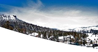
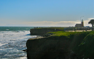
Make plans to get out on Saturday if you are a weekend warrior.  Do it early, as the day may degrade quickly.  Or, head up to Tahoe.  The snow will be fresh and it is always way better in a blizzard than a rain storm.