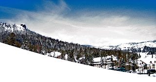
 Depending on the dip of this system, and how much water it pulls in, snow amounts could vary from a trace to perhaps eight inches. Safe bets are in the 2-4" range for areas along the west slope and crest. Enough to keep things fresh and help smooth out the surface. Freezing levels today are well above 9000', but will drop overnight as the system approaches. The snow level will begin a bit above 6000', or near lake level, but could drop down below 5000' as the storm passes. Friday morning could be a powder day, or just dust on crust. Regardless, Saturday should see some nice transitional (winter-spring) skiing. Clouds and chances of snow increase over the weekend.
Down here on the coast, the weekend looks to start out nicely. Saturday will see a bit of warming compared to Friday, but still on the cooler side. Around 60. Partly sunny skies will begin to fill in overnight on Saturday. The system will again impact the north earlier and more aggressively. Marin gamblers could put their money on waking to rain on Saturday, and have a decent chance at winning. Santa Cruz may see the sunrise on Sunday, and might make it through sunset before the clouds squeeze out more than a drizzle. The real bang for this wave looks to arrive on Monday, when all areas can expect rain or snow (guessing above 5K).
Tuesday looks likely to be clear, with more rain possible by Wednesday into Thursday. Another break for some sun on Friday and Saturday. Another system rolls through on Sunday for a day or two. Then a break, but more energy lining up behind that. Really, at this time of the year, those models are of little use in predicting weather, other than the fact they depict trends. Our weather drivers are shifting into neutral now, which would suggest inertia, or continuance of this current pattern. On the other hand, seasonal climate shifts will push us into spring, with a high pressure ridging into Mendocino, driving storms north and developing strong coastal winds. We will need to watch and see how this all plays out over the coming weeks.
This current pattern is working out pretty nicely. It is great for plants. Some rain with mild temperatures. Nothing too cold. Only issues have been a few stronger down pours and a few days of winds. Otherwise, it has been pretty mellow. Punctuate that weather with a few dry and warm days, so soil can drain and sun can be absorbed. As that sun gets higher in the sky, solar warming increases and spring springs. The alternative, of no rain, just means our soil is drying out earlier, turning hard and becoming dust. No, I prefer a lush green landscape that helps me forget that we live in a dessert. Well, at least they do in the southern part of the state. And they've had some of this water too.
Rain Thursday. Sun Friday. The weekend starts out the nicest it will be, and slowly gets grey and wet. Best bet for outdoor play is Saturday. Monday it rains. Tuesday is a break in the storms. More to come.


No comments:
Post a Comment