Thursday, December 28, 2017

GFS MAGA

To soon?  Anyway, GFS looks like it had it right all along.  Storm splits on the high pressure and mostly drives well north.  No rain for us Sunday, or any of California, really.  Still expecting a stellar day tomorrow, with highs pushing in the upper 60s, maybe even 70F.  Today, Thursday, should reach the mid 60s downtown.  On the westside it dipped below 40F for over three hours just before sunrise.  It is in the mid 50s now and temps have been on a steady increase since 8:20 this morning.  I see no reason why we should not warm another 10 degrees by early afternoon.  It was warm yesterday, flirting above and below the 7o degree mark for over two hours, with a peak of 72.8F.  Not shabby for early winter, on some of the shortest days of the year.

Early December evening.  


Friday seems like the peak of the warmth.  Sunshine and mild temps continue.  We will cool a bit over the weekend and into the New Year.  Low 60s expected.  Still gorgeous.  The noon run today of the GFS brings storms back to us as early as Tuesday night (January 2nd).  And a solid one as well.  That would last several days and bring up to an inch of rain by next Sunday.  Each run shifts the solution, so hopefully over the next 48 hours these begin to align.  What is promising is that each run shows a storm hitting us, just with different timing and intensity.  As these pattern shifts tend to be sluggish when moving from dry to wet, I'd wait a few more day before planning for a wet day outing.  You saw how that last storm appeared and disappeared in the forecast for New Years.  That said, in the time it took to write this post (I got distracted mid way through), we are back to a slight chance for a very little amount of rain Sunday night.  So, yeah, forecasts.

...and got distracted again.  Midnight hour run has the storm arriving Tuesday evening, then kind of retrograding through the start of Wednesday, before coming in strong Wednesday night into Thursday.  Maybe a break Friday, with more Friday night and into the weekend.  Wet beyond.  Looks like a full pattern change.  Get ready for some serious water.  Possibly.

Tuesday, December 26, 2017

Model Mayhem

It is Boxing Day, and the forecast models are all over the place.  There is a signal that we might see a storm by New Year's Eve, just 5 days away.  But not a whole lot of consensus.  What we do have agreement on is continued mild weather until then.  Low 40s overnight and mid 60s during the day.  We could even hit 70F on Friday.  With a bunch of luck.  And being in that right spot.  So, the Euro has a storm forecast for us by Sunday.  The GFS and Canadian are still high and dry.  So, we will need to watch these models over the next few days to see what is going to happen.  So be prepared for a possible rain storm.  While the dry scenario has the storms getting now where near us, the wet scenario has us right in the main path, so there is a big difference in rain fall amount.

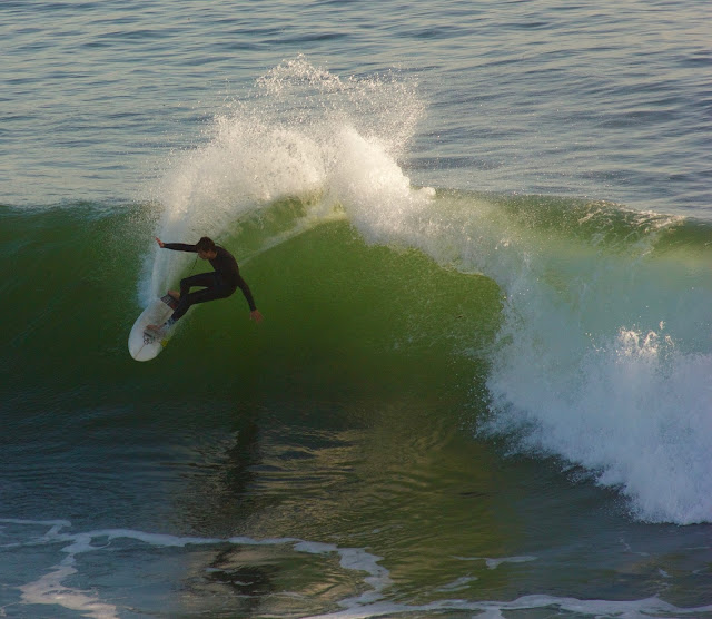
Just watching the surf.


There are also model runs suggesting a storm around the 4th or 5th, next Thursday and Friday.  Not a lot of agreement on that either.  The GFS finally breaks down the ridge around the 9th, or two weeks from now.  Not a whole lot of confidence with two week forecasts.  What is confidence inspiring is the confusion out there.  Somethings are moving and changing in the pattern and that is better than stagnation.  We need water.  The drought outlook for this winter is not great for California, with much of the southern half of the state expected to fall back into some level of drought.  Pray for that rain.

Friday, December 22, 2017

23.1

23.1F in Lockhart Gulch, near Scotts Valley, this morning.  29F on Van Ness and King Street on the west side of town.  Temps range from 29 to 35 Fahrenheit across town this morning, with an outlier of 41F on Western near High Street.  Maybe their thermometer is next to the dryer exhaust.  Regardless, it is a very chilly morning out there.  And pretty.  What is amazing about the cold is how close it gets to the ocean.  It is currently 33.9F on West Cliff Drive at 7:20AM.  Insane.  It should warm up to the upper 50s today with maybe topping 60F in the most favorable spots in town (sunny, wind protected and paved areas).

The Monarchs are clustering at Lighthouse Field.


Lows return to about 40F after this morning.  Highs over the next few days are right around the 60F mark.  Christmas will be sunny and mild.  Low of 40, high of 60.  Light morning winds today and tomorrow, with light to moderate on shore afternoon flow.  Small, mid period swell, dropping through the weekend.  Still could be some decent surf west and north of town in the mornings.  The winds pick up a bit on Sunday, and lighten for Monday, as a storm moves nearby to our west, but not coming on shore.

The Sunday system moves north and dissipates.  Another storm moves in from the north on Tuesday, and currently looks like rain will fall in northern California.  Still, there is a chance this storm could be far enough south to bring us rain some time on Tuesday.  Still need a few days to see what is likely to happen.  GFS then has us high and dry through at least the new year.  Stay warm out there.  Bundle u and go for a walk.  It is pretty up in the Pogonip.  Did my walking rehab up there yesterday.

Thursday, December 21, 2017

This is What Cold Feels Like.

Mid 30s on the west side this morning.  Several areas around town are showing sub freezing temperatures.  There is a fairly big range.  Rio Del Mar, on the water, is one of the warmest spots around at 40F.  Nearby, on the cliff, near State Park Drive in Aptos, it is only 30F.  Market Street in Santa Cruz is also cold this morning.  Eduardo Avenue in Ben Lomond is the coldest I've seen, with a reading of 24F.  Oddly, some of the low lying areas off Branciforte, which can get consistently cold come winter, are all showing temperatures above 40F, with Trinity Outlook (on a ridge) being 45F.  Like I said, a big range of temperatures this morning.  Over 20 degrees.  But basically, it is cold.

Tuesday morning's sky was pretty rad over the west side of Santa Cruz.


And pretty.  Sunrises have been in the good to epic range this month.  This morning's is cloud-less and amber.  The past few mornings had some great cloud structure to play with.  Today will feel cold, as light to moderate north winds keep ushering in the chill.  Certain north-south valleys could see some stronger gusts.  That wind will lighten by afternoon, and switch to a more south easterly flow.

Warming trend starts on Saturday.  Continued cold mornings.  But event eh mornings warm up a few degrees.  By Monday (Christmas), we expect a low in the low to mid 40s and the highs to hit the mid 60s.  Then it stays that way through mid week.  Unless a storm can sneak in here on Tuesday.  Still no confidence, but yesterday's noon run suggested a quick system.  This morning, it is gone from the model.  In fact, it has the state high and dry for almost a week into the new year, with a decent sized storm around the 6th.  In fantasy land.  It will be a very dry December this year.  Something that raises a little concern after those years of intense drought.  We need that rain to return.

Wednesday, December 20, 2017

Storm Has Passed.

The worst of that wet and wild winter storm has shifted to our south and east.  You may have missed it.  You may have been sleeping, but Santa Cruz received between one and two tenths of an inch.  Almost double the forecast, leaving the roads and ground with a wet surface for the sunrise.  Cloudy right now at 7AM.  And chilly.  About 48F on the west side.  33F this morning in Los Gatos, in the Sierra Azul Open Space, along McQueen Ridge.  Most of the readings in Santa Cruz county are in the mid to upper 40s though.  Clouds clear and the day warms a bit into the mid 50s.  It will be a chilly day for the most part.  Wear a sweater.  Sunny afternoon and another cold (in fact, colder) night on tap for us.

Lighthouse Field.  Beautiful light and  great spot for a rehab walk.


The next few days will be cool, warming a bit each day, into the upper 50s for Friday.  Over night, we will be clear, and crisp, dropping into the upper 30s.  Early Friday morning, we could drop into the mid 30s.  Still a few degrees above freezing, but if you live in one of the cold hollow, shaded and wind protected zones, and you have sensitive plants, now is the time to prepare and get a row cover out there.  This is the coldest weather of the year arriving.  It must be the holidays.

Warming comes with the weekend.  Low, the mid 60s for daytime highs.  Christmas Day looks like it will be about 65F, sunny and calm.  Overnight lows climb back into the low 40s.  We do see a chance for more rain after Christmas, maybe arriving on the 26th or 27th, but the models are still all over the place. The pattern is shifting again, and we will just need to wait and see if a system can cut under our protective high pressure.

Tuesday, December 19, 2017

Wednesday Morning Showers, Perhaps.

Timing is looking more and more like a chance for some light showers late late tomorrow night into Wednesday.  Chilly out there.  44F right now.  But it hit 76F today and it was above 70F from about 12:45 until 3:30 this afternoon.  Can't complain too much about that.  Swell has dropped considerably.  Sun through the day tomorrow, but much cooler.  Maybe low 60s.  Tuesday night we see some clouds move in, along with chilly temps.  From a mild day, it will become a clod night.  Cloud cover keeps us above the 30s.  Barely.  Best chance for rain is early morning Wednesday through the commute hours.  Light rainfall if it does materialize.  Best guess right now is showers in some area, over the mountains, and less than a tenth of an inch.  Just enough to moisten the surface.


At this point, another 10% of the state fell into the Abnormally Dry state, for about 45% total.  We need to get rain from here south to make a shift.  Soon.  Looks like cold weather behind the storm.  Highs in the 50s Wednesday through Friday.  Lows in the upper 30s.  I bet we see some freezing temps in the early morning hours Thursday and Friday in the shaded hollows  Protect your plants if they need protecting.  Okay, that is it for now.  More later.  GFS keeps flipping on outcomes for around Christmas, but we could see storms (or not) just after the holiday.

Sunday, December 17, 2017

Less wind, with a chance of showers coming.

It was pretty breezy over the weekend.  Especially so in the Sierra, with gusts over 75mph.  It was not that bad here in town, but there was holiday decoration carnage on Saturday morning.  That wind won't be so bad tomorrow.  The air gets colder though.  Mid 40s right now in town.  That will dip down to 40F in the colder spots.  Maybe even into the upper 30s for certain hollows.  Monday will be sunny, and mild.  Highs a little bit warmer than today due to much lighter winds.  It could even be off shore in the mornings.  Expect a nice day, as the next storm system is knocking on the door.

Nice weather and moderate swell was the name of the game this past week.


Tuesday colder air moves in, as the high pressure shifts west, and frigid flow begins from the north.  This should allow a storm system to swing by to our east.  How far east is still up in the air, but the up shot is by Wednesday, we will see highs back down in the upper 50s, and lows dropping into the 30s.  There is also a chance of rain coming with this thing.  NOAA gives it a 30% chance early Wednesday morning.  GFS keeps it north longer, and allows it to slip inside late Wednesday into Thursday, with us getting barely measurable precipitation.  So, yeah, a chance of rain coming, but nothing to get prepped for.  After that, we look dry through at least Christmas Eve (or next Sunday).

We should warm a bit on the back side of the storm, but don't expect much.  Low 60s, sun and fair days through the rest of the work week.  Nights are cool in the upper 30s for a few nights.  Feels like winter.  I'll keep an eye on this week's mini storm and up date as it forms.  Sunsets are still wonderful almost every night.  Go get some.

Friday, December 15, 2017

Still Warm Today.

I keep saying things will cool off, and they have, barely.  It hit 68F on Western Drive around 3PM yesterday.  It is a little cooler today.  Still not out of the 50s at the same location currently (12:45).  NOAA is calling for 70F downtown today, but that seems doubtful at this point.  And the trend is toward cooler afternoon temps, slowly dipping to low 60s by the middle of next week.  This cooler air might help knock the inversion out of the interior and Sierra.  Been warm up on the ski resorts.  Mt Rose saw a low of 41F at 2AM early Tuesday morning.  Not good for snowmaking.  Our low that night, here in Santa Cruz, was only 5 degrees warmer.  Anyway, I digress.  More of the same for a while still.  Details below.

Steamer Lane, December 14th.  Glassy and fun at 2PM.  


Sunny.  Lows in the 40s  Highs in the 60s.  Some clouds.  Decent swell.  Light winds.  For the next seven days.  Around next Wednesday or Thursday, the high pressure keeping us dry will shift a bit west, allowing for a classic inside slider scenario to set up.  As it looks now, a week a way, the rain will fall mainly to our east.  Maybe some for the Sierra.  Being a week out, and a pattern change, odds and confidence are low for specifics.  Maybe after the weekend details will be clearer.

Get out there and enjoy the late autumn weather.  It will be wet soon enough.  If you are bummed about the lack of snow, you can still get out and warm up those legs on plenty of groomers.  Kirkwood is opening the backside lifts this weekend, essentially opening up the entire mountain.  If you don't ski, this weather is pretty perfect.  Great surf conditions most days, all day.  Swell just keeps on re-upping and staying looking fun.

Monday, December 11, 2017

Cooler Tomorrow.

Today was nice.  A thermometer here on the westside hit 80F right around two PM for ten minutes.  It hit 73.8F at noon and was above that through 4:08PM.  Like I said, a nice day.  Surf showed up smaller than expected.  It looked about shoulder to head hight at the Lane, with a bumpy chop to the surface.  No wind.  Been an off shore flow.  Bigger and possibly cleaner surf outside of town.  Might take a drive on Thursday to take a look as fresh swell arrives.  Maybe I'll get the camera back out. Might try to paddle around Cowells before that, just to get back int he water.  And take advantage of this fantastic run of weather.  It will be cooler starting tomorrow, hitting only the low 70s.  Upper 60s Wednesday, and through the rest of the week.

Ski resorts are open.  The upper mountains have good coverage, but it gets pretty thin below 8000 feet.  This dry spell has not helped, but resorts with big snow making systems have had a good run.  It was cold up there until a few days ago, and will be cold again.  Problem now is there in an inversion.  Bad for spots like Rose or Kirkwood, but great for making snow on the lower runs at Squaw or Heavenly.  Northstar has focused on their frontside and have a good variety of runs open off Pluto.  Mammoth is in great shape at Main Lodge and will have all three bases open in a few days.  On the other hand, the higher based resorts have a ton more natural snow top to bottom.  No, it is not epic, but there is snow.  Get out there and stretch your legs.  I wish I could.

No change to the forecast.  Decent westerly swell for Thursday into Friday. Fair weathers.  Wisps of weather possible around the 20th.  My experience tells me these things usually take longer than predicted, so maybe a Christmas Eve present.  And I certainly don't see the storm doors flinging open.  But I'll keep watching.  And post up any changes before then.  Enjoy this fine stretch.  Grab a sunset walk on a beach.  They have been off the hook.  Tonight there was a blazing red fire ball.

Ten Days.

That is about how long it has been since we have seen rain.  Actually a bit longer than that.  As well as since I last post (sorry about that - my leg cast came off, the weather has been fine, and it has been all about the rehab).  And it will be at least ten days until we see rain again.  What began as a decent start to the water year should took a quick halt back around Thanksgiving.  Good for me, my healing, my unfinished yard work and my need for roofing repairs to be completed before the main part of winter.  Not so good for snow lovers or maintaining non drought status.  In fact, we've seen about 4.5% more of California become Abnormally Dry, again, over the last week, with 1.5% shifting into Moderate Drought.  Not good folks.  Those numbers are small, but you can see, at this point in time, we are slowly moving back into drought.  Currently 65% of the state is normal, or wetter than typical.

Anyway. Forecast.  Nice.  Sun.  Cool mornings, mild afternoons, offshore breezes.  In fact, today will be splendid, pushing into the upper 70s.  Get out and get some.  Some nice small to moderate swell out there, coming from both the W and SW.  It actually almost seems like October out there today. Head high to overhead swell on the exposed coast.  More swell arriving today, and a bigger one later this week.  Sure wish this ankle were ready for the surf.  It is rocking out there right now.  Some of my favorite conditions; when you can get out of town and surf any spot on the coast.  Anyway, today is the warmest of the week, with a cooling trend into Wednesday when we drop into the upper 60s.  High temps should be in the upper 60s through next weekend.  With all sun.  Overnight lows in the low 40s to start the week, and upper 40s by Sunday.

I'm watching the charts for a pattern change here.  As soon as I see that, I will get around to posting more.  In the meantime, enjoy this great weather and prepare for winter.  As you know, when she comes, she comes.  As it stands now, we are looking for a slight chance of light rain possible just before Christmas, as our high pressure shifts slightly west, allowing some storms, and cold, to push down from the north.  Only time will tell.