Monday, March 31, 2014

A fairly wet start of the week, with a chance to linger.

Gonna make it short and sweet this morning.  Headed to the snow with the boy to escape the damp here on the coast.  Clouds this morning, with rain on the way.  We could make it through most of the day without seeing any serious precipitation.  Though, showers are likely, and we will likely linger in the upper 50s.  Colder air fills in this evening.  And rain.  It will have a chill to it tonight.  Might want to run that heater.  Currently looks like a rainy day tomorrow.  Especially through the morning hours.  Cool again tomorrow, but hitting 60F would not be shocking.  Another wave from this system pushes down the late Tuesday night, providing us with more rain.  Showers could linger on Wednesday.  Low 60s.  Sun comes out late or on Thursday.  Mid 60s.

Been a week of sun and a week of three feet of snow on this face.  Wonder what it looks like now.


Late Thursday another system drops out of the gulf.  This one is breaking up just off shore.  Maybe showers early Friday.  Warming through the weekend as high pressure fills in.  As that happens we will leap to the upper 60s, maybe even low 70s to start next week.  Chance for more rain by the end of that week, though.  Rain is good, but the sunny weekend coming up will sure be nice.

Saturday, March 29, 2014

A Godsend.

This rain today sure feels nice.  Not too cold.  Not too heavy.  But it isn't just showers.  Over an inch in the last 24 hours in Ben Lomond, and about a third of an inch in town.  San Francisco is sitting just shy of an inch, and will for sure go over that tonight.  There is a pretty good size area of moderate rain sitting on top of us right now.  Looks like Monterey and the south portion of the bay are about to get hammered.  Rain will subside overnight, and we are looking at a good chance for some sun on Sunday.  Colder air in place will keep temps in the low 60s.  So thee is a chance to get out and enjoy some sunshine.  It will be wet, so put on the stomping boots and go looking for puddles, rainbows and waterfalls.  Might even see a unicorn tomorrow. Who knows.  Stranger things have happened in Santa Cruz.  Regardless, it is looking like a stellar day, especially if you enjoy photography.  Surf might even clean up a bit to move from the pure utility and exercise realm and into the one of fun.  Next system is hot in this ones heels.

Nap Time.


This one has a few slightly different scenarios showing up in the models right now.  Little doubt we will see rain developing late morning or early afternoon on Monday.  Some models suggest a direct hit, others suggest that as the storm comes ashore, it splits. One portion falling apart on top of us, and the other driving south along the coast and hitting L.A.  Scenario number one delivers us moderate to heavy rain to our region again.  Scenario number two delivers moderate rain to the coast, but not much moving inland.  I'm betting on something between the two for now, so expect another period of rain, similiar to today's, for mid day Monday and Monday night.  Maybe a bit less water falling.  And with even colder air.  Now, it will be April, so this won't be that bone chilling stuff we can sometimes see in December.  Showers look to persist through early Tuesday, and maybe even reaching into the afternoon.  Temps will be in the high 50s, unless the sun breaks out and helps warm things up.  Then there will be Wednesday.  Glorious Wednesday.  The day the storm breaks.  Gonna be a nice one I tell you.  Next round of storms could stay north of us.  If that is the case, expect some drying and warming through the week.  Could pop back into the upper 60s for Friday.  That is if the storms stay north.  If they don't, then showers could be on the menu Thursday and Friday, and temps will be cooler with the cloud cover.  But Wednesday looks like a sure bet.  For now.  Better check back.

Long term has a high pressure developing and sticking around for at least a few days.  The end of the following week, we could see more storms.  April could be relatively wet through mid month.  Like I said.  A Godsend.  We need this water.  And the dents are getting bigger.  Hopefully we can a put a hole in this drought.


Friday, March 28, 2014

It might be sunny next Wednesday...

Hope you are all ready for the good dose of grey we are getting right now.  Consider it practice for the summertime fog bank.  Kind of feels that way outside right now.  Not too cool.  Almost humid feeling.  But it won't be feeling like summer for very long.  Keep your fingers crossed and it will keep the rain at bay today.  Right now a large, wet storm is moving south along the coastline.  Rain is again falling in Washington, making for increased challenge with the search and rescue  work going on in Oso.  Hearts going out to the folks dealing with that tragedy.  Here in Santa Cruz we won't see that sort of devastation, but we will get some decent rain next few days.  Somewhere in the order of 1.5 to 2 inches here in town.  More in the local hills and points north and east.  The Sierra Crest could see upwards of three inches (that is 3 feet of snow, yo!) and there is a bullseye right around Lassen National Park with 9.5 inches of precipitation.  That is much needed rain.

He takes handouts.  Municipal Wharf, Santa Cruz.


Here are the details.  Clouds today.  Should continue to feel pretty cool out unless the sun breaks out.  I would love to see a short break of sun today, but I won't be holding my breath.  By tomorrow morning, the rain should be impacting the north bay.  Heavy rain.  We might be able to hold off until noon, but once the rain does come, we can expect several hours of heavy rain.  And strong south winds.  It will be a stormy day Saturday.  The storm will bring some colder air, but not terribly cold.  Low 60s perhaps.  Sunday morning we could see some lingering showers, but expect mostly clouds for the day.  Next round is expected to show up early Monday.

Current model runs suggest the strong storm for Monday will show up mid morning.  So, you commute types might still have an easy morning drive.  Don't expect that to be the case for Monday evening.  More strong south winds and heavy rain should be wide spread by evening.  And this one is packing some cold air.  We could be hovering in the upper 50s on Monday.  All in all, this is really good news for our water issues.  Still not going to be enough to knock us out of drought, but it is moving us in the right direction.  Rain subsides on Tuesday.  And as of today, it looks like it might even be sunny on Wednesday and warming into the mid 60s.  But that is still a long ways off, so, you never know.  But know what?  There is another small system forecast for Thursday, so it is not like it is high and dry.  So there is that to consider.

Wednesday, March 26, 2014

On track.

Around 9AM this morning I was thinking I blew the forecast on rain amounts.  I mean, it was dumping out.  Then, things started to dry up quickly around 10AM.  Rain continued off and on through the early evening hours, but since then it has been pretty dry in town.  Some stars out tonight, but clouds hang on the local peaks.  Maybe a few passing showers on the right up hill slope, but for the most part, this things is passing.  Now, the chance for showers persist the next few days.  But it is not likely Thursday.  Maybe a touch warmer than today, as there will be a bit more sun.  Perhaps.  The air mass remains moist though.  Friday is a little warmer, but it will also be more humid.  Still, rain will likely hold off until Saturday morning or so.

Middle Peak, Steamer Lane, Santa Cruz.  Look closely, it is well overhead.


Could be a real wet day Saturday.  And cool again, with highs similiar to today.  I mis-wrote last night and suggested a quarter inch, when I should have said more like an half inch.  It will be swift.  Kind of like this thing was, but more clearly pulling out quickly.  Sunday might have some morning showers, but it also looks like the stars will be out for night fall.  Back up into the mid 60s.  And it still looks like another storm showing up on Monday and filling in through the day.  This one could bring some cold air.  So, no big changes.  Maybe some more lingering showery weather through the week.  Still maybe more behind that.  Nothing too big, but Monday's system could bring another quarter to a half inch.  What is impressive is the bullseye near the OR border with over nine inches of rain by Monday midnight.  And there is likely rain falling after that.  Tahoe could be seeing two to three inches by then.  They already got 6 to 16 inches from this current storm.  We are getting a little water.  And the skiing should be improving as well.

Anyway, gotta get to sleep.  Decent weather Thursday and Friday.  Could be getting wet late Friday, but pretty sure Saturday will be like this morning.  As in moderate rain.  Sunday could be the best bet at sun this week, and maybe Monday morning.  Next storm arrives Monday and last into Tuesday.  Perhaps showers to follow.  Not a lot of sunshine in the forecast.  Only much needed rain.


Tuesday, March 25, 2014

Big changes in timing. So I think.

Right now looks like the heaviest rain will fall during the daylight hours tomorrow.  Likely some more light rain tonight.  We had a quick threat of showers around 1PM, then decent showers from about 4 to 5PM.  Grey out there right now.  Cool tomorrow.  Like today, but with less sun and stronger south winds.  Blustery perhaps.  Clearing out through Thursday morning.  Looks like that high might try to nose in Friday, but barely.  Expect decent cloud cover.  Could be the warmest day of the week.  Might see 65F.  Then the next round has sped up.  Saturday looks like a wet one.  Here is the difference.

Just chilling on a calm day, barking and playing away.  Municipal Wharf, Santa Cruz.


We have backed off on precip for this current system.  Perhaps a quarter inch added up between what has already fallen, and everything until it wraps up maybe late Thursday.  Saturday we could see the same total.  Just during the day.  Add in the lingering stuff, and it begins to add up.  It now looks like things will clear out mid day Sunday before another round arrives late Monday along with a colder airmass.   Man, it just keeps changing.

Do you ski?  Have you written off winter?  Could be a good weekend coming up.  A refresh tomorrow could put a foot of snow on the resorts and two feet along the crest.  Mid week skiers will pack that down and create a nice mid winter surface for shussing.  Add another foot plus of powder on Saturday, and you have fun storm day skiing.  Hell, it might even go bluebird for you on Sunday.  Winter ain't over yet.  And thankfully so.  We do need that water.

Anyway, looks wet during the day Wednesday.  Plan accordingly.   Could be clear(ish) by Thursday afternoon.  Friday looks decent.  Some clouds, but dry(er) and warm(er).  Now looks like Saturday could be a moderately to very wet day.  Hopes for some sun later Sunday.  Colder air and more rain arrives late Monday.


Monday, March 24, 2014

A wet week in store.

Really good news folks.  This run of dry sunny warm weather is coming to an end.  Next few days play out as thus.  Clouds fill in overnight.  Tuesday begins off in the mid 40s and warms into the low 60s.  Very low.  Sporadic showers fill in from the north, likely crossing Santa Cruz in the evening.  North Bay commuters should plan on an afternoon rain.  It currently looks like showers will remain light overnight, but fill in a bit Wednesday morning.  If you travel the hill, expect extra fun (or slow your roll weather) in the morning.  Day begins in the upper 40s and warms to the upper 50s.  Maybe 60F.  Light to moderate rain persist through most of the day.  You can expect breaks in the the rain, but likely just brief ones.  Watch the radar, but plan your day accordingly.  Could be a good day to go view fish at the Aquarium.  Temps about the same through at least Saturday.  We remain right on the shower line during the day Thursday, so we could still be a little wet.  Looks like the showers will lift north for Friday.  Thing is, a lot of rain is looking to fall north of us.  Maybe eight inches in Brookings, on the southern Oregon coast, by Sunday.  Two inches or more along the coast north of Point Arena.  An inch in Marin.  Two to three inches from Shasta to Tahoe.  That is several feet of snow along the crest.  I mean, this could be a nice run of water for the state.  Another dent perhaps.

Big Dipper.  Oldest wooden rollercoaster on the West Coast.


In town a half inch or more of rain is reasonable.  The mountains will get more.  We could see some runoff, especially in paved areas.  A boost to the creeks and water falls.  Expect bacteria counts to increase at your favorite surf breaks.  And sand bars to improve.  It will feel warmer on Friday and Saturday with the decrease in cloud cover.  Don't get me wrong.  We are real close to the moisture plume that will continue through this time period.  We could see continued rain.  We are still 4-5 days out, during spring, on this.  A lot can change.  Still looks like a storm digging further south starting Sunday.  Now looks like a one-two punch, with the second wave coming Monday afternoon.  Could carry some cold air with it by then and some copious rain.  And we are not necessarily in the clear after that.  So, a winter week lay ahead.  Hope I have given you ample warning.

So, I will get more into the whole upcoming weekend thing soon.  Maybe take a closer look after this system. But plan for showers filling in tomorrow.  Much cooler than today.  Wednesday looks rainy.  Thursday more showery.  Friday clearing.  Saturday nice.  Another storm arrives Sunday and lasts through Tuesday.  Maybe a day of sun after that, and then more rain.  Feeling hopeful.


Sunday, March 23, 2014

'Member that whole progressive thing? Well...

Each run gets a little wetter with this next on up stream.  GFS is now calling for over half an inch through Saturday morning.  Tomorrow still looking like a winner with light winds, moderate swell and topping out at just about 70F.  Sounds nice.  Tuesday will have increasing clouds.  Right now it looks like rain will hold off through noon or so.  I'll try to fine tune that tomorrow, but plan on a wet evening commute.  Showers push from north to south, increasing to moderate rain overnight.  That is round one.  Highs in the low 60s.  Cool, but not cold.  The heart of this system is around Seattle, so the cold core is still well north.  Breaks in the showers, and even maybe some sun during the day on Wednesday.  A little cooler than Tuesday.  Then reinforcements arrive late in the day.  We may even see sporadic heavy rain overnight Wednesday.  The cold core will shift south, closer to us, but that big ocean next door will keep our temps mild.  It will be getting colder in the Sierra.  Overall, they see a foot a snow.  North portions of the state see and inch or more of water.  Good news there.

Fishing boat by the flagship.  4 Mile Beach, Santa Cruz.


Rain looks to persist through much of the day Thursday, and we may even see some showers lasting overnight or into Friday morning.  High noses in a bit late in the week.  Still looks like the second storm will be hitting on Sunday and the models keep intensifying that things.  We could see wide spread copious rain and some cold.    Could.  More on that later.  Just be ready for a wet few days ahead.

Saturday, March 22, 2014

Panning out nicely for wet solution.

Yeah, yeah, more of the same tomorrow and Monday.  Maybe warming up compared to today.  Maybe 70F on Monday, but likely not that warm.  It will all depend on that fog bank.  Expect it back for Sunday.  If the developing low pressure in the Gulf of Alaska can suppress it on Monday, it might fell warm indeed.  GFS speeds up storm number one for next week.  Now, just to note, this things still does not look terribly wet or terribly cold.  If you were planning on planting seedlings this weekend, you can still go for it.  But we are running into a wet and cool period.  If you don't have anything going in the ground Sunday, no need to run out to the store just yet.

Bird.  In water.  4 Mile Beach.  Santa Cruz.


First, I want to say this wet period is nothing as severe as the last one.  Sure, we will accumulate some more water, which is very good, and we may see water running in the streets, but it does not look like there will be torrential periods.  Rain moves south down the coast on Tuesday.  North coast in the morning hours and passing San Francisco around noon thirty.  Here just a bit later.  Fine tuning will be needed.  Rain becomes more persistent overnight.  A second wave reenforces Wednesday evening.  Showers clear out early on Thursday.  About a quarter inch locally in the hills.  A bit more in the city.  The bullseye for this round hits the crest from Tahoe north.  It will bring cold air.  Low 60s on Tuesday, and maybe staying in the upper 50s on Wednesday.  Rebound begins Thursday and mid to upper 60s return for Friday.  Or something like that.  Again, I'll fine tune.  But confidence is high we will see some rain mid next week.  And #2 is still on the charts, so more to come, likely late next weekend.  And still maybe something after that.  How cool.

So, at the very least, use your free time over the next two days to clean up the yard and wrap up projects.  If you are like me, you have been busy this winter, taking advantage of the dry weather, and tending to some outside work.  Tidy up and focus on inside for a bit.  It is not going to get super wet, but a quarter inch is enough to wet the surface for a while.  I know I need to clean out the crawl space.  Too much wood lying around down there.  Anyway, next Friday/Saturday will likely be dry, but with more rain likely coming, it might just be time to shift gears.  On the other hand, if you were planning on spreading some lettuce, or greens, seed, might want to get to that just before the rain.  Nothing like Ma Nature's showers to help germinate those little things.  Fair the next two day.  Monday could even be nice.  Stormy conditions filling in Tuesday and pulling out Thursday.  Fair Friday and Saturday, and maybe Sunday morning.  More storms to follow.

Friday, March 21, 2014

So, yeah, uh, that whole fog thing.

So I did put in an edit this morning.  When I wrote my post yesterday, I really did not see that coming.  I had juts looked at the visible, and there was nothing out there mid day.  Still, I saw it coming in yesterday afternoon, and felt it yesterday evening.  And it was thick this morning.  Some high clouds was more like a shroud of damp.  Hope you did not leave the newspaper out on the deck.  Anyway, it looks like this summer like weather will persist at least through the weekend.  Good news if you are trying to score a mid day surf.  Bad news if you like sunshine.  I tell you, I think my garden enjoyed it this morning.  Anyway, more cool weather this weekend.  Like today.  Still a chance of a Monday warm up, but I don't expect much beyond 70F.  And then that gets slammed in the face with a cold front.

Big Ron and a glass of red by the sea.


Still looking like we will have a system Tuesday through late Wednesday or early Thursday, and then another for the coming late in the weekend.  This mornings run has the first one a bit wetter and further south than the previous day's run.  Good news for water.  The Sunday system also looks stronger, and like it could last several days and blend with the potential third system.  I'll have more on all this by later this weekend.  But it looks like we could see some wet periods moving through the next ten days starting on Tuesday.  Please, please, please.

Thursday, March 20, 2014

Increasingly Progressive.

Not a description of a developing, forward leaning candidate.  The model runs have been consistent over the past few days.  The GFS has been consistently drier than others.  Even the forecasts in the mid and long term have been relatively consistent.  And now we are five days out from round one, which will play out in two parts.  But first, the next few days.  Northwest breezes have picked up again this afternoon, and will keep our air cooling.  Almost 70F today, mid 60's tomorrow, maybe even low 60's for the weekend.  No real fog issues showing.  (edit: oops, looks like there will be fogy mornings through the weekend- bummer) So, yeah, kind of nice.  It probably won't be until Monday that we feel the warm air pump, with temps reaching back to the 70s.  Round 1, Part 1 arrives late Tuesday.  It will  bring some cooler air, but how cool, and how wet, depends on how far south it dives.  And really, no matter how wet we get, it won't be very wet.  Might not get wet at all.  Odds increase with Part 2.

Winter evenings have come to an end.  Time to prepare for spring light.


Anyway, right now looks to me like showers will extend as far south as San Francisco.  But this is still five days away, so don't hold me to that.  Decent confidence the northern portion of the state will see light and moderate rain.  A few inches in Tahoe.  And, the storm will bring with it a cold front.  It will not carry with it a whole lot of water and clears out east through Wednesday, just as Round 2 pushes onshore, wetter and deeper than the first.  I think we will see some light rain, especially on the north end of Monterey Bay, on Wednesday night or Thursday morning.  All that pushes east with high pressure setting up Friday and Saturday (the 28th).  Still pretty light accumulations here in Santa Cruz.  Tahoe could add up six inches to a foot.

Here is the thing.  As I look beyond 7 days, it looks like the progressive pattern will continue and shift further south.  Now, understand, this is pretty much pure fantasy, but is the last several day's of consistent model runs hold true, here is kind of what it will look like.  Sunday arrives Round 2.  A wet and colder storm arrives, but is kept from crushing us by the huge high in place.  Northern portions of the state get a good inch from the system.  We might start measuring tenth of an inch by this time.  Moves slowly north and east Monday afternoon.  Showers continue in the north and along the Crest through mid day Tuesday.  Some more snow for Tahoe.  Round 3 starts to arrive on the scene Tuesday night, April 1st.  Winds up off the coast and moves on shore Wednesday through Friday.  Moderate rain here, heavier north.  Cold air pushes in through the end of the system.  Might need to check the heating system.  Ours has been off for months.  Anyway.  Like I said, all fantasy.  But looks like high pressure would nose in after that for the weekend of the 5th.

Tuesday, March 18, 2014

Keep on suggesting a return to wetter weather.

Just keep on suggesting it, and it may come true.  Just like that.  Fine weather this week continues.  It may even begin to get a bit warmer through the weekend, as low pressure develops in the Gulf of Alaska and pumps warm up underneath it.  What we can count on for sure is a nice warm Wednesday.  We could see 75F, with lighter sea breezes in the forecast.  Warm air will try to move in to maintain that temperature, but the building seabreezes will chill things off.  Wind could go slack on Saturday, as the aforementioned low develops.  I hear there is going to be a decent head high plus long period swell showing up on Saturday and building into Sunday.  That could be fun with slack winds.  Funny year.  Anyway, the weather will be mostly nice.  Anyway, warm Wednesday, then a bit cooler through the end of the work week.  Weekend could warm up again depending how the low moves.

It must be spring.  Where I grew up the lady bugs showed up in spring.  This must be their winter home.


Game day for this storm will be Tuesday into Wednesday.  Right now we are on the souther end of the storm track forecast.  That would give us drizzles to light rain.  That could easily change.  Beyond that system, the forecast models remain progressive, bringing storms increasing south.  That would me heavier rain and stronger winds for us.  That brings us through April Fool's Day, so there is that.  Anyway, this beautiful weather will change.  If it is going to be cold and windy, it mind as well dump buckets.

Sunday, March 16, 2014

Classic Sierra Corn Cycle or Surf's Up!

California is gold right now.  A solid swell hitting the coast today.  I can tell you that is true as we spent last evening and this morning at the beach.  The inside barrel last night on the low tide was sick, I tell ya.  And the tide pools were even better.  High tide this morning paired with larger swells made for more adventure.  Up in the mountains, we are seeing overnight freezes, and warm, sunny days yielding great corn cycles on E-S-W facing slopes.  Other than a few runs with my son on Friday, I have not been out in either recently.  Just an observer.  But it sure has looked like fun.  Hope you found something enjoyable to do this past weekend and enjoyed a bit of the fine weather.  Thing is, it looks like it will continue.  Wind came up today, and that will be with us for a bit.  It is spring after all.  None the less, the week ahead looks nice.

These folks enjoy napping in this fine weather.  


Just about a high of 70F for the work week.  Maybe a ouch cooler toward the end.  Mid 40s for a low.  Nothing surprising there.  Winds will remain on shore out of the north west, which will keep the breezier locations cooler.  At the beach I was at today, we were out in the wind, due to the high water.  But as the tide dropped, we tucked up behind a cliff not 50 yards away.  It felt 20 degrees warmer out of the wind.  So, yeah, it will be like that.  The breeze will be lightest in the mornings, but it looks like it will stick around most of the week.  Monday might be a good day to take a kite out at Scotts and play with some energy.  If you like that sort of thing.  Anyway, swell will mellow by Tuesday.  By the weekend, the day time highs may be a bit cooler. Wet weather is still on the charts for the 25th, but keeps on slowly backing away.  What is noticeable is the size of this high pressure as it gets pumped up over the next ten days.  Who knows, maybe the bubble will burst.  Today's run suggested something big building.  That would be cool.

Whatever.  At least ten days of good weather on tap.  Yard work, afternoon hikes, morning strolls, beach time, stoop time, bench time, for the next ten days.  Enjoy it.  And pray for that rain to come again.  Another good dumping would sure feel nice.

Saturday, March 15, 2014

Just in case you live under a rock, it is damn nice outside. Damn nice.

So, not a whole lot to report on today.  Forecast has been holding true the last few weeks.  It feels kind of good to look at models and feel they have some accuracy.  What does not feel awesome is the lack of rain in the forecast.  While the past few weeks felt wintery, it was not nearly enough to solve our water issues.  Drought levels are now hovering around 'extreme', down a bit from 'exceptional.'  So, we did make a dent, but just a dent.  Please be conscientious of your water use in the coming year.  As an El Nino continues to develop, I feel hopeful for a very wet winter next season.  Now, all this talk of dry weather does not mean we will not see more this year, but there is no sign of a wet hose pointed at California in the coming month.  Just some slight chances of wetter weather by months end.

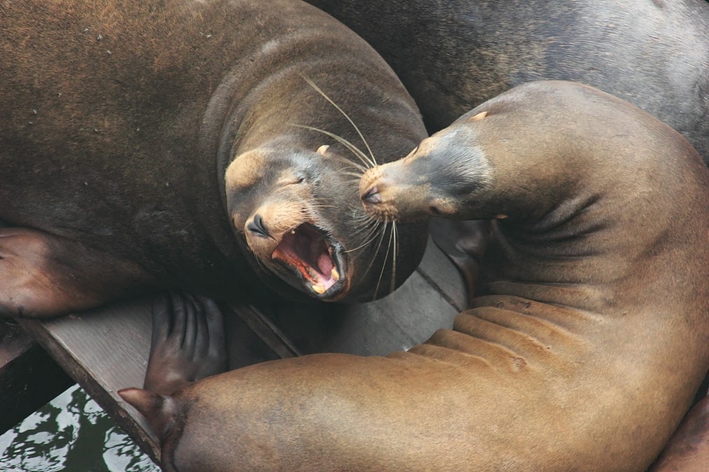
Wanna kiss a sea lion.  Head to the Municipal Wharf, Santa Cruz.


Now the forecast.  Super nice out there right now, and warming up nicely into the mid 70s.  In the sunny, breeze protected and paved parts of town we could easily see temps reaching up into the low 80s.  For like ten minutes or so.  Point is, it is quite warm out there.  Up in the Sierra, the snow will be corning up nicely on east, south and west facing slopes as the sun hits them.  North facing slopes will soften less.  60F at lake level, and low 50s in the mountains.  All in all, some great spring skiing conditions.  My son and I were out yesterday and he had his biggest day yet.  The weather was perfect for the young ones and learners.  Kind of nice not being cold on the hill.  Back here on the coast things are not boring either as decent surf continues from last week, with a new round of swell arriving mid day Sunday boosting heights back into the over head range.  For March, things look great.  Still, a decent sea breeze is expected int he afternoon.

If you are a gardener, this will be a great weekend to get out and prepare your planting beds.  Our winter garden is looking great right now, producing too much lettuce and kale.  You can't ever get too many peas, but we are close, and the Brussels sprouts are beginning to set on the stalk.  As are the fava beans.  If you like to gamble a bit, it might be worth getting a zuke in the ground.  In my mind, it is still a bit early for the real tender plants like cukes and tomatoes.  Right now, the weather looks fine, but it is still technically winter, and we could see cooler weather through months end, and if it gets too cold, those plants will stunt and fail.

Speaking of cooler weather, Monday we will drop back to around 70F for a high, and by Thursday we will drop further into the upper 60s.  The chances of rain are looking slimmer, as the high pressure will not shift far enough west to allow storms to drive down the coast.  Forecast models continue to suggest a shift in about 10 days.  We've heard that before.  Still, will keep an eye on things and my fingers are crossed for more snow and rain.  Lord knows we need it.  Super nice this weekend, sun through the week, with some slight cooling through next weekend.  Maybe rain by the following Tuesday (25th).

Tuesday, March 11, 2014

Gonna be an epic surf week.

It is damn nice out there right now.  Damn nice.  Low 70s all this week.  Upper 40s overnight as a low.  Not a whole lot to report new.  People are out working in the yard.  Good week for that.  Great week for growing produce as well.  Sun is warm out there, especially in south facing areas.  A bit cooler down by the water, but that is to be expected. Morning breezes are shifting E-NE through the week.  So, that is a good thing.  Some residual swell in the water keeping things chest high in town, a bit bigger further west.  New swell arrives on Wednesday.  Could be a nice decent sized long period westerly.  Gang busters.  More arrives through the weekend, and again late Sunday, with size building early next week.  That is if the models are running correctly. And if they are, our weather will be gangbusters.

Lighthouse Field, all lit up.


Warm up still expected for the weekend.  It will be a warmer warmer inland, but the coast is going to be quite nice in the mid to upper 70s.  Good stuff.  It will cool off the beginning of next week, and by the middle of next week, we could see some cold air move in.  Like high temps in the upper 50's by Thursday.  But that is 10 days out, so don't go counting chickens.  Fingers crossed for some cold snow up on the mountains.  Wouldn't be nice to get some snow around the Monterey Bay peaks before we close out winter?  For now, enjoy the fine, fine weather.

Monday, March 10, 2014

Put that sun tan lotion on.

Hey.  Sorry I forgot to mention this wind.  Still pretty nice out there today, as we stay a bit warmer and drier than expected as that system last night skirted by just a bit too far north to get us wet.  That is the end of it for a while.  No, winter is not over yet, but the next week plus is going to be mostly sunny.  I don't see the fog filling in just yet, but I'll keep an eye out for that.  But here is the break down.  Strong north west sea breeze today and the storm moves through to our north and east.  Warm.  Tonight will be in the mid 40s.  Cool, not cold.  Winds subside.  Then things get good.  I mean, real good.

Some Christmas Cheer with December light.


The rest of the week will be warm.  Low to mid 70s.  Light morning winds, with some afternoon sea breezes.  Not as gusty as today, though.  By the weekend, as low pressure system will begin to develop just north west of here.  The super high bubble will force this system back north into the Canadian coast while pumping in warm air from the southwest.  Yup, the weekend is going to be gangbusters.  As nice as this past Sunday, or even better.  Could we see 80s.  As the high pressure flattens next week, temps will moderate back into the low 70s.

Long term forecast always lack confidence.  Still, we have been seeing a consistency for a few days now that would suggest this high pressure will migrate toward the Gulf of Alaska and begin to allow cold air to move south from Canada.  Middle of next week, we begin to cool, perhaps.  It looks like some moisture will flow in as well.  Light at first, as the high will still be too far east to allow much over water trajectory.  If, and when, the high shifts further west, more rain and snow will fall.  And it could get quite cold.  As always, will keep an eye out on this as it develops.  For now, it is like super awesome out.  Go get some.

Sunday, March 9, 2014

Rain Tonight and Monday.

Real short update tonight.  I'm wiped out from a day enjoying excellent corn snow and travel on Saturday.  Today turned out stellar.  Heavy rain is now falling in the northern portion of the state, and will push south overnight.  Mostly light showers for us after midnight and through the morning.  I'd be surprised if we get a tenth of an inch.  Warm, in the upper 60s.  Two to four inches of snow for Tahoe.  Excellent weather starting Tuesday, with highs well into the 70s.  The high pressure could continue to build through the weekend, before retrograding west and north next week.  Upper 70s this weekend, with a chance for cooling next week.  I'll get into more detail tomorrow.  Just wanted you to be prepared for a drizzly morning commute.


Friday, March 7, 2014

Finest Kind.

Of weather that is.  Damn nice out there today.  We had to run a bunch of errands, so a hike in the hills will have to wait till Sunday.  Can't wait to be on a stroll through the redwoods in search of tumbling water.  I know a few places my son and I can easily get to.  Anyway, that is a few days away.  Today is warm out there.  Still on track for an even warmer day on Saturday.  And it is finally wet out there for the most part.  Plants are a coming up, and the world is green.  This is a good time right now to get some spring veggies in the ground.  Nothing too tender, like eggplant or tomato, but a broccoli would do well.  We have fava about a foot high, with brussels about to sprout.  Peas and lettuce round out our garden.  All that could still be planted and get going before the sun gets too strong.  And it will be a nice weekend to go out and work the yard.  With the moisture in the ground, seedlings should have no issue taking hold.

Winter light is on the wane.


Update for today is that fine weather should hold through the day on Sunday.  The storm coming over night will be just to our north, diving south east.  The west slope of the Sierra will get over a half inch of precipitation.  Not a big storm, but more than just some light showers.  We will have much less rain and as far north as Big Sur will likely be dry.  But it does look like we might get hit a bit harder than I was thinking.  That last system literally just brushed us.  This one may give a bit more precipitation.  Maybe a quarter inch.  Never enough, but better than nothing.  Things still clear up on Monday and a good week lay ahead.  Warm even.  Maybe hot in a few spots.  Still chatter about a pattern change to cold, and maybe rain, around mid month.  For now, go out and enjoy the weekend!

Thursday, March 6, 2014

Clearing weather and fun surf on tap.

Some high clouds out there.  A little water was trickling down toward the ocean this morning.  By noon, it had slowed into puddles.  And it felt quite warm, as long as you were out in the sun.  Not hot, but warm none the less.  Some high clouds persist, and some fog hangs on the water.  And the surf in town if running about head high.  Should be fun as the tide drops in the evening.  The west side had a little wind outside the kelp around noon, but it was glassy up north in the morning.  More of the same tomorrow?  Looks like it.  Fog pulls in tonight, with mild temperatures in the upper 40s.  Friday will be foggy in the morning, especially right along the coast.  That peels out before noon, and things will warm up into the upper 60s.  Saturday looks the same, but perhaps a bit warmer.  Let's call it 70F.  Fingers crossed.  Sunday starts off looking even better except for the fact you will lose an hour Sunday night.  Don't forget to spring forward your clocks one hour.  Partly cloudy day, but fog will likely be kept out to bay.  Another warm one with a good chance of getting into the (very) low 70s.

Tree.


That will be dependent on this next system staying well north until late in the day or early evening.  Some light showers could pass through early Monday morning.  It will be a touch cooler as well.  Mid 60s or so.  Clouds likely.  Especially in the morning.  Will keep an eye out for fog, but Tuesday through the end of the week look sunny and warm.

In short, great few days to go out on a hike.  I must emphasize the water falls being the best they have been in over a year.  Go find some.  And please, please, please, don't forget to adjust your clocks.  Sunday afternoon could be wet, as could Monday.  Clear after that.

Wednesday, March 5, 2014

Spectacular Evening Abounds.

It is seriously gorgeous out there right now, with the textured ski, and the late day, late winter light easing through.  If you like to take pictures, grab your camera and go.  Anywhere.  Along the coast.  In the hills.  Downtown.  The light is sick.  And if you don't like to take pictures, that is even better, because you can just enjoy the view.  Steamer Lane is pumping this afternoon, classic style.  I'm sure the mass will be on it, but there did not seem to be too many when I drove by around 1:45.  It was warm today when the sun poked out.  That is March.  Showers may fill in tonight as a system pushes through to our north.  With the air mass already moist, I imagine we will get something.  Maybe a showery morning on Thursday.  Likely clouds.  In the 60s, but how far will depend on how much the sun comes out.  As for water, we are looking at a tenth of an inch or so.  Point Arena an inch, the CA/OR border 5 inches, Seattle 7 inches.  So, yeah, we are on the southern fringe.  The crest will be lucky to get a foot in the best locations.

I discovered how hard it is to get a capture of Humpbacks from a ponga bouncing in the whale waves.


Still looks warm and sunny for Friday and Saturday, with rain possible Sunday.  Showers Monday, then a week or so of high pressure.  So, enjoy these last few wet days while they are around.  This is rainbow weather, if you did not already know that.  It is quite nice out in a light shower.  Things smell cleaner.  The air feels crisper.  Puddles abound.  There is no dust.  Water is flowing.  And falling.  This wet season is far from over, but the way things have been going, I would not be surprised if the dry spell last much longer than a week.  There is talk of chances, but that is just what they are.  Enjoy the rain tomorrow, and pray we get some Sunday, cause after that, nothing is on the charts.  Just sun.

Tuesday, March 4, 2014

Forecast holds tight. One more period of rain, then a fine start to the weekend.

Today was a nice one.  A little rain first thing in the morning, but you kind of needed your sunglasses around noon.  And it felt a whole bunch warmer than what I suggested yesterday.  I saw one thermometer reading 67F just before 1PM.  It sure is not going to get cold tonight.  Low to mid 50s.  Tahoe got a few sloppy inches.  A bit more at the higher peaks.  Good base building snow.  I guess we need that, but it sure would be nice to be getting some cold storms.  We can only wish.  Anyway, cooler again tomorrow, mostly due to the building cloud cover.  Rain showers begin to fill in from the north late in the afternoon or even as late as overnight in the early morning hours.  This thing is barely going to scrape by to our north.  A quarter inch here in town, maybe a half inch in the local hills.  Eight inches of snow for the Sierra Crest, but not much, if any pushing into the Tahoe Basin.  High freezing levels. Warm here in town on Thursday.  Mid 60s.

When for a mountain stroll with some friends on Sunday.  We had fun.  Check it out.


Things turn up from there.  Nights will be colder, due to the clearer sky.  But it is not going to be cold.  Mid 40s.  The nice thing will be a little pumped up high pressure for Friday and Saturday.  While this things is small and weak by January 2014 standards, but it is March.  Skiers ofter refer to the spring sun as the Death Star.  It effects the snow so strongly because it is so high up in the sky.   It also warms us up here in Santa Cruz.  Upper 60s on Friday and pushing 70F on Saturday.  Kind of nice.  Go hike to a water fall.  Bring your camera.  It should be flowing pretty nicely.  At least the best in over a year.

But then the break is over.  More showery weather for Sunday and into Monday morning.  Another swift northerly tracked storm.  The northern border will get hit fairly good with the two systems.  Nothing epic, but more than the showers we are expecting.  After Monday morning we are looking high and dry for at least a week.  And it will likely be getting pretty warm.  Like 70s warm.  More on that as we get closer.

On a more local note, the surf was pumping today.  Should still be pretty good sized north of town tomorrow and more swell is expected to arrive on Thursday.  All in all, these rain systems are bringing in fairly light winds, and being on the south side of things has aided in developing a cross off shore direction.  Water could still be pretty dirty in town.  Check the ecoli counts if you, like me, are concerned about little bugs and can;t afford to get sick.  But surf should be up through at least Saturday, and it looks like more could be on the way.  Could we get some March Madness?

In short, wet off and on the next two days, mainly over night Wednesday into Thursday morning.  Fair Friday and Saturday with more showers Sunday and possibly next Monday.  High and dry starting Tuesday.

Monday, March 3, 2014

Mo' Showers.

Seriously, it really does finally feel like winter around here.  A warm winter, but winter none the less.  A grey day with out rain is by definition a fine day in the past, and current week.  And the run of sunny weather looks like it will need to wait until past this coming weekend.  It is not rain every day for the nest eight days, but it certainly is not all sun.  But before we get into that, let's talk water and snow briefly.  Two to three and a half feet of snow fell over the Sierra Nevada around Tahoe so far this wet period that began last Wednesday.  More than five inches of rain has been recorded in the Santa Lucia and southern state coastal ranges.  We are not out of the drought, but this round has been better for the state's water issues than the AR event a few weeks back.  With a few more of these type of systems, we could at least not be getting worse this year.  And my fingers are crossed for a strong El Nino developing by next fall issuing in a year of wetness we have not seen in a decade.  Or at least as wet as 2010/11.  That was good year, in part because it lasted into June.  But, we were talking about this coming week.


Slow going headed into Kirkwood this past Sunday. 


More showers today, with more tonight.  A decent cell is sitting just off shore to our northwest, and should be moving over us by later this afternoon.  Nothing as strong as last Friday night, but rain none the less.  It stays mild with over night lows just above 50F and afternoon highs just above 60F.  Tuesday will be less wet, but no promise of dry.  Wednesday starts dry, but more moisture streams in by evening.   Most of these systems will be north of us, and the Thursday system will likely pull in warmer air.  Showers begin to clear by Friday, but there is now chances of another system by later on Sunday.  After that it looks like high pressure will pump in.  Say around Tuesday.  Dry through mid month.  Or something like that.  All said and done, another inch of rain in SF, a bit less down here, and 2.5 for parts of NorCal.  Socal stays dry this round.

Saturday, March 1, 2014

It feels about right.

Been a while since I've seen a rain like that.  Kind of a nice test on the drainage of my partially built yard.  I was thinking I could have done better when I saw my puddles this morning.  Not quite draining fast enough.  Then I walked out onto the street and along the railroad tracks and realized I must have done a pretty good job, because my puddles made the ones out in the real world look like oceans.  That ground is saturated, and will take a while to drain off.  Breaks of blue started to show around noon as the rain let up.  We could still see showers breaking out through the afternoon, but chances are slim.  We might even get to see a little sun Sunday morning.  Get out an explore puddles and creeks in the morning, as chances for showers increase through the afternoon tomorrow.  And speaking of creeks, give them some room.  Don't fall in.  They are moving quite swiftly right now.  And speaking of not falling in, watch your self near the ocean.  We have a moderate, but high energy, west-southwest swell hammering the coast.  Not looking all that great for surfing, but east winds are cleaning things up.  The ocean surface that is.  Water is still super dirty right now.

Water Fowl.  Or at least it usually is after a bunch of run off.  Har, har.


GFS continues to keep most of the next two storms just to our north.  The Canadian has us in the bulls eye.  I'm thinking it will play out like this.  First, don't put that rain coat away.  Chance for showers pretty much every day this week.  Sunday could have some.  Monday night, into Tuesday morning could have some heavier showers.  Tuesday afternoon into Wednesday could have some clearing, but we will continue to see clouds and the chance for a shower.  By early Thursday, another storm brushes out north with moderate rains for the southern Cascades.  If it dips a bit further south, we could see another inch.  It is not until Friday that we are out of the woods.  Not saying it is going to be five more days of super wet conditions, but just keep your rain gear handy.

Next weekend looks pleasant.  Suggestion of more storms by mid month continues.  Two to three feet around Tahoe on the ground from the past few days.  Snow showers this week, and an easy drive next week.  Should be an easy decision.  We also look like we could have some surf on the way this coming week.  All in all, it feels about right.  Welcome back old friend.  Winter.