Thursday, December 28, 2017

GFS MAGA

To soon?  Anyway, GFS looks like it had it right all along.  Storm splits on the high pressure and mostly drives well north.  No rain for us Sunday, or any of California, really.  Still expecting a stellar day tomorrow, with highs pushing in the upper 60s, maybe even 70F.  Today, Thursday, should reach the mid 60s downtown.  On the westside it dipped below 40F for over three hours just before sunrise.  It is in the mid 50s now and temps have been on a steady increase since 8:20 this morning.  I see no reason why we should not warm another 10 degrees by early afternoon.  It was warm yesterday, flirting above and below the 7o degree mark for over two hours, with a peak of 72.8F.  Not shabby for early winter, on some of the shortest days of the year.

Early December evening.  


Friday seems like the peak of the warmth.  Sunshine and mild temps continue.  We will cool a bit over the weekend and into the New Year.  Low 60s expected.  Still gorgeous.  The noon run today of the GFS brings storms back to us as early as Tuesday night (January 2nd).  And a solid one as well.  That would last several days and bring up to an inch of rain by next Sunday.  Each run shifts the solution, so hopefully over the next 48 hours these begin to align.  What is promising is that each run shows a storm hitting us, just with different timing and intensity.  As these pattern shifts tend to be sluggish when moving from dry to wet, I'd wait a few more day before planning for a wet day outing.  You saw how that last storm appeared and disappeared in the forecast for New Years.  That said, in the time it took to write this post (I got distracted mid way through), we are back to a slight chance for a very little amount of rain Sunday night.  So, yeah, forecasts.

...and got distracted again.  Midnight hour run has the storm arriving Tuesday evening, then kind of retrograding through the start of Wednesday, before coming in strong Wednesday night into Thursday.  Maybe a break Friday, with more Friday night and into the weekend.  Wet beyond.  Looks like a full pattern change.  Get ready for some serious water.  Possibly.

Tuesday, December 26, 2017

Model Mayhem

It is Boxing Day, and the forecast models are all over the place.  There is a signal that we might see a storm by New Year's Eve, just 5 days away.  But not a whole lot of consensus.  What we do have agreement on is continued mild weather until then.  Low 40s overnight and mid 60s during the day.  We could even hit 70F on Friday.  With a bunch of luck.  And being in that right spot.  So, the Euro has a storm forecast for us by Sunday.  The GFS and Canadian are still high and dry.  So, we will need to watch these models over the next few days to see what is going to happen.  So be prepared for a possible rain storm.  While the dry scenario has the storms getting now where near us, the wet scenario has us right in the main path, so there is a big difference in rain fall amount.

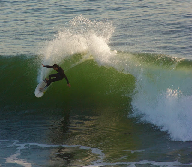
Just watching the surf.


There are also model runs suggesting a storm around the 4th or 5th, next Thursday and Friday.  Not a lot of agreement on that either.  The GFS finally breaks down the ridge around the 9th, or two weeks from now.  Not a whole lot of confidence with two week forecasts.  What is confidence inspiring is the confusion out there.  Somethings are moving and changing in the pattern and that is better than stagnation.  We need water.  The drought outlook for this winter is not great for California, with much of the southern half of the state expected to fall back into some level of drought.  Pray for that rain.

Friday, December 22, 2017

23.1

23.1F in Lockhart Gulch, near Scotts Valley, this morning.  29F on Van Ness and King Street on the west side of town.  Temps range from 29 to 35 Fahrenheit across town this morning, with an outlier of 41F on Western near High Street.  Maybe their thermometer is next to the dryer exhaust.  Regardless, it is a very chilly morning out there.  And pretty.  What is amazing about the cold is how close it gets to the ocean.  It is currently 33.9F on West Cliff Drive at 7:20AM.  Insane.  It should warm up to the upper 50s today with maybe topping 60F in the most favorable spots in town (sunny, wind protected and paved areas).

The Monarchs are clustering at Lighthouse Field.


Lows return to about 40F after this morning.  Highs over the next few days are right around the 60F mark.  Christmas will be sunny and mild.  Low of 40, high of 60.  Light morning winds today and tomorrow, with light to moderate on shore afternoon flow.  Small, mid period swell, dropping through the weekend.  Still could be some decent surf west and north of town in the mornings.  The winds pick up a bit on Sunday, and lighten for Monday, as a storm moves nearby to our west, but not coming on shore.

The Sunday system moves north and dissipates.  Another storm moves in from the north on Tuesday, and currently looks like rain will fall in northern California.  Still, there is a chance this storm could be far enough south to bring us rain some time on Tuesday.  Still need a few days to see what is likely to happen.  GFS then has us high and dry through at least the new year.  Stay warm out there.  Bundle u and go for a walk.  It is pretty up in the Pogonip.  Did my walking rehab up there yesterday.

Thursday, December 21, 2017

This is What Cold Feels Like.

Mid 30s on the west side this morning.  Several areas around town are showing sub freezing temperatures.  There is a fairly big range.  Rio Del Mar, on the water, is one of the warmest spots around at 40F.  Nearby, on the cliff, near State Park Drive in Aptos, it is only 30F.  Market Street in Santa Cruz is also cold this morning.  Eduardo Avenue in Ben Lomond is the coldest I've seen, with a reading of 24F.  Oddly, some of the low lying areas off Branciforte, which can get consistently cold come winter, are all showing temperatures above 40F, with Trinity Outlook (on a ridge) being 45F.  Like I said, a big range of temperatures this morning.  Over 20 degrees.  But basically, it is cold.

Tuesday morning's sky was pretty rad over the west side of Santa Cruz.


And pretty.  Sunrises have been in the good to epic range this month.  This morning's is cloud-less and amber.  The past few mornings had some great cloud structure to play with.  Today will feel cold, as light to moderate north winds keep ushering in the chill.  Certain north-south valleys could see some stronger gusts.  That wind will lighten by afternoon, and switch to a more south easterly flow.

Warming trend starts on Saturday.  Continued cold mornings.  But event eh mornings warm up a few degrees.  By Monday (Christmas), we expect a low in the low to mid 40s and the highs to hit the mid 60s.  Then it stays that way through mid week.  Unless a storm can sneak in here on Tuesday.  Still no confidence, but yesterday's noon run suggested a quick system.  This morning, it is gone from the model.  In fact, it has the state high and dry for almost a week into the new year, with a decent sized storm around the 6th.  In fantasy land.  It will be a very dry December this year.  Something that raises a little concern after those years of intense drought.  We need that rain to return.

Wednesday, December 20, 2017

Storm Has Passed.

The worst of that wet and wild winter storm has shifted to our south and east.  You may have missed it.  You may have been sleeping, but Santa Cruz received between one and two tenths of an inch.  Almost double the forecast, leaving the roads and ground with a wet surface for the sunrise.  Cloudy right now at 7AM.  And chilly.  About 48F on the west side.  33F this morning in Los Gatos, in the Sierra Azul Open Space, along McQueen Ridge.  Most of the readings in Santa Cruz county are in the mid to upper 40s though.  Clouds clear and the day warms a bit into the mid 50s.  It will be a chilly day for the most part.  Wear a sweater.  Sunny afternoon and another cold (in fact, colder) night on tap for us.

Lighthouse Field.  Beautiful light and  great spot for a rehab walk.


The next few days will be cool, warming a bit each day, into the upper 50s for Friday.  Over night, we will be clear, and crisp, dropping into the upper 30s.  Early Friday morning, we could drop into the mid 30s.  Still a few degrees above freezing, but if you live in one of the cold hollow, shaded and wind protected zones, and you have sensitive plants, now is the time to prepare and get a row cover out there.  This is the coldest weather of the year arriving.  It must be the holidays.

Warming comes with the weekend.  Low, the mid 60s for daytime highs.  Christmas Day looks like it will be about 65F, sunny and calm.  Overnight lows climb back into the low 40s.  We do see a chance for more rain after Christmas, maybe arriving on the 26th or 27th, but the models are still all over the place. The pattern is shifting again, and we will just need to wait and see if a system can cut under our protective high pressure.

Tuesday, December 19, 2017

Wednesday Morning Showers, Perhaps.

Timing is looking more and more like a chance for some light showers late late tomorrow night into Wednesday.  Chilly out there.  44F right now.  But it hit 76F today and it was above 70F from about 12:45 until 3:30 this afternoon.  Can't complain too much about that.  Swell has dropped considerably.  Sun through the day tomorrow, but much cooler.  Maybe low 60s.  Tuesday night we see some clouds move in, along with chilly temps.  From a mild day, it will become a clod night.  Cloud cover keeps us above the 30s.  Barely.  Best chance for rain is early morning Wednesday through the commute hours.  Light rainfall if it does materialize.  Best guess right now is showers in some area, over the mountains, and less than a tenth of an inch.  Just enough to moisten the surface.


At this point, another 10% of the state fell into the Abnormally Dry state, for about 45% total.  We need to get rain from here south to make a shift.  Soon.  Looks like cold weather behind the storm.  Highs in the 50s Wednesday through Friday.  Lows in the upper 30s.  I bet we see some freezing temps in the early morning hours Thursday and Friday in the shaded hollows  Protect your plants if they need protecting.  Okay, that is it for now.  More later.  GFS keeps flipping on outcomes for around Christmas, but we could see storms (or not) just after the holiday.

Sunday, December 17, 2017

Less wind, with a chance of showers coming.

It was pretty breezy over the weekend.  Especially so in the Sierra, with gusts over 75mph.  It was not that bad here in town, but there was holiday decoration carnage on Saturday morning.  That wind won't be so bad tomorrow.  The air gets colder though.  Mid 40s right now in town.  That will dip down to 40F in the colder spots.  Maybe even into the upper 30s for certain hollows.  Monday will be sunny, and mild.  Highs a little bit warmer than today due to much lighter winds.  It could even be off shore in the mornings.  Expect a nice day, as the next storm system is knocking on the door.

Nice weather and moderate swell was the name of the game this past week.


Tuesday colder air moves in, as the high pressure shifts west, and frigid flow begins from the north.  This should allow a storm system to swing by to our east.  How far east is still up in the air, but the up shot is by Wednesday, we will see highs back down in the upper 50s, and lows dropping into the 30s.  There is also a chance of rain coming with this thing.  NOAA gives it a 30% chance early Wednesday morning.  GFS keeps it north longer, and allows it to slip inside late Wednesday into Thursday, with us getting barely measurable precipitation.  So, yeah, a chance of rain coming, but nothing to get prepped for.  After that, we look dry through at least Christmas Eve (or next Sunday).

We should warm a bit on the back side of the storm, but don't expect much.  Low 60s, sun and fair days through the rest of the work week.  Nights are cool in the upper 30s for a few nights.  Feels like winter.  I'll keep an eye on this week's mini storm and up date as it forms.  Sunsets are still wonderful almost every night.  Go get some.

Friday, December 15, 2017

Still Warm Today.

I keep saying things will cool off, and they have, barely.  It hit 68F on Western Drive around 3PM yesterday.  It is a little cooler today.  Still not out of the 50s at the same location currently (12:45).  NOAA is calling for 70F downtown today, but that seems doubtful at this point.  And the trend is toward cooler afternoon temps, slowly dipping to low 60s by the middle of next week.  This cooler air might help knock the inversion out of the interior and Sierra.  Been warm up on the ski resorts.  Mt Rose saw a low of 41F at 2AM early Tuesday morning.  Not good for snowmaking.  Our low that night, here in Santa Cruz, was only 5 degrees warmer.  Anyway, I digress.  More of the same for a while still.  Details below.

Steamer Lane, December 14th.  Glassy and fun at 2PM.  


Sunny.  Lows in the 40s  Highs in the 60s.  Some clouds.  Decent swell.  Light winds.  For the next seven days.  Around next Wednesday or Thursday, the high pressure keeping us dry will shift a bit west, allowing for a classic inside slider scenario to set up.  As it looks now, a week a way, the rain will fall mainly to our east.  Maybe some for the Sierra.  Being a week out, and a pattern change, odds and confidence are low for specifics.  Maybe after the weekend details will be clearer.

Get out there and enjoy the late autumn weather.  It will be wet soon enough.  If you are bummed about the lack of snow, you can still get out and warm up those legs on plenty of groomers.  Kirkwood is opening the backside lifts this weekend, essentially opening up the entire mountain.  If you don't ski, this weather is pretty perfect.  Great surf conditions most days, all day.  Swell just keeps on re-upping and staying looking fun.

Monday, December 11, 2017

Cooler Tomorrow.

Today was nice.  A thermometer here on the westside hit 80F right around two PM for ten minutes.  It hit 73.8F at noon and was above that through 4:08PM.  Like I said, a nice day.  Surf showed up smaller than expected.  It looked about shoulder to head hight at the Lane, with a bumpy chop to the surface.  No wind.  Been an off shore flow.  Bigger and possibly cleaner surf outside of town.  Might take a drive on Thursday to take a look as fresh swell arrives.  Maybe I'll get the camera back out. Might try to paddle around Cowells before that, just to get back int he water.  And take advantage of this fantastic run of weather.  It will be cooler starting tomorrow, hitting only the low 70s.  Upper 60s Wednesday, and through the rest of the week.

Ski resorts are open.  The upper mountains have good coverage, but it gets pretty thin below 8000 feet.  This dry spell has not helped, but resorts with big snow making systems have had a good run.  It was cold up there until a few days ago, and will be cold again.  Problem now is there in an inversion.  Bad for spots like Rose or Kirkwood, but great for making snow on the lower runs at Squaw or Heavenly.  Northstar has focused on their frontside and have a good variety of runs open off Pluto.  Mammoth is in great shape at Main Lodge and will have all three bases open in a few days.  On the other hand, the higher based resorts have a ton more natural snow top to bottom.  No, it is not epic, but there is snow.  Get out there and stretch your legs.  I wish I could.

No change to the forecast.  Decent westerly swell for Thursday into Friday. Fair weathers.  Wisps of weather possible around the 20th.  My experience tells me these things usually take longer than predicted, so maybe a Christmas Eve present.  And I certainly don't see the storm doors flinging open.  But I'll keep watching.  And post up any changes before then.  Enjoy this fine stretch.  Grab a sunset walk on a beach.  They have been off the hook.  Tonight there was a blazing red fire ball.

Ten Days.

That is about how long it has been since we have seen rain.  Actually a bit longer than that.  As well as since I last post (sorry about that - my leg cast came off, the weather has been fine, and it has been all about the rehab).  And it will be at least ten days until we see rain again.  What began as a decent start to the water year should took a quick halt back around Thanksgiving.  Good for me, my healing, my unfinished yard work and my need for roofing repairs to be completed before the main part of winter.  Not so good for snow lovers or maintaining non drought status.  In fact, we've seen about 4.5% more of California become Abnormally Dry, again, over the last week, with 1.5% shifting into Moderate Drought.  Not good folks.  Those numbers are small, but you can see, at this point in time, we are slowly moving back into drought.  Currently 65% of the state is normal, or wetter than typical.

Anyway. Forecast.  Nice.  Sun.  Cool mornings, mild afternoons, offshore breezes.  In fact, today will be splendid, pushing into the upper 70s.  Get out and get some.  Some nice small to moderate swell out there, coming from both the W and SW.  It actually almost seems like October out there today. Head high to overhead swell on the exposed coast.  More swell arriving today, and a bigger one later this week.  Sure wish this ankle were ready for the surf.  It is rocking out there right now.  Some of my favorite conditions; when you can get out of town and surf any spot on the coast.  Anyway, today is the warmest of the week, with a cooling trend into Wednesday when we drop into the upper 60s.  High temps should be in the upper 60s through next weekend.  With all sun.  Overnight lows in the low 40s to start the week, and upper 40s by Sunday.

I'm watching the charts for a pattern change here.  As soon as I see that, I will get around to posting more.  In the meantime, enjoy this great weather and prepare for winter.  As you know, when she comes, she comes.  As it stands now, we are looking for a slight chance of light rain possible just before Christmas, as our high pressure shifts slightly west, allowing some storms, and cold, to push down from the north.  Only time will tell.

Sunday, November 26, 2017

Swift and Solid.

Rain begins later today.  GFS is still suggesting holding off until sunset until any serious rain.  The radar has a lot of rain well north; as in out of state.  Still, there is a band just pff shore south of SF, so we could begin seeing rain earlier.  The heaviest of rain will be from late afternoon to late evening, with rain becoming lighter by midnight.  We cold see up to a half inch of rain by Monday morning. We could even see totals approaching an inch, especially in the mountains.  Tahoe is still looking at a possible foot of dense snow above 8K.   Be prepared for the commute after several days to a week off.  Rain and returning workers will clog up that road.  On Monday, showers will likely happen during the morning daytime hours, with sun likely by afternoon.  It will be cool, in the low 60s.

The rest of the week will be epic autumn weather.  Overnight will be chilly, in the mid 40s.  Clear.  Sunny days, with warming through the week into the mid and upper 60s.  We will need to look at the mid term over the next few days.  Models keep changing.  Some have a cut off low hitting LA; some have us dry under a big fat high pressure; some have cold air pushing south.  So a bunch of different outcomes are possible, from warmth and sun, to cold and rain.  Time will tell.

Friday, November 24, 2017

Sunday Evening Punch.

Oh my goodness.  I spent today with the family at the car lot.  It needed to get done, but man, what a day to miss being out doors.  Absolutely stunning.  What a great week this has been.  It was 75F when I got home just before 4PM today.  Ah.  Love it here.  Anyway, all good things must come to pass.  The storm last week put down enough snow for a few resorts to open up for skiing this past week.  Snow was described as excellent spring sugar, or corn.  Dense base of a few feet.  Well, more is to come for above 7000 feet.  And that means rain for us.  Tomorrow, Saturday looks a bit like today, but cooler. Still hitting the low 70s though.  It will be a nice one.  Get outside.  With, perhaps, more clouds by evening.  But those do help the sunset.

NWS is calling for a chance of rain overnight, but GFS suggest it holds off until after noon on Sunday.  Regardless, rain should fill in during the day Sunday.  Right now it looks like we will get hit, and hit hard, late afternoon and evening.  Exact timing, as always, is hard to nail down.  With this rain comes a cold front.  It will only warm into the mid 60s on Sunday.  If that.  Windy too.  Rain is expected heaviest Sunday evening through the early morning hours of Monday.  Light rain may persist through the day Monday.  All told maybe 3/4" of rain here in town.  Monday will be in the low 60s.  And the cool air persists after that with temps rebounding only to maybe to the mid 60s.  With a little luck, Thursday could be warmer.  But more weather is on the horizon.

For now, expect less than a foot of snow on the ski resorts.  Some higher resorts on near the crest could get a foot.  Not a big storm, but more snow, and water for California.  It is nice to see a normal seasonal shift, even if this year I'd prefer it to stay dry for a few more weeks.

Monday, November 20, 2017

High, Dry and Getting Warm.

Hey folks.  Looks like the storm scheduled for today will miss us.  I mean, we could actually get a shower, but it is not likely.  There is another AR shaping up to our north, but maybe SF and Tahoe might get some rain.  Unfortunately it looks like it is currently raining on some of the ski resorts, shifting the snow surface from decent to wet.  Does not seem like enough to wash out any of the limited base, in part thanks to it having been a dense heavy snow fall to begin with.  For us here in Santa Cruz we are in for one hell of a nice week, with sun and temps warming into the 70s.

Today, Monday, will remain in the 60s, but could get real close.  We have a lot of warming to do still, with a 10AM reading of 58F.  Likely, how warm it actually feels will depend on how much the sun shines.  With that AR event pummeling the PNW, we still see plenty of breeze and cloud cover.  It has been real pretty this morning.  Sunrise was a speckled pink.  The sun is in and out.  Clouds are varied, but visibility to Monterey.  Surf is looking small, but should pick up a bit out of the west mid week.  Still, not big long period swell on schedule for the holiday.  There seems to have been a mix up.  Oh well, at least some one ordered the fine weather.

Almost 70F today.  Almost clear tonight, but warm.  Lows will be in the low to mid 50s.  Tuesday looks splendid.  Mid 70s and plenty of sunshine.  Perhaps just a few clouds to keep the sunrise and sunset rocking.  Man, does it look pretty out.  Wednesday and Thursday should stick around in the low 70s, but a little cooler than tomorrow.  And by week's end, day time highs will drop into the upper 60s.  Mid 60s by Sunday.  Overnight lows stick in the low 50s, continuing this warm trend.  If you have any autumn veggies still going (beans, peas, lettuce, etc) the next few days could be a good period of growth.  I'm hoping for a late bean harvest in two weeks.  That would be sweet.

It is not like there won't be plenty of rain just to our north.  First this AR thing, then another, then a gale, then a storm, but all just to our north until next Monday evening, November 27th.  So that is what we will be mainly watching for; or a shift south of any of the coming week's rain events.  For now, the Thanksgiving Week looks pretty darn fine.  Go out and get some.


Thursday, November 16, 2017

Southern Side of AR.

This morning the southern side of the AR has shifted over our town.  Not that much rain recorded yet on the west side.  A few tenths of an inch.  Less than a quarter inch as of 9:30 this morning.  Almost two inches in parts of the Santa Cruz Mountains.  Areas north of us have also seen a fair amount of rain so far, with Daly City and San Francisco reporting over an inch or rain since midnight.  And they had nearly a third of an inch yesterday, compared to our several hundredths of an inch.  Misty out there, as I type.  There is still a good push of rain to come, as the main stream of the AR pushes over us later this afternoon.  Thing is, as it pushes over us, the feed also dies off.  But we will still get a good rainfall from the combination with the storm pushing it south.  So yeah.  More rain, and wind today.  In fact, through Friday noon, the GFS puts a bullseye of over three inches in the mountains out our backdoor.  That is a lot more rain to come.

Expect rain to get heavy as the day wears on.  Late in the afternoon and early evening still looks like the heaviest period.  New to the forecast is rain sticking around a bit more after midnight, so it looks like your Friday morning commute could still be a wet one.  With several inches of water haven fallen in the past day.

I'll update this page later today with now cast for the storm.  Love watching this thing from my window.  I can see the clouds streaming across the sky.  I love getting a slight glimpse of Monterey before clouds shroud it again.

9PM UPDATE:  Gonna be quick.  AR is now gone, and essentially would be south of us.  It will pump in some rain to Big Sur, but this system is winding down quick.  We could still see some showers overnight, but those look rare.  Temps are still in the upper 50s, so it is warm.  We got almost an inch here on the Westside, 1.45" in SF, and in the Santa Cruz Mountains, at Love Creek, the gauge busted at 2.38" at 10AM.  So we can assume more rain fell there later in the day.

Expect sun tomorrow.  Maybe even by morning.  Warming trend.  Could be fine weather for the holiday week, with even 70F possible.

Wednesday, November 15, 2017

Upping The Game!

Well, GFS this morning has really pumped up the rain totals forecast for this 36 hour storm coming our way.  It also keeps the vast amount of rain to our north.  But not that far.  The coastal bullseye in in SF with five inches of rain by midnight Friday.  Seven inches in the northern Sierra.  Let's lay out the current time line as per the current run of the GFS.  Rain arrives after midnight tonight.  Less than a quarter inch by 6AM; so light rain.  But not for long.  The beast arrives mid to late morning and with a fury.  And it lasts all day.  We could see several inches here in town.  It will be a windy, rainy day.  Oh, and the wind.  That should start whipping up out of the south this evening.  It will be breezy overnight and tomorrow.  The rain may be hardest around sunset tomorrow, as the AR center moves from north of us, to south of us.  This will shift that wind to northerly and bring cooler air.  This will be the onset for snow at pass levels and below.  Rain should shift south of us by midnight.  Friday looks sunny.

So, again, a rainy and very windy day Thursday.  Yesterday I warned about the morning commute.  Now it seems it will be the afternoon commute that is worrisome.  If we get those several inches in town, or anywhere near that amount, in town, it will be even wetter over the hill.  All that water hitting pavement needs to run some where.  At least we've had a few rain storms to lift some of that oil.  Still, expect accidents and delays coming home Thursday.  Plan for it, and you won't be a part of it.

This is a quick moving, very wet system.  I was going to say fierce, but it is not that fierce.  Just a solid amount of water.  Be prepared.  It will be fun to watch from here.

Low 60s climbing to mid 60s through the weekend.  Even warmer next week.  Chance for rain still around Monday and Tuesday.  More on that storm on Friday.  For now, we are watching the weather.

Edit to add:  Oh, yeah, we will get a few burst of showers this afternoon and evening.  In fact I've noticed three, but nothing measured yet.

Tuesday, November 14, 2017

It is Gonna Rain - For Reals

Another very nice day on the record books.  Tomorrow will be different.  Rain is likely by evening, and definite after midnight.  The main AR stream will be to our north when this thing hits, and it will then shift south.  The heaviest rain may be for a brief Several hours in our region, but the entire rain event likely will last over 30 hours.  Rain pushes hard ashore from the south west Wednesday afternoon.  It will be a hose for norcal.  Overnight and into mid day Thursday, there will be a ton of rain to our north.  Here in Santa Cruz, we could see over an inch of rain by late morning Thursday.  Maybe even two.  This will make the Thursday morning commute a real headache.  Be prepared if you are headed over the hills.  And we will get a first glimpse of how our new hydrology management systems will perform over the winter.  But don't worry too much.  This is not January 2017.  That was for reals for reals.

The heaviest rain will have shifted south by mid day Thursday, and the AR seems to turn down.  We could still see upwards of a half inch of rain Thursday afternoon, so don't put away those rain coats.  Showers abate Thursday overnight, but we could still see some light showery weather on Friday morning as the storm center shifts well east.  But it will be essentially a sunny day.  The back end of the storm has slightly cooler weather in store, but it rebounds nicely to the mid 60s by Saturday.  Ahead of the next system.  As it stands now, it looks like it will be a fine sunny start to Sunday, with just enough evening clouds to make that sunset pop.  Rain fills in overnight and looks quite heavy on Monday.  NorCal getting a lot of of wide spread rain, with moderate amounts to the south.  Early forecast for an inch or so of rain.  Still a fair amount, but nothing compared to the five plus inches to our north.  Stay tuned for this one.

As for snow, still a question how and when the moisture falls and what to temps will be.  No big change in that forecast.  1-2 feet at 7000 feet, with three or more above 9K.  It is looking a little warmer mid storm this morning, so we will need to see how it all falls.  The real snow concern will be this next storm. It looks real warm, without much of a cold component.  With some luck, another, third, but small system, will lay a fresh few inches for the holiday week skiers.  I don't care.  I've still a month plus before I can wear a ski boot.

Monday, November 13, 2017

Nothing New, Ultimately.

Ultimately.  Pretty nice out there today.  The morning's clouds and light precipitation has burned off to sunshine.  Mild.  NOAA still calling for showers likely today.  Dwindling overnight.  I still think it is mostly likely to shower after sunset.  Just a bit.  A tenth of an inch or so.  And more sunshine again tomorrow.  There is still a lot of variables to the storm coming later this week, but everyone one is inline for a solid rain storm starting Wednesday.  This could be the first big storm of the winter.

The GFS has things coming in fast and furious.  The Euro holds the worst of the storm off until later in the evening into Thursday morning.  Regardless, rain starts on Wednesday as early as late morning, continuing through the day on Thursday.  It will be warm at the start, in the mid to upper 60s.  A high elevation cold front moves through early Thursday, but it will stay quite warm on the coast.  Low to mid 50s.  Thursday will be cooler, with a high of about 60F.  This should be just cold enough for some high elevation snow.  But first, our rain.  I'm seeing it hold off a bit.  Wednesday could be quite pleasant.  Rain impacting us from the north to south after sunset.  Light until midnight or so, then it gets heavy.  We will likely see an inch or more here in town by noon on Thursday, with significant amounts forecast in the Santa Cruz Mountains.  The bulk of the storm will move south by mid day, leaving us will light showers for the afternoon.  And cooler weather.  Rain and mid to high elevation snow continues in the Sierra into Friday morning.  

Sunny and low 60s for Friday and Saturday.  We could see a return to rain on Sunday.  Regardless, it will be warm, with temps in the mid 60s.  We will need to watch this system for next week.  Either warm southerly storm or a protective high pressure.  We will need to see.

So, snowfall.  There are better outlets for detailed snow forecasts, but here is the jist of it.  Snow starts above 9000 feet on Wednesday, lowering to 8000 feet through the day.  Overnight it cools further, dropping snow levels to about 7000 feet Thursday morning, and further to 6000 feet as the cold front moves through.  All in all, we could see several inches at lake level by Friday morning, with up to four feet above 9000 feet.  What falls in between will be determined by when the most rain falls, and at what temperature.  All in all, we could see over 5 inches of precipitation on the crest.

Welcome to fall and get ready for winter folks. 

Sunday, November 12, 2017

Wet and Wild??

Wow the mid to long term this morning looks wet.  Let us start with today and the next few days first though.  Mild out there today.  Feels warm in the sun right about now.  Not hot, though.  My pole beans are starting to rebel.  Anyway, beautiful sun with some high level haze on the southern horizon.  Cool night time temps expected, dipping into the upper 40s.  Monday should start fairly clear, but more clouds moving in, with a storm moving though to our north on Monday.  By late Monday night or early Tuesday morning, enough will sag south to give us some light precipitation.  NOAA is calling for this system to arrive earlier.  Both forecasts call for a few tenths of an inch at most.  This storm is really hanging out to the north.  Expect showers.  Maybe during the middle of the day Monday, but maybe during the night.

We have another system arriving on Wednesday.  Fairly warm this one.  We should see some sun on Tuesday, into Wednesday morning, but clouds move in quickly mid week.  There is a forecasted AR moving into the coast to our north late Wednesday, then shifting just south of us by mid day Thursday.  This system could bring significant rain and high elevation snow to the Sierra.  Snow levels are in question.  From today's models, it seems like a lot of rain falling up to above 10K, but lowering snow levels during the second half of the storm.  It is feasible this could be a base builder.  Or a washout.  Or, like some many storm events over the last few weeks, back off considerably in the next few days.  It is worthwhile to expect out first period of heavy rain to begin Wednesday, peak overnight, and continue through the day Thursday.  Highs in the low 60s, low around 50 Wednesday night, and cooler there after.  Sunshine for Friday and next weekend it would seem.

Fantasy charts has another AR fed storm early in the week prior to Thanksgiving.  Another chance of too much rain, plenty of snow, or just fantasy model hype.  Watch the weather, as the next week plus could be more heavy rain events.  The wet season is trying to bust down that door.  Lucky for me, I got a little more work done in the yard.  What I could get to on crutches.  But at least erosion won't destroy me; I hope.

Thursday, November 9, 2017

Grey Sky.

Last night was underwhelming and very welcome by myself.  Still have a number of projects under way that are not yet ready for winter.  Having had a broken ankle for nearly two months sure did slow me down on my seasonal wrap up.  Anyway, just a hair over a tenth of an inch on the Western Drive this morning.  Falling over two hours but mostly from 1 to 2AM, and again from 3:50 to 4:20 this morning.  Very light rain folks.  OTOH, it rained up on, and over the other side of the mountains.  A rain gauge at Love Creek, near Ben Lomond has recorded almost two inches since 4 o'clock yesterday afternoon.  Almost half an inch at Saratoga Hills, and still raining lightly this morning.

A small, but solid cell is running across the Santa Cruz mountains just north of town and Highway 17.  Expect some of those streams and creeks be moving through today.  No real flooding, but perhaps some moving water.  The cell is moving north west, parallel to the highway.  If another comes ashore ten miles south, we could see some burst of showers or even a heavy squall.  Another, larger, but weaker, more dispersed cell is moving into the Tahoe area.  Maybe some light, upper mountain snow.  

It was cool last night, warming past 50F just before 9AM this morning.  Slate grey out there now with that rain just to our north.  Cool, in the low 50s.  It should warm up to the low 60s today.  Clouds hang around.  I don't see much evidence of much of a chance of rain by late afternoon.  Of course, a small piece of the larger system well to our north could always break away and send a bit of showers our way.  Cool night time temps in the upper 40s.  Low 60s by day.  Clearing on Friday, but still clouds and some chance for a wrap around shower.  Partly to mostly sunny for the weekend, with another chance for showers Monday night.

It will be a brief period for a chance of rain.  Some warming on the sunnier days.  Will look at the long term over this weekend.  Worth getting out today and playing around.

Wednesday, November 8, 2017

Update: Humpday

Even less rain!  Forecast as posted this morning, which was written Tuesday.  Clouds out there.  Gorgeous sunrise this morning.  Rain after midnight.  Dropping forecast to two thirds of an inch in town.  Or less.  Mostly overnight, but sticking around during the day tomorrow.

Still looks like some rain Monday night.  This morning, the GFS flipped in the long term again.  So instead of a a big fat high pressure, we will have a weak one, with storms just to our north for a few weeks.  We will need to see how this one plays out.  If this new forecast is accurate, a slight shift on path and we could be in for more rain.

For now, plan for a windy evening, and some rain.

On Track.

Okay.  Sorry about the lack of actual posting last night.  I did not realize the page was frozen off line.  Anyway, forecast for this week looks like it was pretty on  A few changes below.  A decent day out there today with a moderate north east breeze on the bay.  Cool right now.  Just about 50F out at 10AM.  No real swell out there.  Kind of more of the same tomorrow.  NOAA is still calling for a chance of rain on Wednesday, but the GFS noon run today has it holding off until after midnight, or the early morning hours of Thursday.  Regardless, clouds for Wednesday and temps topping in the mid 60s.  I'd be ready for some periods of rain during the day or early evening, but the bulk comes late.  Winds increase from the south all day and could be quite gusty in the evening out of the south west.  Top gust could hit 25 or more miles per hour.  Make sure things are buckled down.

Total rainfall forecasts for our region have increased, even though the storm path has shifted north.  It looks like a southern flank will swing right into us, getting some orographic assist.  Best guess for heaviest rain is from 3AM through 10AM.  Rain event could last through the day and evening on Thursday.  I guess another change from yesterday'd forecast is the burst of heavy early morning rain, but ultimately a shorter period of rain.  Plan for about a quarter inch plus in the morning, with totals of up to three quarters of an inch in town.  An inch plus in the mountains, with some localities getting a good bit more.  It seems like NOAA and the GFS have come in tune with each other this morning.

Best bet is for clearing Thursday overnight.  Some clouds on Friday.  Low 60s.  Cool weather for the weekend.  Lows in the 40s and highs in the low 60s.  But it should be mostly sunny.

The forecast for next week has us getting hit pretty hard with a storm Monday evening.  A swift moving gale.  We could see an inch or more overnight.  Still a ways off, but this could be a solid storm.  Long term the next storm stays well north as high pressure increases.  We could be back into fair, and warming weather, through the latter half of the month.  More to come.

Tuesday, November 7, 2017

Storms Backing Off.

(Monday evening's post)

First things first.  Cool weather we are having.  Mostly clear out.  Gonna be another chilly night dropping into the low 40s.  Sun in the morning, with a slightly earlier sunrise.  Warming to the low 60s by afternoon.  But be ready for quick afternoon cooling with a sunset around 5PM.  It looks like we have more rain coming our way.  The GFS has been backing off this storm, and the 6PM run has this storm almost missing us completely.  It will need an update tomorrow, but going with the latest run, here it is.

Clouds fill in overnight Tuesday, keeping temps a little warmer, in the upper 40s.  Wednesday will be cloudy, but it could be spotty early.  Mid 60s.  Rain fills in late. It could hold off until after midnight. Mid 50s.   Rain looks to fall heaviest in the early morning hours, with light showers possible through the day Thursday.  We are looking at about a third inch in town and a half or so in the mountains.  Pretty high snow levels, above 8K, in the Tahoe zone.  Mid 60s on Thursday.  Clouds remain, and chance for wrap around showers.  There will be moisture in the region.

Chances for showers decrease over night, with lows again in the mid 50s.  Friday will see much more sun, but we could see sporadic showers in the morning.  Still, totals likely to be less than a 1/2 inch here in town.  The weekend looks nice, with sunshine and some daytime warming, but overnight lows dropping back into the upper 40s.  Looks like my pole beans will have a hard time setting flowers.  I sure could use a three or four day warm spell with daytime highs in the 70s.  Wouldn't that be nice.

So, I sad a nice weekend.  Up until earlier today, we had a pretty cold storm hitting us Sunday.  Then it was Monday.  Now it is Tuesday.  But barely scraping us here in Santa Cruz.  Check in tomorrow for updates on this mid week system and news about what will come early next week.

Friday, November 3, 2017

The Euro.

I awoke last night around 3AM to the pat pat pat of rain on a sun roof.  This morning, on the deck, I was sure the Euro model was the big winner, bringing in the storm earlier and wetter.  Or so it seemed.  Nearly a third of an inch fell between 2:30 and 3:45, and again from 7:45 to 8:45 this morning. Two separate hour or so long bursts.  Then nothing.  All day and evening.  There is a bunch of rain falling well north of Sacramento right now.  And some just came off the bay.  I was seeing it approach on radar, but out the window, seemed to clear up, and then it was raining.  Didn't last long, but it was a heavy two minutes of rain.  Looks clear out the window all the way across the bay and on the radar as well.  Still, expect more rain tonight.  GFS still has us getting another few tenths of an inch before midnight Saturday.

This storm looked like it had a big sub tropical moisture stream up until a few days ago. Now it is looking like a decent few days.  Today would have been wonderful for a walk under the redwoods.  Fall Creek will have a bit more flow tomorrow.  Rain is still possible.  Looks like it is most likely over night and into the morning hours.  But showers could come at any time.  Like that two minute downpour a few minutes ago.

Sunday is looking better and better each model run, and while moisture is still around into Monday, we should be rain free through mid day Wednesday.  Then we have another system to take a look at. And then another after that still.  We are in an active pattern.  

Thursday, November 2, 2017

Teeing Off.

Clouds have moved in today.  The sun peaked out for a bit, but it is mostly obscured.  Gorgeous light out on the bay right now.  Clear straight across and you can distinctly see the Monterey Peninsula sticking out into the Pacific.  Stunning.  Mild out there, in the mid 60s.  This will be the warmest it will be for a bit now.  I'm vacuuming out my floor heater today.  Gotta burn it out before the need comes to turn on the heat.  It is good to keep the windows open that first run of the season, otherwise the modern high tech alarms begin to sound.  Anyway, clouds and mild overnight, with temps dropping to the mid low 50s.  Not cold yet.


Friday is cloudy, with temps only reaching about 60F.  Wind should increase out of the south.  The GFS keeps us dry in the morning.  The Euro brings in rain before morning.  Going with the combo, expect light showers to start late morning.  Mostly very light until nightfall, when light rain becomes more likely.  Two tenths of an inch by midnight or so.  Low 50s.  Rain tapers overnight, and we could see it take a break just around sunrise.  Wouldn't that be nice.  The GFS is actually suggesting we fall into a little bit of a rain shadow through mid day, but not all day.  A second round of rain looks like it could swing through Saturday afternoon.  This currently looks like a short, but heavier burst.  Perhaps a quarter inch over a few later afternoon hours, tapering around dark.

As of now, it looks like this storm system will be east and south of us by Sunday day break.  As of now, it stays dry into Tuesday, but there is moisture swirling all around.  As of now Wednesday into Thursday looks very wet.  But hey, that is still a week out.  And, as we have seen, a lot can change in a week, so nothing is set in stone.  Not even tomorrow.  But plan for rain.

Wednesday, November 1, 2017

Slight Peddle Back.

Well, the GFS has continued to trend drier, with this weekend's storm possibly splitting at SF, with much of the moisture by passing Santa Cruz.  Still, we are going to get plenty of rain.  Looks like a quarter to half inch in town, with more in the likely in the hills. Still, this is a decent drop in forecast.  The lions share of this storm will hit the Sierra north of Tahoe on Saturday, as well as the shoreline south of Monterey to the Channel Islands.  Let's look at the day to day for this coming week.  Nothing is pinned down, but we have a general idea of what will come to pass.

Today is cool, and wonderful.  Sun.  Some light wind coming out of the northwest.  Tomorrow we see more cloud cover fill in, as the storm begins to sag south.  We could see some showers moving ashore later in the day Thursday, but likely that will hold off even to mid morning on Friday.  It will be in the mid to upper 60s today, but that will drop to the low 60s for the next few days after that.  Expect rain to fill through the evening Friday, but still light to showery weather.  Snow will begin to fall above 7500 feet in the Sierra.

Desolation Wilderness, with Spur Ridge.  February, 2017.  These peaks will see snow.


The heaviest rain should fall overnight Friday night.  I know, these forecasts keep on flipping.  Just goes to show, we don't really know.  By mid day Saturday we could be lucky to see the heaviest rain move south of us, as the storm centers split.  Showers could continue through the afternoon, but should dry out overnight.  A cold front also moves through, so expect those overnight lows to drop into the mid 40s.

We could still showery weather on Sunday, as rain is forecasted to our south, east and north.  As well as Monday.  Temps stay in the mid 40s through mid 60s, with slight warming Monday into Tuesday.  At least that is what it looks like today.  Updates again tomorrow.  Hell, by then I will be able to look out the window and tell you if it started raining.

Past seven days, we remain in a trough set up, so that storm door will remain open.  Looking at the fantasy models, we dodge the worst of the storms and get brushed again with light rain mid next week.  This time, along the southern edge of the storm.  More to come.

Monday, October 30, 2017

Um. Yeah. It's here.

Still looks like a rainy weekend.  Still looks like a two wave system.  Just now, it is the second wave that looks strongest.  The one Saturday night into Sunday.  Still looks like there will be a first wave Friday into Saturday morning.  But the details of all of it are still very much in question.  What is not seeming questionable, is if it is going to rain.  It is going to rain.  This morning's GFS has us getting us, herein town, getting a half inch to an inch of rain by Monday morning in Santa Cruz.  Along the coast, about 2 1/2 inches has Big Sur was the bulls eye.  The north Sierra are expected to get pounded, with maybe 6 inches well north of Tahoe.  Expect snow on the upper resorts, with two feet of snow at 8000 feet.  But exactly how this will all play out is still four days away.

The GFS models seem to be in the middle, with the Canadian drier, and the Euro much wetter.  It should be noted that the GFS was trending drier yesterday, but wetter again by mid day today.  What is really cool about this coming storm is a good portion of it will push south and most of the state will see a significant rain system.  This is good news as we still have over 8% of the state still in a state of drought.  The areas near Pt Conception and that south of the Salton Sea.  Abnormally dry conditions persist in another 14% of the state, including portions of the southern Salinas Valley.  This rain will do us good.  It is coming too soon for me.  I broke my ankle a while back and am still in recovery.  Lots to do to prep for the rain on one leg.  Even more to accomplish before winter really arrives.

As of now, rain arrives early on Friday, with mostly shower weather in the morning, if at all.  They become more persistent later in the day.  Perhaps a short break before a strong wave begins to move in, with heavier rains Saturday morning.  The real punch comes in the afternoon, evening or overnight.  Sunday looks like a rainy day.  Most of it pulls south by Sunday evening.  This is what will soak SoCal.  We may see rain wrap around and give us showers from the north east on Tuesday.

Another storm maybe Thursday.  And again next Saturday.  The fantasy model line is super wet.  

Sunday, October 29, 2017

Winter's Coming.

Or at least a good does of autumn.  Howdy folks.  It has been a good 5 months since I posted.  Been busy.  But figured it was time to take some notice again.  There has been some exceptional weather this fall.  Hot beach days.  Wild fires.  A little rain.  But things get real this coming weekend.  Be prepared.  There is likely to be some serious water falling soon.

Models have been consistent for several days now.  By Friday we could be experiencing our first rain event of the season.  As in over an inch of rain in town, with more expected over the coastal range.  Several inches of precip possible in the northern Sierra.  This could be a base of snow, and a flush of creeks.  Or almost those.  Regardless, confidence is high we will receive some rain this coming weekend, heaviest on Saturday morning.  Could be heavy, as in a inch over a few hours.  Or, a brush. Models are leaning toward much more than a brush.  We are still five days out, so, it will take a day or two more to come up with a confident detailed forecast.

This is just a "get your yard in order" post, as we potentially could have some heavy rain next weekend.  And, actually, a few more storms that may try to hit us over the next few weeks.

Wednesday, May 17, 2017

Missed Us.

But there is a chance next week.  Kind of cool.  In case you are wondering, it is rain that I am talking about.  Not a total miss.  When we pulled into our driveway yesterday afternoon, and I stepped out of the truck, I exclaimed, "It's raining."  My son returned in his typical, up talking, long on the n, "no!  It is not."  I could not blame him for not believing me, this time.  It was so light, and fine, that is was barely more than a mist, but when you looked skyward, it lightly speckled your face.  It lasted ten minutes, and was limited in scope, as I could see the cloud it distinctly fell from.  The ground never wetted, and I collected no water.  I get more from a heavy fog.  Oh well.  There is a chance next week.

Still on track for some nice weather over the next few days.  A few clouds around tomorrow.  Just a few.  Warmer, in the mid 70s.  Not much in the way of morning fog.  That NW breezes lightens up a little bit, but remains quite brisk in the afternoon.  It gets a good bit warmer, and winds a touch lighter on Friday; it could be 80F downtown, with upper 70s along West Cliff.  Breeze will chill you out by the water, though.  Lighter winds Saturday, and perhaps some light, to even slack winds for Sunday.  Temps moderate, with low to mid 70s on Sunday.  It could be a great day though. We will even be seeing some south swell in the water.  More on the weekend later.  I need to get to bed.

Monday, May 15, 2017

Snow tonight.

Along the Sierra Crest.  And inch or more.  Maybe a foot along the higher peaks south of Tahoe.  Kind of cool for mid May.  Like many of these events, much of it will slip by us.  This one to our east, and south.  Still, we get some.  Clouds fill in tonight.  That, along with the winds, will keep the warmth at bay.  Or, rather, inland.  What little there is of it.  But, yay, Saratoga is warmer than Asilomar folks.  Anyway, it will be warm tonight.  Cloud cover can offer that.  Low temp of about 50F.  Good for seedlings.  Tomorrow, Tuesday, clouds increase and by later in the day we could see some very light, and sporadic showers.  High temp of just about 60F.  Rain chances and intensity increase through the evening, and past dark, but this is no rain maker.  Low, again, around 50F.  Total rain fall of less than a quarter inch.  If you have a rain collection system, and it needs to be adjusted, or engaged, you may want to do that this afternoon.  I expect to collect about 20 gallons by Wednesday morning, and while that is not much, it is much more than I've collected over the past few weeks.  Things change abruptly on Wednesday.

Once is Enough, Heart Chute, and the Sisters.  Kirkwood, California.  February, 2017.


As in the clouds clear, and we warm up.  Nicely.  Upper 60s and sun on Wednesday, and fairly breezy off the ocean.  In fact, this system pretty much swings through to our north and east enough that winds never shift out of the NW for any period of time.  They may swing a bit on Tuesday, but not forecasted.  Anyway, warm on Wednesday.  Warmer on Thursday and pushing 80F for Friday and the weekend.  At least downtown.  Beaches will be in the mid to upper 70s.  Winds back down each day and might even blow offshore in the morning Friday.  Plenty of wind swell out there.  Just need to find a window where the winds let off enough to go get at it.  Checking back in tomorrow.

Friday, May 12, 2017

Sunny and Breezy.

Today, Friday, broke with not a fog wisp in the sky.  At least by the time I looked out the window at 7AM, but based on the immense shine coming into my room prior to then, I believe it broke plenty sunny.  That has allowed for the warmest morning of the week, at 55F before 8AM.  The forecast high for today is 65F, but I'm willing to wager it get closer to 70F today, especially in those favored locations out of the wind.  Being out of the wind will be the big determinate today for warmth.  Gust of 25 mph are expected at the Marine Lab and along parts of West Cliff.  Just a few blocks inland will mellow things out considerably.  Get tucked up into Harvey West, and it might even feel calm for bits.  Still, I'd expect some gust find their way even into the most tucked away spots.  More of the same through the weekend, with winds lightening a bit by Sunday.  Spring.  Then it gets interesting.


Still plenty of snow up in the Sierra.  Glove Rock at Kirkwood.


Over the next few days we will be in the mid 60s, dropping to the low 60s Sunday.  This due to a rain system encroaching on us from the north.  This storm will be effecting the PNW and NorCal over the next few days.  And us as well in that it will suppress any warming.  BTW, I changed my mind on hitting 70F today after walking outside.  It is sunny, but that air mass is in fact quite cool.  By Monday a second system begins to move ashore to our north, but this one looks like it could scrape our region.  For us that will mean continued cold weather on Monday, but by Tuesday we could see a moderate period of light rain showers.  While this is no major rain storm, it is plenty big for mid May.  Be prepared for a little rain.  We rebound quick.  By the end of next week, we could be back up into the lower 70s.  I'll have an update sometime on Mother's Day regarding next week.  And for now, make sure you wish your mother a very happy Mother's Day this Sunday.

Sunday, May 7, 2017

Spring Like?

Pretty sizable wind swell in the water right this morning.  Local buoys are recording 15 foot plus at a short 11 seconds.  Local winds are pretty strong as well, creating plenty of surface chop.  Still, this is good size for May.    The rain storm passed well north of us yesterday.  Squaw Valley is still turning lifts (and will do so until July 4th and beyond) and received 7" of snow since yesterday morning.  Powder day!  Otherwise the weather is moving back into typical range for a few days.  Sort of.

Santa Cruz Municipal Wharf.


It will be on the cooler side with the afternoon highs reaching only into the mow 60s.  Brrr.  There will be periods of sun, but mornings could have a decent layer of fog.  Especially along the water.  Overnight lows will likely hover around 50F, unless we see stars.  In that case we will drop into the upper 40s.  Not quite cold enough to damage your plants and garden seedlings.  In fact, we will see a fairly nice week for a starting summer garden.  Those hot days we saw at the start of last week are tough on young plants.  More moderate weather allows them to nicely transition to a strong vegetative stage.  That makes them big and burly for flowering and fruiting.  As we head into the latter part of the week, we see another decently sized rain system push ashore to our north.  NorCal could get a decent little rain maker, with more snow for the Sierra.  After a record breaking year for rain fall in the northern Sierra, more is on the way.  Go figure.  Extremes.  Anyway, we should stay dry, but could see some southerly flow followed by cool air and strong north westerlies.  Transitions.

Wednesday, May 3, 2017

Reprieve

Okay folks.  Been a few weeks of some weather.  Been busy getting out in it.  The snow and surf have both been quite fun this spring, when I've had the chance to be out there in the elements.  In that time, we have shifted into full on spring mode.  A bit warmer than typical the past few days, and we will see an end to what my son was calling the "heat attack" since about last Friday.  Yesterday seemed particularly warm, but then again, we retreated to spend the afternoon at 4 Mile on Monday.  Always a bit cooler on the water's edge.  It was a nice afternoon for the beach.  Sunday late morning saw a bunch of people tide pooling in the exposed reefs at Waddell Beach during the low tide hours.  Anyway, we are here to talk about the forecast, not what was.

March contest atop Vista at Kirkwood.  Gorgeous warm sunny spring skiing day. 


A little less warmth today.  Still quite nice, but a good 5 to 8 degrees cooler than yesterday.  Mid to upper 70s and sunshine.  Winds look a bit mellower today, so that should keep the coast line feeling the same.  Those spring time winds have been in full effect with 20 plus knot winds blowing out of the north west on the outer waters, with 15 plus near shore in the afternoons.  Today those near shores stay below 10 knots for the most part.  Cooler air is moving in, and fog could form overnight into Thursday morning, especially over the water.  Thursday will hang out in the upper 60s, with southerly flow on the water, and fog perhaps hanging out through late morning.  Could be a chilly one after the heat attack of the last few days.  A small south swell is due to arrive this evening, so that might make for a good day of surf, keeping the strong NW at bay.  This is still spring-ish, but more summer like weather.  What comes next is perhaps a return to some winter-ish.

The passing system on Thursday, brings a return to gusty northwest winds on Friday.  Fog gets cleared out and it will stay in the mid to upper 60s.  Should be a cool, but not cold, blustery day.  A system brushes us to our north, bringing increased clouds for Saturday.  Not a full sky of grey, but for sure some passing clouds.  As the day wears on, the chance for a shower increases and then sticks around through much of the weekend.  And temps dip to a high in the low to mid 60s.  Not very spring like.  Winds will be quite strong on Saturday, but mellow a bit on Sunday.  Meanwhile, Tahoe is likely going to receive some fresh snow.  Sunday could be a shallow pow day, and Monday a transition day and Tuesday some prime corn.  Winter and Spring return.  

Monday, April 17, 2017

Solid.

A cold front swept through Thursday morning around 3AM last night, dropping temps from the low 50s to the low 40s in the period of an hour.  It dropped well over the forecast rain; just under 2/3 of an inch.  Friday cleared after the morning rain, and Saturday, as you know, was a very fine day.  It even felt warm and spring like.  The next system arrived early, with rain by about noon on Easter Sunday.  Again, the forecast was broken, and we again almost got 2/3 of an inch of rain.  That system mostly passed by 6PM.  Low fog and drizzle remain this Monday morning.  We have one more wave to pass through the region later today.  The forecast is for just a few showers this afternoon and evening, amounting to at very most two tenths of an inch.  That will likely be the case, but we have already exceeded the week's total forecast of on inch.  In fact, we are tallying 1.66 inch of rain in the past week.  That is 66% more than forecast.

Cool today for April.  Mid 60s.  In fact, you could feel the cool in the afternoon yesterday.  We went for a quick Pogonip stroll in the drizzle yesterday evening, and it was crisp until you developed some heat of your own.  That continues today, with mostly low clouds.  In fact, it continues through Tuesday morning, until about noon.  Then, clouds should clear to bring about a partly sunny afternoon.  It will be slightly warmer on Tuesday.  As those clouds clear out, it will allow the radiational cooling Tuesday night and we will drop into the mid to upper 40s.  And while Wednesday will be sunny, this will need to be over come to get those temps back up during the day.  Expect another day in the 60s for Wednesday.  We also have another system brushing by to our north on Wednesday, so we see a slight chance for some light rain in the evening.

Calm winters day at Cowell's Beach, Santa Cruz.


Then we have spring arriving on Thursday.  Sunny, warm and developing a NW breeze for the weekend.  It will be in the low 70s during the afternoons, perhaps even the mid 70s for Friday and Saturday.  It should be a nice run of weather, and needless to say, great planting weather for your summer gardens.  If you don't already have your early summer plants, like pole beans and lettuce, in the ground, this will be a great weekend to get that work done.  I was asked by a friend if I though this would be the last rain storm of the season.  With weather being weather, it is hard to tell.  The NPac jet is to remain active, but shift slight north.  Sorry Portland.  But, all it takes is a little wiggle to bring us some more of these spring storms.  Usually, they are not all that cold, or all that strong, so not too damaging to the crops.  Time to get your plants in the ground folks.  Unless, of course, you have a different plan.

No change in the drought over the past week.  I'll keep an eye out for this next week's report, but it does not look like enough, or any, rain is getting far enough south to help SoCal.  They are still in varying levels of drought from Santa Barbara south.  OTOH, NorCal has just broken the record for the wettest season on record.  And what is astounding is that it broke that record in April.  We still over 5 more months in the water year.  And while these tend to be the driest months of the year, we could still a an inch or few more to that total.  Winners.

Wednesday, April 12, 2017

Round Two Tonight.

We received almost two tenths of an inch of rain this morning.  Right around school drop off hour.  It has mellowed out, and there is almost sunshine poking through.  But there is not.  The sky is a light grey as of the noon hour.  Another wave, the stronger wave, of this storm is just offshore, and expected to swing through this evening.  Rain should fill in after midnight and in the early morning hours tomorrow.  Again clearing through the morning, but not as completely.  Showers could persist through the early afternoon on Thursday.  It will remain cool,  with highs in the mid 50s.  Snow is expected to fall in the Sierra overnight tonight and through the day Thursday, with up to a foot on the peaks.  Spring pow for Friday is expected.  And temps will remain on the cool side, only in the 30s on the mountains.  Upper 50s to low 60s on the coast.


Winter beach clean up.  Main Beach, Santa Cruz.


The weather is looking fair for the holiday weekend.  Friday will be cool, but the sun should come out.  Warmer for the weekend though.  Mid 60s and sunshine on Saturday.  Over night lows in the mid 40s.  By Sunday, we will see more clouds developing, and possibly some rain late in the day.  Another series of mild spring storms arrive late on Sunday.  Winter ain't over yet.

Tuesday, April 11, 2017

Several More...

Some heavy drizzle this morning.  Thick, big, random drops.  We are not expecting any accumulation; just a minor wetting.  Temps will be mild, in the mid 60s.  I do not consider this a rain day.  More like an east coast spring day.  But we do have rain coming our way.  The system, today is mainly to our north.  We do have a greater chance for some actual rain this evening, but that also looks slim.  What we will be looking at is an increase in the southerly flow.  It will have an easterly component today, but will strengthen and shift more southerly tonight.  The best chance for some actual rain will be Wednesday morning.  By mid day, we will be in the low 60s and see some sunshine.  Then, a storm hits us tomorrow evening.

Now, when I say storm, you are probably thinking of something significant.  After all, that is what we have experienced this winter.  This storm is more of a stormule.  Or stormella.  Anyway, winds turn westerly, up to 25 mph, and rain begins to fall late in the evening.  With some luck we could receive up to a quarter inch.  Just enough to maybe thoroughly wet the surface.  We may see some running or standing water, but only because the ground was so recently wetted.  Not an impressive system, other than it is coming in mid April.   Wednesday will be cooler with a high of only 60F.  Overnight lows begin to dip into the mid 40s.  Light rain could linger into Thursday, and even Thursday night.  That said, we should see some sun on Thursday, although it remains cool.  Light winds, turning south in the afternoon.

The river mouth has been surfing well this winter.  February day, after a storm clean up.  Main Beach, Santa Cruz.


It does look like we will have some fine weather for the Easter weekend.  Friday, the sun returns in earnest.  We also warm back up into the mid 60s, with upper 60s for the weekend.  Overnight lows also begin to climb and will be back to about 50F for the early morning hours on Monday.  Also climbing will be a chance for rain, as a second storm is likely to arrive Sunday evening.  This system is forecast to hit us more directly than the one mid week.  Still, it is not a huge rain maker.  Between the two of them, we might exceed one inch of precipitation.  Let's put the numbers at .41 inches for the mid week storm, and .62 inches for the system early next week.  We even see a third system approaching from the west next Wednesday, but this one looks like it will fall apart before it even reached us.

The bulk of both of these systems will hit NorCal and the Sierra.  So, more water up north and more snow for the mountains.  Kirkwood received 30" of snow last week.  They have a base of over ten feet right now.  Their parking lots are full.  But they will close for the season on Easter, for their earliest closing ever (except for one drought year).  Pretty lame of the Vail overlords.  But if you want to keep on enjoying this record breaking snow pack, you can still visit Sugarbowl, Diamond Peak, Bear Valley or Homewood through April 23rd, and SquawAlpine and Mammoth Mountain will be spinning lifts through the 4th of July this year.  Thank you for there still existing resorts that now how how to keep it real.  They should get a few inches of snow this week, and next.

The North Pacific is also remaining active through April.  We see more chances for rain on the charts, and more chances for waves.  In fact, this morning we have some solid swell in the water.  Nothing like last week on the 2nd and 3rd, but still, nice significant swell, especially for April.  Get out and enjoy what this winter has brought us.  You deserve it.  You made it this far.

Thursday, April 6, 2017

The Fat Lady Has Not Sung.

Rain has already moved into the region.  Light drizzle has been reported in SF, and light snow showers are currently falling along the Sierra Crest.  Winter is back folks.  Today will sit in the mid 60s and it will get even cooler for the weekend.  Rain comes in ernest tonight with over an inch forecast to fall before sunrise on Friday mornings.  NOAA is calling for up to two inches, but that seems a bit high.  Regardless, it will be a hefty amount.  After having several weeks of dry weather, the ground is set to absorb a good amount of water, but, and here is a big but, the water ways are still very active draining the ground already.  And the ground, while not super saturated, is still pretty wet.  So, watch out for flash flooding in the usual areas by Friday morning.


Fall Creek drainage, early February 2017, Felton, CA.  The redwoods love water.


Rain continues to fall during the day Friday, although lighter during the morning hours.  A second wave of the storm arrives mid day on Friday, and we could be seeing close to another inch of rainfall by sun down.  60F for a high.  Rain continues Friday night, but will lighten considerably by midnight.  Another quarter inch of so of rain.  And it continues into Saturday morning, tapering mid to late morning.  Fairly windy through the period, but at its worst tonight and Friday.  Near three inches of rain possible by the time it wraps up on Saturday.

The clouds clear out late Saturday, and we could have a cold night in the low 40s.  Cold for April.  If you have any plant seedlings started for your garden, think of protecting them with a floating row cover.  This will not be cold enough to kill seedlings, but could potentially stunt them.  Nothing worse than a pepper plant that never grows more than 10 inches tall.  Okay, I guess something are worse, but this is one you can make a difference about.

Sunny on Sunday (makes sense), and back up in the mid 60s.  Near 70F as we start the work week.  Yet, by Tuesday, we begin to see the effect of our active pattern, with the high dropping back into the mid 60s.  I am watching the forecasts for mid to late next week as a storm brushes by to our north on Wednesday and the potential for another big system to hit us for Thursday into the Easter weekend.  That poor bunny might have a night of rain to contend with whilst hiding her eggs.

Surf continues to hit solidly, but the new local weather conditions are wreaking havoc on it.  It was an amazing late March, early April run.  And it continues.  It will be big today and over the weekend as both long and mid period swells peak.  Add in the developing WSW wind swell and you have some serious surf.  It all should settle and clean up a bit early next week, as we see a smallish, but big enough to be fun, south arrive early next week and potential for another long period WNW mid next week.  Hopefully during those sunny calm days before the storms.


Monday, April 3, 2017

Or Maybe Two.

GFS has backed off a bit for the Friday storm. Not much.  A bit.  And it brings in a second storm for Monday.  The Friday-Saturday storm looks like the bigger of the two, but it is a string of weather.  This warmth and sunshine should continue through Wednesday.  In fact, Wednesday is looking quite nice, with lighter winds and mid to upper 70s.  Thursday we drop back into the 60s, with more clouds and increasing chances of showers as we head toward sunset.

Brian taking air near Carson Pass.  March 26th, 2017.


Likely, rain will hold off until sometime after midnight, or on Friday proper.  It could get quite heavy at times, lasting into Saturday, and dropping well over an inch of rain.  Maybe two.  Right now, it looks like one and three quarters inch, here in town, by Sunday morning.  Temps in the mid 60s, dropping to the low 60s on Sunday.  Another round of rain comes in early Monday morning.  Mostly showers.  More cold air, keeps the temps in the mid to low 60s.  Light rain through the day, less than a half inch in total.  Maybe some showers lingering on Tuesday morning, but clearing out after that and back to high pressure and sunshine.

Surf has been off the hook the past few days.  Swell will subside, but a south fills in for Tuesday.  A more local NW fills in late Wednesday and Thursday to lighter winds.  This nice run of spring surf could continue.  Conditions will deteriorate as we head into the weekend.  

Sunday, April 2, 2017

One Last Hurrah.

Spring is having a hard time staying sprung.  A solid winter swell arrived a few days back and another is filling in today.  The fog this morning feels kind of like summer, although the strong NW winds from a few days back is kind if spring like.  The weather this week looks variable.  A cold front will pass through this evening, but it is unlikely we will will get any rain.  A touch cooler tomorrow, but barely.  Low to mid 70s through the first half of the week.  Then, as we head toward Friday, it looks like we could get a for real winter rain storm.  Preliminary forecasts is for rain to begin on Thursday night and to get heavy on Friday.  There will be some gusty winds associated with this storm.  Over an inch of rain, with a good chance for over two inches.  The Sierra is looking at three plus inches near Tahoe, and up to seven inches in the mountains of northern California.  I'll update this as the week goes on.  Now it is time to go get some of that fine wintery surf.

Scotts Creek, Early January, 2017.  Love that winter swell.

Tuesday, March 28, 2017

5.5 Inches

We are nearing the end of a very wet winter season.  We are just five and one half inches of precipitation off the record for the Northern Sierra 8 Station Index.  In a average year, we get about 7 inches of rain between April 1st and the end of the water year on September 30th.  Last season we got over 10 inches during this period.  It makes sense that the northern half of the state is completely free of drought.  The only hanger on is the very souther portion of the state, which may see a slight shift when the new report comes out later this week.  Slight, as not much of last week's rain systems got that far south.

Sea Urchin, 4 Mile Beach, Santa Cruz.


We are on track for some fine weather this week.  It still looks like we will miss the rain here in Santa Cruz, but we have that outside chance for some light showers on Thursday.  Today is looking quite nice.  As is Wednesday.  The real humdinger will be on Saturday, as we are looking at possibly hitting 80F, with sun and possibly some lighter winds.

We are still looking at a return to inclement weather for the following week.  We are still 7 days out of the forecasts, but the models seems to have some agreement, and we are several runs into that agreement.  There is building confidence of some light rain early in the week, with moderate storms approaching late in the week.  Check back here for the latest.

Monday, March 27, 2017

A Fair Few Days Ahead

There are still a few clouds out there this morning, but the sun is shining.  It is currently about 58F at noon, and we should hit the mid 60s this afternoon.  It will cool off some tonight with the clear sky, down into the mid 40s.  Tuesday and Wednesday we will get clear into the low 70s.  It would be stellar out of not for the moderate to strong northwest flow off the ocean.  Sure seems like spring.

Spring pow at Carson Pass, March 26th, 2017.


We do have a solid not very spring like swell hitting this afternoon with long period and some decent size.  About six foot of swell.  Well overhead by late today.  Too bad about those winds.  Still, should not be hard to find some decent surfing town over the next two days.  Cooler still expected to arrive on Thursday as a storm passes just to our north.  Looks this morning as if we will have a chance for showers on Thursday, clouds and a high back in the 60s.

Don't fret, as we rebound quick, with sun and very warm temps returning for Friday and the weekend.  Mid to upper 70s, then low 70s on Sunday.  And also don't expect an abrupt end to winter.  GFS this morning is looking very active for next week.  Can't be sure just yet how south the storm track will be, but we could see a few to several days of rain the first week of April.

Saturday, March 25, 2017

Trending Dryer and Warmer.

A quick Saturday evening post.  The storm for tomorrow evening is still in the books, but it is look quite a bit dryer.  About a tenth of an inch, perhaps a little more, late at night, perhaps after midnight and before sunrise on Monday.  I know; run on.  It will likely remain cool on Monday, in the mid 60s or a little armer than Sunday.  The morning on Monday will still have clouds, but sun should increase by afternoon and the starts will shine Monday night.  It will be cool as well, in the mid to low 40s.

Tuesday is looking pretty nice right now.  As is Wednesday.  Models are suggesting high pressure and warmth in the 70s.  A wave moving through to our north might cool us a bit Thursday, but the rain is looking to stay well north.  And east.  As it still right now we could see another long period of dry and warm weather settling in.

Thursday, March 23, 2017

Just a Hair Above Pi

3.16 inches of rain for Santa Cruz since the break in the dry weather.  Scotts Valley received 4.93 inches.  Interestingly enough, that squall we had the other morning that dropped nearly and inch in just over an hour, did not produce as much in Scotts Valley, but it otherwise rained much heavier there during these storms.  These storms did much better than forecast when it came to rainfall amounts.  While the ground has had a few weeks to dry out, it is still saturated and it dod not take long for water to be running in the streams and roads.  Still, there has not been any signs of significant flooding, as our water ways had a chance to clear.  We have a gorgeous day about to unfold, with sunshine, mild temps, light winds and a fun little swell in the water.  Thursday looks very nice.  The next storm upstream will not begin to affect us until sometime on Friday.


Kirkwood Valley, April 17, 2016.  There is about 15 more feet of snow on the ground right now.  


There seems to be some more agreement this morning that clouds will move in overnight.  The rain should hold off during the morning hours on Friday, but when this storm does hit, it will be fast and furious.  The bulk of this system is just to our north, where they will get hit hard on Friday afternoon. Here we can expect some strong winds in the morning, maybe going slack in the afternoon, with up to an inch of rain in town, with more in the mountains.  Rain continues overnight, but clears out quickly on Saturday morning.  Totals in town could exceed 1.5 inches.  So this is a quick, big hit.  Followed by a nice weekend.  Sun comes out, and we warm a bit

Rain looks like it will return on Sunday evening and last into Monday morning.  This storm is now looking to be a bit mellower, but as we have seen this week so far, spring time is hard to forecast.  Up until yesterday afternoon it looked like we would clear out for the week after Monday, but we now may be expecting some weak waves moving through.  Something to watch.