Monday, October 31, 2011

Monday Morning Update. Happy Halloween.

Okay folks.  Things this morning are quite nice out there.  A nice fall day.  But hold on to your seats, because by the end of the work week it is looking a bit more like winter.  No, not just the nasty side of fall, but full blown winter.  I took a look at the morning's models, and things are starting to line up.

If the rain comes, we will be seeing more of these.  This fungus does not look edible.  Pogonip.

I will give you further updates as the week progresses, and as the time line of events becomes a bit more reliable.  At this point, we expect a cold front to move through late on Tuesday, but rain from this one should not reach our area.  Tahoe may see a few light showers, or even flurries, but not much hitting the ground.  Wednesday will be cool, but pleasant.  It now looks like the first bands of rain should be moving through Marin by late Thursday.  And it will be cold as another front passes through Friday morning.  The Friday commute should be wet.  Perhaps both ways.  Another shot of rain passes through on Sunday.

This past weekend was great for water sports along West Cliff in Santa Cruz.

The first half of next week looks to be cold, and perhaps a deeper, wetter storm driving into our coastline by the middle of next week.  Say Wednesday (9th) and Thursday.  After that it looks like we may be in for some clearing and warming.  A return to beautiful fall weather for mid month.  Or not.  Stay tuned and I will keep you posted.

Sunday, October 30, 2011

Chance for Winter this next Weekend. This Week Looks Fair.

Fog rolled into the coastal zones this evening after what could only be described as a spectacular weekend. I found my self down on the beaches around Moss Landing, inside Monterey Bay, both mornings of the weekend, and it was just great.  Cool crisp mornings that began to warm as soon as the sunrise.  No fog and no wind made for some great surfing conditions, as well as bird watching and photography.  Unfortunately, the surf kept me occupied, so no current shots of an egret are posted today.  The days got warm, with over 75F posting yesterday afternoon here in town.  Today was slightly cooler, but for the last weekend of October (and for this New England boy who's family is getting hit by a foot of snow right now) it was just perfect.

Closing out the month of October.  A lazy Sunday afternoon on West Cliff.

This start to change this week.  Before I get into the details, I just want to say that Fall is not over.  It does look like we could have a brief visit of winter, but I don't think the change will come as early as it did last year.  Right now I expect great weather for November, except for short intervals of clod and rain.  Like what it looks like for the coming weekend.  First though, this coming week.  It will start off decently, after the fog burns of Monday morning, thing should be clear through Wednesday.  Tuesday will get windy, and the interior again has some fire concern.  North east winds will dry things out, and it will be gusty.  Those of you in the East Bay may want check the yard and get things tied down.  The beaches may see some off shore flow, but the building high pressure through mid week will also drive a strong coastal northwest wind.  It will be a fight for dominance.  Both either way, expect wind.  Things stay clear through Wednesday night, but then we should have a change.

We need more clouds for the sunsets to go off, but you can't really complain about this.

As has been mentioned here before, a strong winter like system looks like it will begin effecting our region around 4th of November.  Now it looks like it might show up on the third.  Or the fifth.  But let us pretend we know more, and look at Thursday.  Things will start to cool down on Thursday, as a cold storm begins to carve out of the Gulf of Alaska and down the coast.  Highs across the region will drop well into  the 60s.  By Friday it will get even colder, and stay that way for the weekend.  Rain and snow may begin to arrive on Thursday, but it looks even more likely through the day on Friday.  Too hard to tell just yet, a s lot will depend on the trajectory of the storm.  Regardless, it will feel like winter.  Over next weekend, the skies will begin to clear, but we will need to wait until the following week before the temperature rebounds.  Did I mention the cold?  Freezing levels and snow could drop below 3000 feet.  And it is barely November.  Just because I do like to mention it - drive safely and carry chains if going to elevation.

Low tides in the Fall often go negative.  Lots off reef exposed this past weekend.

Up at Ocean Beach, in San Francisco, the Rip Curl Search surf contest will begin on Tuesday.  The venue is tucked up near the Cliff House, in Kelly's Cove.  There should be good waves for the event, with our next swell arriving late Monday night or Tuesday morning.  Winds could be an issue, but the Cove is decently protected from the worst winds.  Waves continue through the week, with perhaps another round of NW for late in the week.  But by then, we may be seeing stormy conditions as our 2nd winter storm of the season will be rolling over us.

And don't forget the Pogonip near UC Santa Cruz for great forest views.

So in short.  Get out and enjoy the first half of this week.  Or finish up that yard or garden work.  This is our last week of sunny evening after work.  We Fall Back this next weekend to give those early risers a bit of sun.  By late in the work week, things gets chilly and wet.

Wednesday, October 26, 2011

Red Flag Today, and maybe Rain returns on the Models.

Cypress in the fog along West Cliff. 
Red Flag warnings are up around the Bay, especially in the East Bay Hills.  Remember, these are warm, dry winds we are experiencing today through Thursday, and fire danger is real.  These north east winds really dry out our grassy hills and even the forest, and if fire does start, it spreads really quickly.  I can still remember Marin burning the year I moved out to the west coast.  From SF, it looks spectacular.  From any closer, it just looked devastating.  Be careful out there.


On the other hand, Ocean Beach could be experiencing some off shore winds today and tomorrow.  With the amount of NW mid period swell and short period wind swell, combined with a building long period south swell, things are looking to be fun.  Down here in Santa Cruz, the O'neil Cold Water Classic begins today Steamer Lane.  They are just waiting for the tide to drop a bit before starting the trials.  Come on down and watch the pros have at it.  As long as one keeps winning, they keep getting empty Steamers all to them selves (an three other aggressive surfers).  Should be a decent show, and we may even get a bump in the NW swell for the finals over the weekend.

Short term it looks like the fog is out.  I know I have been saying that, and the fog keeps coming back.  Must be a demon.  But today broke clear, and the rest of the week should be the same.  It is a bit cooler, as cold air has moved in from the north.  We will see a little rebound through the week, but Santa Cruz looks to spend most of its time in the 60s with perhaps low 70s for Friday and the weekend.  Some fog could return for Saturday and Sunday morning.  By the middle of next week, we could be seeing more off shore winds. All in all, a nice end to the month of October and start to November. So get out there and enjoy some great autumn weather, a nice weekend and a dry Halloween.

October has had a nice run of surf.  Steamers Lane, Santa Cruz.


Mid term, the models are still suggesting a pattern change to start around next weekend, or November 5th.  Low pressures that are currently pushing through the North Pacific (and potentially sending us some fun waves) will progressively grow in size and shift further south.  by the end of next week, our high pressure will be fairly suppressed and low pressure will dominate the Gulf of Alaska.  Depending on how this sets up, we could see some decent weather (meaning rain and the such) moving down the coast and affecting our region for five days to a week.  I will keep an eye on this and report back here as we approach.

Cormorants.  Slim, elegant on painted rocks along West Cliff Drive in Santa Cruz.


In the meantime, it is nice out there, so go get some.  Remember, that the time shifts back on November 6th, so those sunny afternoons will be harder to come by for the 9-5ers.  Don't dally this week or next.  Get on the bike, rake the lawn, till the garden, grab some waves.  Because soon you will only be able to enjoy the beautiful sunsets.

Sunday, October 23, 2011

Holy Spectacular Weather on Tap. Git sum.

Have I said that before?  Today, it is so nice out there.  I hope every Bay Arean got out and enjoyed this most wonderful Sunday.  Santa Cruz showed up with 85F, and Pacifica was only a touch cooler around mid day today.  The beaches were well in to the 70s with some spots heating up nearly to 80F.  And this is not even the off shore wind event I wrote about a few days ago.  This is actually an interesting set up we have going on today, as what looks like a typical summer gradient is pumping in warm air, but the waters just off the coast are much warmer.  No fog, and an eddy breeze kept us high and dry through the day.

There have been a few foggy mornings along the Central Coast.  Scotts Creek.


A little cooling tonight, as a dry short wave moves through to our north.  South winds develop, and we could see fog form along the coast.  This should be gone by mid morning tomorrow, and sun will return.  But most of us will notice a change from today, as high temperatures could be 10-15 degrees cooler.  Expecting low 70s in Santa Cruz tomorrow.  Things then develop to be just a bit cooler than that through the week.  Those folks living in the Sierra will really notice a big difference with highs today in the 70s, and in the high 40s by mid week.  They will really notice it in the early morning Thursday where many locations above 6000 feet could drop into the teens.


But almost every evening has been clear.  West Cliff Drive, Santa Cruz.


Down here along the coast, we can still expect pleasant weather, and after Monday, it looks like we could get several days of clear sunshine in the morning.  As for that off shore wind event, driving in warm, dry air.  Looks like it will be likely to be short lived.  This short wave moves a bit too quickly to get a good gradient set up.  If anything, it looks more like a Thursday event.  Still, winds look light this week, so the surf should stay decent.  A new NW starts to show late tomorrow, peaking Tuesday at a few feet overhead in the best spots.  A SW peaks Wednesday, resulting in perhaps head high waves at south facing breaks.  Looks like we should have decent waves through the work week, and possibly more NW swell developing later next week.  In short, fall swell season looks like it is turning back on.

P.S.  the sunset just now was off the hook.  Wish I had the camera.

Friday, October 21, 2011

More Fog, and then some Dry Wind.

Well.  So much for sunny mornings and putting things into print.  This fog just does not want to seem to budge.  Afternoons have been nice, but warming has been kept to a minimum due to our damp blanket.  Do not fret, as this will soon come to pass as it looks like another fall event is coming our way.  Dry, and warm offshore winds are lining up for the middle of next week.  If this does come to pass, it will be quite nice out there.  Perhaps I should avoid writing this down, as my promise of beautiful mornings has yet to come to fruition.

More sunsets from Waddell Creek in Santa Cruz.

Okay, so here is the daily break down.  Clearing this afternoon with highs reaching about 70 in Santa Cruz.  More of the same for Saturday, but a bit warmer.  Possibly mid 70s..  Sunday may start clear, but storm systems moving through well to the north of us, will brings a shot of cool air, keeping us around the mid 70s.  We feel that cool off on Monday, with a crisp morning, and daytime highs struggling to get out of the 60s.  Winds are fairly calm during this period, with some NW afternoon breezes over the weekend.  Tuesday, things begin to change.

There are birds in the lagoons near Natural Bridges.


With Pacific storms being pushed further north, and a huge high pressure bubble sitting on top of us, things look prime for increasing north east winds.  Every surfer in the room now has their ears perked.  As should you beach combers.  This wind will usher in some warmer air, bring the coast back up into the mid 70s.  Or even higher.  And this wind will dry things out.  No more fog.  So you need to think about a few things.  First, this is fire season weather, so use caution when barbecuing or using fire.  Second, don't to forget to water your garden, as the soil will dry out as well.  And third, think about what board you will want for the deep barrels that Ocean Beach will be throwing out next Wednesday with the new west swell.  Yup, that is right.  Fun sized swell should be arriving along with the off shore winds.  And a SSW should show up as well.  Time for a fall combo swell.

Because you can't have too many sunsets to enjoy.

Still looking at the same long term.  After the off shore wind event (say later next week) we can continue to expect fair weather.  Next chance of rain is looking to be the end/beginning of the month with a decent system running into the PNW.  Odds for significant rain are low.  But seeing it will be around Halloween, you may want to stay tuned.

Wednesday, October 19, 2011

Sunshine and Warmer.

Natural Bridges SP offers up the Green.
The lingering clouds, fog and drizzle (yes drizzle) are clearing today.  In fact, the sun has broken out everywhere except the immediate coast and low lying areas.  Soon, they too will have a wonderful day on tap.  The next few coming days look to be quite pleasant.  A slight warming trend is expected, especially along the coast.  Los Gatos will continue to see 80's.  Probably mid 80s by Saturday.  Santa Cruz should be about 70F today and mid 70's by the weekend.  SF will see a spread of mid 60s in the Sunset today to high 70s downtown for Saturday.  The beach should remain cool.  The mountains will heat up finally, with mid 80s forecasted in parts of the Santa Cruz Mountains.  Still expect well shaded valleys to stay cool.  But it could be a great weekend for a hike through a redwood forest.


Mid term, things look to stay the same through the middle of next week.  Chances of fog diminish, as a storm forming day at the dateline moves into the northern Gulf over the weekend.  It looks to be a rainy month for Seattle northward.  A stronger, broad system moves squarely into the Gulf around the 25th.  This is keeping with previous models of some sort of larger system in the area around this period of time.  Again, this system should drench Seattle northward.  This time rain extends south through Washington State.  Another system is modeled in the Gulf around the 3rd.  Remember, these are fantasy models.   This system is to reach further south, nearly to our direct west.  As it approaches the coast, it too looks to lift, with rain only from Humbolt north.

More Momarchs have arrived.  Easily thousands upon thousands in the grove.  When the wind blows...


The take aways.  Great weekend and week stretch ahead of us.  Perhaps stretching even further out.  Probably won't see much fog in part due to storms moving through the Gulf of Alaska and onshore north of us.  Might start getting some waves again.  Probably won't rain for a bit, unless the jet shifts further south.  Strawberries could bounce back.  A great time to get out and play.  And handle some yard work. I bet those leaves need to be raked again.  Almost time to plants some garlic.

Sunday, October 16, 2011

Weather Moderates. Mild for the coming Week.

So last Thursday is what October is all about.  Pleasantly warm, even hot, down along the coast.  Areas at elevation felt a bit cool.  Inland it was nice and warm, but not miserably hot.  Just good old fashion autumn perfectness.  Things have changed a bit, with some low clouds along the coast for the weekend.  But things should be improving during the coming week, returning us to sunshine.  Overall, the weather is kind of boring, but otherwise pleasant.

Waddell Creek and Ano Nuevo Island sunset.  Got to love October.

It also looks like the north Pacific will be taking a bit of a break for the coming weeks.  So in short, little chance of rain.  Without the storms moving into the PNW, we may see the return of some fog.  Just like this weekend.  And just like this weekend, any fog should be short lived.  We are still seeing a possible change in pattern coming around the end of the month.  Time will tell.

Monarch season to boot.  These guys are all around town at this point.

For now, we can expect mostly sunny days, with coastal highs just about 70 degrees.  A bit warmer in the valley, and a bit cooler in the city.  Patchy fog along the coast possible for Monday and Tuesday mornings.  By mid week, the sky really begins to clear, with Thursday being another very nice day.  Highs could reach 75 in Santa Cruz.  And a bit warmer over the hill.  After that, things look to continue the same, with a nice weekend on tap.

Good sized waves at three mile beach in Santa Cruz.  

Low pressure returns to the Gulf by the middle of next week.  This is, in part, what will move the fog out  of our region.  Still, the next series of storms look fairly weak and dispersed.  Perhaps we will see some swell action by the end of next week.  All rain will stay way to our north, perhaps even north of Seattle.  The next big change in pattern looks to be around the 25th or so, when a large scale, and powerful storm system may enter the Gulf.  The bulk of this is still looking to pass to our north, but some models are suggesting rain by months end.  It may be a wet Halloween.  But for now, things looks placid and a return to sun, even down by the sea.

Bonus shot.  Because it is just that beautiful out there.

Tuesday, October 11, 2011

Third time is the charm. Excellent weather is on tap.

The nice thing about variable weather is the views.
So I tried, more than once, to get this post up.  I apologize about the weather change over the last two days and the lack of posting.  I first noticed a change about mid day on Sunday and tried to get the information out there.  And then again on Monday.  What happened is that a portion of the storm that ran into British Columbia over the weekend broke off to the south and impacted our area yesterday and this morning.  It really felt like a typical summer fog bank yesterday.  A wet drizzly one at that.  It was a very wet day in Santa Cruz on Monday after following a pretty amazing fall weekend.  All that moved to our east this morning, and after some low morning clouds, the sun came back out.  Many of the west facing beaches (hello Ocean Beach) remained foggy and damp.

The next few days will bring in some excellent fall weather.  Here in Santa Cruz we can expect mid 70s to even 80F during the peak on Thursday.  Up in the city and other coastal locals will be seeing mid 60s for the most part.  It will be nice over the hill with 80s through much of the San Jose Basin, with the best locations possibly breaking into the 90s (hello LG) on Thursday.  Further inland, the central valleys should be expecting mid 80s, so this is not your typical summer heat pumped in from the southwestern desserts.  This is fall time goodness, and much of the coast will break away from all the fog by Thursday.  In fact, it will be a rare pocket.  This weather to persist through next week; a few clouds (just enough to make it pretty) for the weekend.

Monarch season is on.  Gonna be a lot of these pics, cause they are a great subject.
The big news around is the large NW swell starting to impact our coast this evenings.  Swells have been showing on the buoys  around 6 feet at 25 seconds.  That is a huge period folks.  So what that means is long waits in between sets, but those 6 foot swells will wall up to 12-15 foot faces at deep water breaks like Mavericks.  By morning, the period should drop down below 18 seconds, but swell heights could exceed 10 feet.  Lots of big wave action on tap for Wednesday, with still good sized waves for Thursday and beyond.  We also are seeing a decent sized late season south swell arrive by Friday.  So the outlook for the weekend is good.  Sun and swell.  We may even get a little off shore action to happen by later in the week.  At the very least, we are in a lighter wind pattern.  Which means more places to surf as we see the 2nd fall swell of the season.  And even though Mavs got surfed during the last one, this may be the season opener.  If you can, get out there over the next few days.  And as always, be careful out there and know your limits.

West Cliff Drive and Its Beach in Santa Cruz, just after the storm.

Long term, thing look pretty nice through the month of October.  We see mostly high pressure on top of us, and through the Gulf of Alaska for the rest of this week.  Next Monday, a storm system moves over the date line and into the northern Gulf.  Some swell making potential, but that is it.  This storm stays well to the north.  Another follows, just a bit further south, later next week.  By around the 22nd, a larger scale low pressure system may take residence up in the gulf, pushing waves around it.  If this things starts to sag a bit further south, we may see another chance of rain near month's end.  Otherwise, things look dry and calm around here.  Perhaps you should go out and enjoy some apple picking.  Or a stroll through the coastal hills.  Might even make a trip up to the Mendocino coast before things get too wet up there.  Regardless, it looks like we should have some nice weather in the near and mid term.

Sunday, October 9, 2011

Fall Market Report is Up. New Page.

The Fall Market Report is up on the new blog page - Santa Cruz Market & Garden Report @ http://santacruzmarketreport.blogspot.com.  You can also link to it on the side bar.  Only one post to start, but I will try to get up some winter garden tip in the near term.  And will try to remember to take some pictures and notes of our seasonal meals to share recipe ideas.  Update later today or tomorrow on the fantastic weather for the week ahead.

Wednesday, October 5, 2011

Is it October? Cause it Sure Feels Like December.

But that will soon pass, and we can expect a nice return to the weather of choice.  Although, it is pretty spectacular out there this evening with parting clouds and breaking sun.  Thursday should bring clearing weather, but there does linger the chance of showers through most of the day.  Things really begin to dry out on Friday and start to warm up some for the weekend.  But more on that below.

It is a powder day, and turns have been made up in the Sierra.  Those lucky enough to get out found about a foot of fresh snow.  But be careful if you go, because under that fluff in a summer's worth of dry rocks, logs and other end the season before it begins hazards.  We will have to see how the rest of the storm plays out, but there is a small chance that we will see a bit of this snow stick around up high.  If we get a cold period before our seasonal base comes in, we could see some facet development and sketchy conditions.  And there is already suggestions of more snow and rain on the fantasy charts.  But it looks like the 10/11 snow season has begun.

Clouds break near Steamer Lane light house in Santa Cruz.

But more about our local weather down here on the coast.  Another chilly and possibly wet at times day on tap for tomorrow.  Many areas may wake to mostly clear skies and see it stick that way through the day.  Still, this system has bands rolling through, so plan for possible showery weather.  By Friday, we can expect minimal clouds and temperatures returning into the 70s, even along the coast.  The weekend and next week look pretty nice.  No fog along the coast.  Cool, crisp mornings in the low to mid 50s, warm, to hot days in the low to high 70s, with some of the best spots (LG) breaking into the 80s.  By mid week, most areas will be seeing mid 70s and higher.  Not too shabby for the Halloween month.

A break in between two systems offered up a beautiful morning Tuesday.

Over this weekend, a large, powerful storm of forecasted to move through the north eastern Pacific.  It will weaken some as it crosses the dateline, but if this comes to pass, we can expect a large winter like swell to develop for the middle of next week.  All weather from this system if forecasted to move well north of us, and mainly impact the Alaskan panhandle.  Our next chance at rain looks to be the following weekend, or around the 15th.  That is all fantasy at this point, but something to keep an eye on.  It would be an oddity, but this strong of a storm in the first week of October sure is an anomaly.  More likely than not, we will see the rest of the month stay high and dry.

A great spot to relax in Natural Bridges SP, Santa Cruz.

Still hope to put up a market report later this week.  Things are changing at the farms, and after this rain, noticeably fewer farms had strawberries out for sale this week.  Other produce is leaving for the season, as others are coming on line.  More on that later.  For now, clearing through the rest of the week, with a great weekend ahead.  And even better for next week.

Monday, October 3, 2011

No Big Changes. Rain Moves in Today.

Your commute home may be wet, especially if you live in the North Bay.  A cold front will move through our region today, driving north to south.  Cold and rain should arrive mid day in Mendocino and by this evening in Monterey.  This first round is still expected to be mild, but rain should fall across the region.  Things dry out by Tuesday morning.  Well, sort of.  Precipitation will halt, but clouds should linger.  A second, much stronger (and wetter) front will be impacting us late Tuesday into Wednesday morning.  Everyone should plan for a rainy commute on Wednesday morning.  Give your self a little extra tim, and the folks in front of you a little extra room.  And remember, being five minutes late is always better than someone getting hurt.

Aging in the farm fields of Santa Cruz.
And this is no little rain storm.  This is the first significant system of the 11/12 winter.  Winter Storm Watches have been raised by NOAA in the Sierra.  If you are headed that way over the next few days, check them out and stay tuned.  This seems to be the time of year when folks forget to pack the chains.  Don't be that guy.  Lake level should only see slushy stuff, but along the crest a foot or more may fall.  Down here, along the coast, precipitation totals will be impressive.  Over an inch, and up to three for the areas north of SF.  Expect urban flooding.  South of the city we could see up to an inch, and possibly more in the coastal mountains.  Plan for swift moving creeks and ocean outflow.

So, for you surfers.  Some early season sandbars may form along the Monterey Bay beaches.  Also, for the next week or so all that crap, that has accumulated in river and stream beds all summer, will come rushing into the ocean.  You may want to watch for bacteria levels and pay attention to where you surf. Not that the next few days will be all that good.  Sloppy local conditions combine with raw local swell to create a victory at sea type experience.  Things should shift by Thursday as one more New Zealand south swell hits the central coast.  This may be followed by a decent north west.  But this week, at least the first half, it better for focusing on work than surf.  Hopefully you got out this weekend to enjoy some clean conditions and dwindling north west.

Relaxing on the bluff after a fun weekend session.

Thursday morning will see things clear from north to south.  The sun will come out.  The fog is expected to be held at bay.  Things will start to warm up, and we can return to our typical fall weather.  Plan for low 70s by the weekend in Santa Cruz.  And if you are hoping to get up and enjoy the new snow, do it quick.  Later this week, another update and the fall market report.

Saturday, October 1, 2011

Clean your Gutters this Weekend, Drive Carefully on Monday

Now wasn't autumn great?  After two four day periods of bliss, it is now time to prepare for winter.  It looks like we will get a taste of it this coming week.  The good news?  It is to last just a few days and then we should return to sunny and clear.  If a touch cooler.

This weekend should provide perfect weather for getting your yards, gardens and home in shape for the coming rain.  And it is not a time to take the rain lightly.  While it will not be the opening of the full on winter storm door, we will be getting several days of significant rain.  Not just a measurable amount, but upwards of an inch in the Bay Area, and even more in the foot hills and mountains.  The weekend first.  Santa Cruz should see fog clear out early today.  If yesterday is any indicator, it will warm up quickly once the sun shows.  Not hot, but about 70F.  Another decent day on tap for Sunday, but clouds will begin to gather along the coast in the evening.

Lighthouse Field showing off its fall colors of gold, green and blue.

We can expect the first wave of rain to arrive in the evening hours on Monday.  Perhaps earlier, especially the further north you travel.  The first band will keep the heavy stuff mostly north of SF, but rain should extend well down into Monterey Bay.  Light rain will fall overnight and mostly subside by the morning commute hours for Tuesday.  Roads will be slick and there will be accidents.  Remember, this is California where 1) dry summers seems to allow most residents to forget how to drive on wet roads and 2) oil rises to the surface with the first rains making for very slick conditions.  Enough with the PSA and back to the weather.  Tuesday will remain cloudy with chances for light and sporadic rain.  The next round arrives late Tuesday night and into Wednesday morning.  This is the heavier stuff, and the round that will most directly effect our zone.  Expect heavy rain during the day Wednesday and into the evening hours.  It will feel like winter.  High temperatures across the region will be in the low 60s.  Slow clearing through the day Thursday.  By Friday, we see sun and perhaps 70F.

Okay, now for our friends in the Sierra.  Timing is just about 18 hours behind us.  These systems are moving not too fast, or slow, through the region, so there is a bit of lag time.  The heaviest precipitation will be falling Wednesday night along the Sierra Crest.  This also coincides with the coldest weather and the timing of the passing of the second cold front through the area.  In short, Monday night may see a dusting of snow on the peaks above 9000 feet.  Wednesday night may see up to a foot of snow at 7000 feet and a dusting down below 6000 feet.  That means several things.  Winter driving condition on all of the trans Sierra passes.  Use caution, carry chains, water, food and extra clothes.  Be prepared.  It also means that that the 11/12 ski season begins this Thursday.  For all of the turns all year crowd, new snow means a new season.  You can expect to see a decent amount of folks touring around the Tahoe passes later this coming week.  As for you lift served junkies, there are still several more months to go, as this new snow, except on the highest north facing aspects, will mostly melt away in a weeks time.

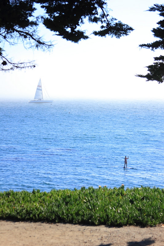
West Cliff warmed up quickly Thursday when the fog pulled off the ocean. 


After these next weeks storm, it looks like the storm door is to close again.  We should see a return to fall like weather, which in short means cool, crisp, clear mornings and warm afternoons.  A cold air mass will be in place so most areas will feel a significant drop in daily highs from earlier this week.  Coastal areas will see just a slight drop and perhaps even a rebound.  This is the time of year where the central valley and Santa Cruz begin to see similar day time highs, as they no longer have heat pooling and we no longer have fog cooling.

Just a note here for you dry farm tomato growers.  This will be enough rain to mess with your crop.  Remember, they have not had a drink since you put them in the ground.  Even if you water until they fruit, it has been a while.  You will need to do one of two things.  First, you can protect them from the rain.  A simple plastic sheeting green house supported by 1"x1" stakes is efficient and easy enough to build in an hour.  That is really your best choice, as we have several weeks to months left in the grow season.  The second option it to pick all of your fruit with any color.  You can continue to ripen them in a sunny window.  And then hope the rest of the fruit does not burst when your roots start drinking.  Or, I guess a third option is to pick your green fruit and make a chutney.  Oh - and another note - expect a brief spike in strawberry and lettuce prices.  And a drop in availability.

North Coast farmstead.  These folks will be busy the next few days.

I will try to fine tune this by Monday, as timing and trajectory keep flipping in the models.  But confidence is high for rain next week between Monday and Thursday morning.  Be prepared.  And if you are running around the yard this weekend, trying to get things ready, it is because you have not been reading this blog.  Here it was suggested that a rain even could occur sometime around Oct 1-6 almost three weeks ago.  Hear it here first folks.