Well, that surf was raging on Monday. All along West Cliff people were lined up watching the action in the water. It was pretty exculpating from the cliff. It was even more so in the water. I was lucky enough to get out for a short bit and grab a few waves. One was a part of the purple blob. That one was all I needed. Fear and excitement all wrapped into one. I spoke with a member of water patrol who was out working the jet ski rescue team on Monday. He was bummed he didn't get to surf, but the good news is there were no major issues. They did assist some with getting out of currents and not washing into the pier, but all went okay for the first big day of swell in the 18/19 season.
Surf is still solid, and another long period swell arrives on Thursday. This one is smaller, at about 10 feet with peak period around 17 seconds. Solid, but not the beast that arrived Monday. Today, Wednesday looks very nice with a high temp near 65F. Just enough clouds to allow that sunrise to pop right now. Weather will be a touch cooler Thursday as we see a storm move through to our north. We have a very slight chance of some light showers overnight Thursday. Whatever happens, it clears out during the day Friday. Although some models show showers sprouting u locally late Friday night as well. Most likely we are talking just about cloud cover, though.
The weekend looks fair, but we see an increasing chance of rain on the far end. By Sunday night we should have some cloud cover, and I am watching the forecast models for a Christmas Eve storm. The bulk of this system may be north and east of us. It is kind of an inside slider, and might miss us on the coast. As it stands right now, the heaviest rain looks like it will fall after dark on Christmas Eve and early Christmas morning.
Tahoe ski hills are in decent shape. Kirkwood, as usual, has fantastic early season coverage. The snow pack is near perfect right now, with so many features and gullies. The entire region received a few inches Sunday night, will likely get another few Friday night, and are looking at up to a foot Christmas Eve, with potentially more to follow. Things are looking good if you are planning for a little holiday skiing or boarding. Go get some.
Wednesday, December 19, 2018
Sunday, December 16, 2018
Massive Waves Monday.
Apologies for the very late post from the 18th. It somehow got clogged up in my computer. Anyway, it was close to accurate. This storm tonight was ratcheted up a bit over the past few days and has hit us with moderate rain. We are at about 8/10th of an inch of rain at this point, and likely to break the one inch mark before sunrise. Rain is forecast to subside over night. Only a very little of this storm will make it up to Tahoe, so instead of measuring in feet, we will be recording inches on Monday. Expect about 10 inches on the crest, most in the north, and just two or so on the east side of the lake. NorCal is getting drenched tonight, as is the west slope. Just not making it into the high mountains.
Fair weather on Monday, with NW breezes behind the storm. A fair amount of sunshine and temps reaching into the low 60s. The big news for this week is the big North Pacific swell arriving overnight. By morning, we should be seeing swells in excess of 15 feet at 18-19 seconds. That is big people. Surf in town will be well overhead to double overhead at most spots, with the big wave magnets reaching triple or more overhead, with the biggest sets possible around 30 feet. Tomorrow will be a great day to watch some impressive waves and watch some amazing surfing. Please know your limits, and use extreme caution when approaching the ocean. And if this is your thing, have fun and play smart. Swells will subside a little for Tuesday, but will still be int he XL category.
We are headed into a dry week folks. Afternoon highs will be in the low to mid 60s, with Wednesday expected to be the warmest. We do see a chance of rain returning by Sunday, but the GFS holds the next storm off until the 26th. Other models show different timing, but the earliest modeled storm is not until Christmas Eve. Check back here middle of the week for an update on what to expect for the start of the holiday weeks. Good money is on fresh snow between Christmas and New Years.
Wednesday, December 12, 2018
Chance of Wind and Rain.
That about sums it up. More fair weather today and tomorrow. Seasonable temperature. Thursday could even be a little warm, pushing into the upper 60s. Some clouds. Friday morning will be cloudy, with a southerly breeze developing. Rain showers looking possible by mid day and into the evening. Little to no accumulation. Perhaps just enough to dampen the surface.
Saturday looks much like today; perhaps with a little more cloud cover. Another system comes ashore on Sunday. Currently, it looks like the storm will arrive overnight on Sunday, and into the day Monday. Some light showers could persist into the evening hours of Monday. This storm also looks like it will be falling apart as it moves on shore. Just like last Monday's and Friday's, but this one will hold it together just a bit longer, and bring us some actual rain fall. Maybe even a little snow for the mountains. Three quarters of an inch of rain possible in town and up to six inches of snow up on Sierra Crest near Tahoe. Nothing exciting, and nothing like the string of storms at the end of November and the first few days of December. Still, more rain is likely over the ext five days.
Tuesday high pressure builds in. We could see some strong northerly winds behind the storm, moderating into the week. High pressure looks like it will hold through at least the work week, and perhaps even lasting past Christmas. Models are all over the place in the mid and long term, so we should consider the possibility of a wet Christmas (or white if you are high enough). But forecasting that is still a ways out into the future. For now, expect a chance of showers Friday, and a chance of light rain Monday. Otherwise, fine winter like weather is on tap.
 |
| Saint Oars' in Loche, France. |
Saturday looks much like today; perhaps with a little more cloud cover. Another system comes ashore on Sunday. Currently, it looks like the storm will arrive overnight on Sunday, and into the day Monday. Some light showers could persist into the evening hours of Monday. This storm also looks like it will be falling apart as it moves on shore. Just like last Monday's and Friday's, but this one will hold it together just a bit longer, and bring us some actual rain fall. Maybe even a little snow for the mountains. Three quarters of an inch of rain possible in town and up to six inches of snow up on Sierra Crest near Tahoe. Nothing exciting, and nothing like the string of storms at the end of November and the first few days of December. Still, more rain is likely over the ext five days.
Tuesday high pressure builds in. We could see some strong northerly winds behind the storm, moderating into the week. High pressure looks like it will hold through at least the work week, and perhaps even lasting past Christmas. Models are all over the place in the mid and long term, so we should consider the possibility of a wet Christmas (or white if you are high enough). But forecasting that is still a ways out into the future. For now, expect a chance of showers Friday, and a chance of light rain Monday. Otherwise, fine winter like weather is on tap.
Saturday, December 8, 2018
Quickie.
This post and the coming storm. Mild tonight, dropping only into the upper 40s. A little bit of cloud cover helps reduce radiational cooling. Tomorrow will also be mild, a little cooler than today, with a high if just about 60F. Some sunshine. Clouds increase late, and we could see a little bit of rain late Sunday night and into the morning of Monday. The storms will bring slightly cooler weather. But clear weather allows for things to warm quickly back up starting Tuesday. There is a system brushing to our north mid week, and another attempting to hit us Friday. Even that second one looks like nothing ore than tomorrow nights. The high pressure is starting to do its thing and keep us dry.
That is good news for growers. My beans are starting to sprout and I might get myself a Christmas harvest, as long as we get enough sunny, and mild days in the weeks to come. It does look like rain is in our mid and long term forecast at the moment. Time will tell.
That is good news for growers. My beans are starting to sprout and I might get myself a Christmas harvest, as long as we get enough sunny, and mild days in the weeks to come. It does look like rain is in our mid and long term forecast at the moment. Time will tell.
Thursday, December 6, 2018
Big Surf and Fine Weather.
De Laveaga rain gauge is reporting .41 inches of rain for Tuesday and Wednesday. Shy of a half inch. We are at .79" for the month to date, already putting us ahead of last December which only recorded .15 inches. So far so good, and for now, the rain is behind us. The weather over the next few days looks splendid. Cool overnight, in the ow 40s. Highs in the low 60s. Tomorrow, Friday, looks like it will have the most sun. Still, there will be enough cloud cover out there to make for stunning sunrise and sunset sessions. Sunday will have the most cloud cover, especially by afternoon.
There does look to be a storm diving from the northwest on Sunday evening that will bring with it a chance of light rain. This system is falling apart as it approaches the high pressure, and will likely be very mild. Clouds, a little wind, a bit warmer and rain overnight, maybe showers on Monday, but clearing out fairly quickly. Tuesday should be sunny again, and not making it out of the 50s. We can call it crisp. The rest of the work week is looking good, with low 60s and sunshine. Next chance at some rain will be Friday afternoon and evening. This one could bring back the inch plus measurements. Stay tuned. Winter is here.
Surf is cranking this evening and will be even bigger tomorrow. Surf heights are not huge, but the waves are very long period. Today had 20 second plus swells, and tomorrow will be mostly 18-19 second periods. Swell heights are less than 10 feet, but breakers far exceed that. More importantly, these swells will have a lot go firsthand power due to the long periods. Broken waves will sweep across points with a ton of power. Know your skill set and limits. Play accordingly. Surf should be up through Saturday, subsiding over the weekend, but still head high plus in Sunday. Another storm is already developing a swell that could hit us on Monday. This one looks even bigger, but with ore moderate period.
Word in the back rooms is Kirkwood is going to open the backside, as early as mid day on Friday. Saturday if that does not work out for them. Sounds like the resort is going to be 99% for the weekend. I imagine Vista will not be running, so Look Out will be hike to only. And I can only assume Hell's Delight will still be roped off. But the rest is good to go. Although it might be a little peppery at the top of 10. Ski season is in full swing. Make plans and get out there.
Tuesday, December 4, 2018
Windy.
Generally an easterly wind. A little north or south in it depending on where you stand. Blowing at 23 mph on the wharf, with a gust to 30 mph. Long Marine Lab has it clocking at 12 mph. What is interesting is how strong of an east wind we are getting. Rain started to fall around 2:15 today and has been sporadic. It was heavy briefly around 8:40, and then this wind really kicked up. I can hear holiday decorations getting tossed around out there. This storm should subside overnight. Periods of heavy rain are possible, but we are looking at getting maybe a half inch overnight. I'm thinking it is closer to a third of an inch by sunrise and maybe, just maybe a half inch by the time this thing wraps up. Showers should start breaking by late morning and we should be high and dry by the early morning hours on Thursday. But it all depends on how this system moves. Right now it stays off shore and swiftly gets to our south.
Forecast still looking good into the weekend. Storm tries to break downtime high pressure for Monday. Better chance of more rain late next week. It is a nice wet December.
I'll get back on here later this week to recap this storm and look at our next one. I'll leave you with this. Solid NW swell is arriving Thursday. Long period, and moderate height. It should hit at 7.5 feet at 19 seconds, with the best breaks seeing double overhead surf. Game on folks. Use caution. Eastside should be head high plus, westside overhead, Middle Peak and north county will be double overhead. Conditions look clean. Swell continues Friday and drops a bit, but still solid, on Saturday.
Monday, December 3, 2018
Hard Saying, Not Knowing.
Gorgeous sunrise the morning. Not nearly as cold as forecasted. Low 40s, maybe even a bit warmer than Sunday morning. Cool, fine weather today on Monday. So, with this midweek storm we are going to have, it is cut off from the jet stream and will be doing its own thing. That makes it hard to forecast. This morning's 06hr model run suggests that we won't see any rain until daylight hours on Tuesday, and it will be light through that period. The storm shifts more onshore Tuesday evening and we get a half inch plus overnight. The real surprise is how quickly it shifts south, and we go dry by Wednesday mid morning. Now, the rain line is basically just south of Watsonville, near Marina. And (I know you don't start sentences with "and", but this is a though), it will be fairly heavy rain. So a slight change in location or velocity of the storm, and we could see moderate rains through late Thursday. But let's go with this forecast this morning. Almost sunny late Wednesday, some sun Thursday and fine fine Friday.
It looks like the high pressure will hold for the weekend ahead, so use that time to get outside. Maybe purchase a tree (if you are one of the few who do get a tree, but not on Black Friday). They will be dry. Next window for tree purchasing with added water will be late the following week. As it stands now, there is another powerful system breaking through next Sunday night lasting into next Wednesday morning. Another cut off low, that will take its Tim pushing inland. This one looks to stay on top of us, instead of move south.
The really good news about al of this is that SoCal is getting some water folks. For the first time in like 7 years, they are getting some decent early season rains. That is excellent news. You may have forgotten about the drought, as it is no longer Exceptional in large portions of the state. Still, the entire state is listed as Abnormally Dry or in a level of Drought. Five percent of the state was listed as Extreme at the start of the water year in late September. It is now down to 3.78% as of November 29th. I expect after these next two storms, we will see more drops, especially in the coastal regions. Just to keep you informed, we are in Moderate Drought on the OR Borger to SLO. South of there they are in Severe Drought, with a section from Pt Conception to Ventura listed as Extreme. Bring that water.
Surf is settling from a larger NW swell we had late last week and over the weekend. Another NW should arrive on Thursday. Smaller swell through the first half of the week, with easterly winds. Smaller, but not tiny. It is head high out there this morning. If it was too ligand stormy for you over the weekend, and have time, get out over the next few days. More swell is on the way.
Sunday, December 2, 2018
Almost Five.
Da Laveaga rainfall gauge came in at 4.97" for the month of November, knocking it out of the park over the previous three years. We are off to a great start for our water year and all of that started just over 10 days ago. So far we recorded .38" at this plot for December. And there is more to come in the coming week. But first we get another fine late autumn day on Monday. It will be crisp in the morning. Some locales in town could hit the freezing mark. Expect front, and if you are on the before sunrise commute, you might want need to scrape your windshield. Easterly breeze and mostly sunny. Cool, with a high in the upper 50s. Feels kind of like winter. Rain moves in overnight, possibly before midnight.
This storm is basically driving down the coast and will dissipate and push inland well south of here. The result will be moderate rains over 36 hours, with moderate easterly winds. The storms center stays to our west, offshore, through its duration. Right now it looks like rain will arrive after sunrise on Tuesday. Mostly light showers to start, but will increase in intensity by afternoon. It could remain moderate overnight and through Wednesday. Rain lightens overnight Wednesday. Lows in the low 40 and highs in the upper 50s. Things will clear out slowly on Thursday. Friday looks nice. Sunny and back up into the 60s.
Over the next weekend it looks like a storm attempts to hit us, but high pressure building in will try to block it. Hang on, we are on our way into the water year and storms are lining up. Great news for the ski resorts that got another 20 to 45 inches of new snow over the past five days. More terrain is opening and it looks like we are off to a good start. This storm for next week will mostly miss the Sierra, being too far west, but that could still get a few more inches.
Thursday, November 29, 2018
Well On Our Way.
Van Ness and King has seen 2.09 inches of rain since the start of this round of storms. We should have no problem reaching the lower end of the forecast range of 2.5 inches in town by Sunday morning. Sunlit Lane in Bonny Noon is at 4.27 inches so far. They will surpass the high end of the forecast for town, but remember, I said more in the mountains. The gauge at Henry cowell in Felton is registering 4.68 inches. It is wet in those mountains. Carmel Valley has a total of only 1.79 inches. I think this location is tucked into the valley a bit and gets a little shadow protection from the rain. Compare that to the 2.89 inches just south in Big Sur. And while the main water plume was pushing ashore just south of Big Sur, we got more rain. In part we received rain earlier and for a longer period of time.
Wind out there this morning. I can see a lot of clear sky. Not yet blue because it is too early in the morning with the light just coming. Should be a breezy day with some showers, especially in the morning. Winds clock from the southwest in the morning, to the west-northwest in the afternoon at 20-30 mph with a few stronger gusts, especially early in the day. Surf is big out there. Still over ten feet in height with periods between 14 and 17 seconds. That is the swell. Copious wind waves on top of that. I imagine it is Victory at Sea for most locations today. Be careful if you decide to enter out.
We are seeing a break right now, but we have another band of strong showers ad thunderstorms headed this way. We are not yet in the clear today. We could still see over a half inch of rain here in town today, depending how this next band sets up. It looks pretty wet on the radar. You can see it spinning off shore and rain heavily in Marin right now. Give it an hour or two and it will be here.
No major changes in the forecast. This have been sailing smoothly. Friday still looks like it will have some sunshine, but many in the morning. Final storm in this series arrives Friday afternoon and evening. Strong NW winds this time and maybe a half inch by Saturday afternoon.
Sunday through Tuesday look cool (upper 50s for a high, low 40s for a low) and mostly sunny. Another storm may be moving down our coast Tuesday and through the middle of the week. GFS is suggesting high pressure builds in to keep us dry next weekend, ahead of a strengthening storms that will move ashore the following Monday, December 10th.
 |
| Base of Vernal Falls. Rivers are starting flow. |
Wind out there this morning. I can see a lot of clear sky. Not yet blue because it is too early in the morning with the light just coming. Should be a breezy day with some showers, especially in the morning. Winds clock from the southwest in the morning, to the west-northwest in the afternoon at 20-30 mph with a few stronger gusts, especially early in the day. Surf is big out there. Still over ten feet in height with periods between 14 and 17 seconds. That is the swell. Copious wind waves on top of that. I imagine it is Victory at Sea for most locations today. Be careful if you decide to enter out.
We are seeing a break right now, but we have another band of strong showers ad thunderstorms headed this way. We are not yet in the clear today. We could still see over a half inch of rain here in town today, depending how this next band sets up. It looks pretty wet on the radar. You can see it spinning off shore and rain heavily in Marin right now. Give it an hour or two and it will be here.
No major changes in the forecast. This have been sailing smoothly. Friday still looks like it will have some sunshine, but many in the morning. Final storm in this series arrives Friday afternoon and evening. Strong NW winds this time and maybe a half inch by Saturday afternoon.
Sunday through Tuesday look cool (upper 50s for a high, low 40s for a low) and mostly sunny. Another storm may be moving down our coast Tuesday and through the middle of the week. GFS is suggesting high pressure builds in to keep us dry next weekend, ahead of a strengthening storms that will move ashore the following Monday, December 10th.
Wednesday, November 28, 2018
Point Eight Four at Six Thirty.
The gauge at Van Ness and King received .84 inches of rain as of 6:30AM. That is an impressive first round. I'm thinking we are off to a good start to hit that total of 2.5-4 inches of rain by Sunday. A very good start. In fact, if things continue to perform as such, we might be pushing toward 5 inches. But let us now get too far ahead of our selves.
Returning to write at noon. Its a lunch break and the sun actually broke out for ten minutes. On the westside we are just shy of a half inch since midnight. The strongest showers are south of us, just as forecasted on Monday. Big Sur is getting hammered, and Monterey is getting some as well. The winds are moderate out of the south off shore, but kind of light here in town. More rain should fill in this afternoon or evening.
The heaviest rain looks to fall over night Thursday.
No major changes since yesterday. Enjoy the rain. Make outdoor plans for Friday and Sunday.
Tuesday, November 27, 2018
Working on the First Quarter.
Bonny Doon sure gets a heck of a lot of rain. They already have over 4/10th of an inch and it just started raining in town a little after 6PM. It was light and misty at first, but we had a decent 45 minutes of real rain fall around 7PM. It backed off a bit, but now is turning back on outside of my house. Should be a decent night of rain, with the heaviest rainfall over the next few hours. Probably will end up around a third of an inch in town. A low in the 50s. Quite warm really.
Steady showers build back in tomorrow morning. It looks more like steady showers as opposed to shifty gusty intermediate thunderstorms. At least through the day and evening hours. A half inch or more in town through the daylight hours, with more if that falling in the afternoon. A high of about 60F. Breezy out of the southwest. Steady showers continue into the night time hours, with some stronger cells moving through around midnight. We could see some strong gusts late night. 35mph or more. A low in the 50s again. Another half inch or more of rain. Let's say, for now, sunrise Wednesday to Thursday we are looking at 1.25" of rain. Not bad for a solid start, because that is not the end of it.
The strongest winds look like they will occur Thursday morning with gusts up to 40mph from the southwest. Rainfall lightens up a bit from Wednesday night, but remains a fairly steady shower. Thunderstorms could roll through and bring short bursts of very heavy rain. Basically a storm day. There are some indicators that suggest a very wet day Thursday. Others suggest not so much. Right now it could be as little as a half inch, or upwards of a full inch. High around 60F. The storms clears out in the afternoon. Raina and winds lighten. Some clouds clear overnight. Light showers and maybe an additional tenth of an inch. Cooler, with some stars. Around 45F. Winds remain brisk, and shift from the northwest.
Friday could be kind of sunny. Lots of clouds to make for great sunrise and sunset. It will be cool, with a high of just 60F, despite the sunshine. That last system brings in cooler air. But the real cold comes on Friday night, as clouds fill back in and rain returns. Low around 45F. Showers on Saturday, and cool, only in the upper 50s. The weekend system does not look as wet, but all together we expect between two and a half and four inches of rain in Santa Cruz. As of 9PM Tuesday, we have almost a quarter inch on Western Drive. Only 3.75" more to go to hit the high mark, and 10% of the way to the low end. Let's see how this all rides.
Cold air will be in place Sunday and early next week. The weekend storm has forecasted freezing levels around 3500'. We could see some snow in the Santa Lucia. Low on Sunday and Monday nights could be below 40F. Highs in the upper 50s. About 60F on Tuesday.
And another system might slide down the coast next Wednesday, bringing much needed rain to SoCal. The best news is this week's storms is bringing a close to one of the worst fire seasons in history. Good riddance.
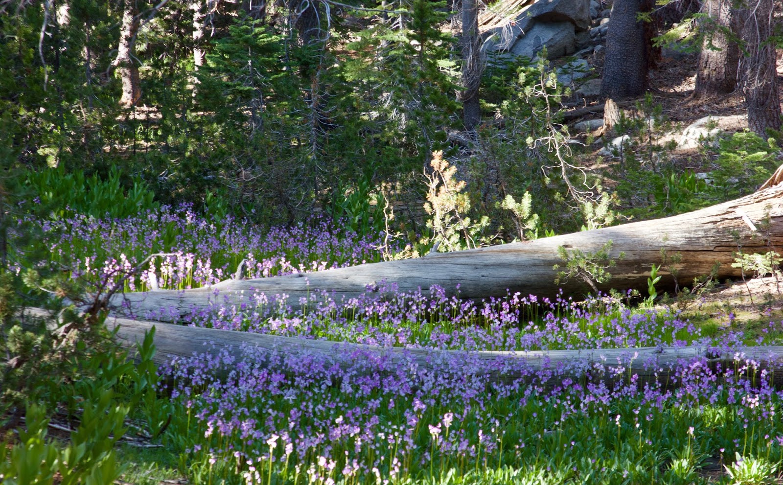 |
| Rain is coming, which means more flowers next year. Below Lake May, Yosemite High Country. June 2018. |
Steady showers build back in tomorrow morning. It looks more like steady showers as opposed to shifty gusty intermediate thunderstorms. At least through the day and evening hours. A half inch or more in town through the daylight hours, with more if that falling in the afternoon. A high of about 60F. Breezy out of the southwest. Steady showers continue into the night time hours, with some stronger cells moving through around midnight. We could see some strong gusts late night. 35mph or more. A low in the 50s again. Another half inch or more of rain. Let's say, for now, sunrise Wednesday to Thursday we are looking at 1.25" of rain. Not bad for a solid start, because that is not the end of it.
The strongest winds look like they will occur Thursday morning with gusts up to 40mph from the southwest. Rainfall lightens up a bit from Wednesday night, but remains a fairly steady shower. Thunderstorms could roll through and bring short bursts of very heavy rain. Basically a storm day. There are some indicators that suggest a very wet day Thursday. Others suggest not so much. Right now it could be as little as a half inch, or upwards of a full inch. High around 60F. The storms clears out in the afternoon. Raina and winds lighten. Some clouds clear overnight. Light showers and maybe an additional tenth of an inch. Cooler, with some stars. Around 45F. Winds remain brisk, and shift from the northwest.
Friday could be kind of sunny. Lots of clouds to make for great sunrise and sunset. It will be cool, with a high of just 60F, despite the sunshine. That last system brings in cooler air. But the real cold comes on Friday night, as clouds fill back in and rain returns. Low around 45F. Showers on Saturday, and cool, only in the upper 50s. The weekend system does not look as wet, but all together we expect between two and a half and four inches of rain in Santa Cruz. As of 9PM Tuesday, we have almost a quarter inch on Western Drive. Only 3.75" more to go to hit the high mark, and 10% of the way to the low end. Let's see how this all rides.
Cold air will be in place Sunday and early next week. The weekend storm has forecasted freezing levels around 3500'. We could see some snow in the Santa Lucia. Low on Sunday and Monday nights could be below 40F. Highs in the upper 50s. About 60F on Tuesday.
And another system might slide down the coast next Wednesday, bringing much needed rain to SoCal. The best news is this week's storms is bringing a close to one of the worst fire seasons in history. Good riddance.
Monday, November 26, 2018
More Rain.
It could be a wet December. Still, et us finish up November first. Month to date in Santa Cruz at De Laveaga is 2.32 inches. That is about a half inch behind last season and a full inch behind 2015. It looks like we might surpass both of those years. What a come back for November which was completely dry up until last Wednesday. We have two storms coming at us this work week. Today, Monday will be mostly sunny. It was cold out there this morning. 41F at King and Van Ness. 60F as of 9:40AM. I expect a high of about 70F in the warmer locations of town. Light winds.
Tuesday begins mostly sunny, but clouds fill in through the day. It will be a bit cooler, maybe 65F. Winds will shift to southerly mid day, and we could see light rain before sunset. Rain continues overnight. with perhaps a half inch here in town. Rain cuts off in the very early morning hours Wednesday. Cloud cover keeps us warm, around 50F. Looks like we could have a break during the morning commute. Then a second storm is hot on the tails of the first.
The 12h GFS suggest rain starting and ending a little later. More like from midnight through noon Wednesday. It is also looking a little further north, so maybe lighter amounts of rain. It comes in south of us. Big Sur could get some heavy rain late Wednesday. Overnight we see heavier rain in Santa Cruz, lasting into the day Thursday. Over one inch of rain in town. Maybe even two. More in the mountains. We will see rain and clouds break overnight, cooling to the mid 40s. Colder air is in place Friday. Clouds should stick around through much of the day, as we see another system arrive late Friday night. Not so sure about storm #3, as only the GFS is showing it, but it will be a cold one if it comes through. A little less wet. Perhaps 3/4 of an inchSaturday and 1/4 inch on Sunday.
We are looking at a total of over 4 inches of rain locally over the next seven days. Hope you are prepared for plenty of rain and some run off. We could see some minor flooding Thursday into Friday morning.
It looks like high pressure returns the following week. Long term, we could be back into storm systems for the weekend of the 8th.
Saturday, November 24, 2018
One Inch Plus.
1.04 inches of rain fell at King and Van Ness yesterday, with .04 more inches early this morning. Up by Westlake they received one and one third inch in the past 24 hours. Sunlit Lane in Bonny Doon is the winner, with over three inches since yesterday morning. And it is still raining in the mountains. Clouds should slowly clear out today, and the sun will return. Low 60s for a high.
In the Sierra, more snow fell at high elevations. Kirkwood is reporting 30" total from this storm. But don't rush up, as it has been lightly raining on the snowpack since 4PM yesterday. It is a wet and dense snow pack out there at 7750'. It is possible the snow is still in good shape above 9000'. That fresh snow pack will be touchy, with heavier, wetter snow on top of lighter, dryer snow. Sierra Avalanche Center is not yet forecasting, but I would guess today would be rated as High, due to wind slabs and wet loose avalanche danger. Make good choices and it could be super fun out there up high. Sun could come out this afternoon with a high of 40F at 8000 feet.
Back in Santa Cruz, the forecast holds for clear weather over the weekend. A little bit warmer on Sunday. It might even hit 70F on Monday. Super fine. Then we see a chance for more rain beginning on Tuesday. And it will drop back into the low 60s. As it looks right now, rain will brush by to our north during the day Tuesday, with rain filling in late in the day. Perhaps after sunset. Light rain overnight and into Wednesday. The brunt of the storm arrives Wednesday evening and last through the day Thursday. Rain could be heavy at times. High temps in the upper 50s to about 60F. Rain continues into Friday morning, before clearing out mid day. High pressure builds for the weekend. Sun and warming are expected.
Looking out into the long range, that high pressure is brief. It keeps a storm to our north over the weekend, but more rain storms break through the following week. December could be a wet month folks. I hope you prepared for winter. It is coming. Almost seems like we missed autumn this year, except for a week or two in early November.
 |
| The Wall @ Kirkwood. We don't have this much snow yet, but it is coming. March 2018. |
In the Sierra, more snow fell at high elevations. Kirkwood is reporting 30" total from this storm. But don't rush up, as it has been lightly raining on the snowpack since 4PM yesterday. It is a wet and dense snow pack out there at 7750'. It is possible the snow is still in good shape above 9000'. That fresh snow pack will be touchy, with heavier, wetter snow on top of lighter, dryer snow. Sierra Avalanche Center is not yet forecasting, but I would guess today would be rated as High, due to wind slabs and wet loose avalanche danger. Make good choices and it could be super fun out there up high. Sun could come out this afternoon with a high of 40F at 8000 feet.
Back in Santa Cruz, the forecast holds for clear weather over the weekend. A little bit warmer on Sunday. It might even hit 70F on Monday. Super fine. Then we see a chance for more rain beginning on Tuesday. And it will drop back into the low 60s. As it looks right now, rain will brush by to our north during the day Tuesday, with rain filling in late in the day. Perhaps after sunset. Light rain overnight and into Wednesday. The brunt of the storm arrives Wednesday evening and last through the day Thursday. Rain could be heavy at times. High temps in the upper 50s to about 60F. Rain continues into Friday morning, before clearing out mid day. High pressure builds for the weekend. Sun and warming are expected.
Looking out into the long range, that high pressure is brief. It keeps a storm to our north over the weekend, but more rain storms break through the following week. December could be a wet month folks. I hope you prepared for winter. It is coming. Almost seems like we missed autumn this year, except for a week or two in early November.
Thursday, November 22, 2018
Round Two.
Second round of rain recently started up in town. After this, we will see a break for a few days. Yesterday was rainy in the county. The Bonny Doon Airport Lost Empire recorded 2.74 inches of rain yesterday and another quarter by 9PM today. In town Santa Cruz readings were about a third of an inch. Showers are moving into the county as I type. Light at first, but they should pick up before sunrise Friday. We could see some moderate to heavy rain Friday morning, The heaviest precipitation falls before noon Friday, but we should expect showers to linger past sunset. High temp in the low 60s. Cooler air follows this storm, and we drop into the upper 40s over night. We could see an additional half to one inch of rainier in town, with more in the mountains. Good news.
Sun arrives for the weekend. High pressure and warming through Monday, with highs reaching into the upper 60s. Overnight will get cooler, with a clear sky. Lower 40s. Tuesday the high pressure fights off an approaching storm and strong southern jet stream. Yup, we are looking at more approaching storms. It is likely we will be in another wet stretch starting some time around the middle of next week and lasting into the weekend.
Up in the Sierra, Kirkwood received a foot of new snow. I went out for a skin nearby, and found nice deep snow, with many areas around 18" deep. It was a good base building storm. Tomorrow will be warmer, and maybe too warm even for Kirkwood's base. Another foot plus is expected. Unfortunately, a lot of ski resorts will receive rain with this next system at their bases. Too early to be looking at next week's storms, but the season is off to a good start. People were getting anxious with no snow on the ground as of yesterday, but this is how Tahoe delivers. Often. It looks like things will be good to go here at Kirkwood for their opening on Saturday. Mt Rose should also be in really good shape with its high elevation.
Monday, November 19, 2018
Timing.
I've missed the last few morning, but I'll be up for sunrise tomorrow. Expecting it to be chilly and beautiful. Tuesday is our transition day. It will begin like today, with more haze. Ugh. Thankfully to coming weather should dampen the fire as well as clear out this smoke. Winds shift out of the southwest during the morning and pick up in speed late. Clouds fill in through the day. Rain will arrive in the early morning hours of Wednesday. It will be heavy at times through mid afternoon, with about a half inching town and 1.5" in the favorable spots in the local mountains. Some decent winds with this one as well. Nothing super wet or super windy, but decent amounts. Like a real honest to goodness rain storm. The cloud cover will keep it warm Wednesday night, near 50F. Colder air moves in behind the storm early Thursday morning. And a little break from the rain.
Thanksgiving morning will be cloudy, and cool, in the upper 40s, and perhaps with a drizzle. By mid day, another storm is going to be moving in. Mostly light through the day, and picking up near night fall. High in the low 60s. Low in the upper 40s. Rain through the night, moderate at times. The Euro has this storm much further south than the GFS, so it could turn out we see heavy rain. But as of now, looking at the GFS, we are seeing only moderate amounts of rain, likely removing under an inch in the mountains and perhaps a third inching town. Regardless, it will be wet.
The heaviest rain from the second storm looks to be before sunrise Friday, but rain persist through much of the day, off and on. Tapering in the evening and ceasing after dark. The weekend looks sunny and warmer. Saturday morning will have the most clouds, but high pressure moves in and clears things out quickly. West winds return with that building pressure.
Looking out at the fantasy charts, more storms for the middle of next week possible. For now, drive carefully, and leave early. Roads will be very wet Wednesday, for the first time in many months. Oil will surface, and make slicks. If driving to elevation, expect snow, and be prepared, above 6800 feet. Have a great holiday, eat some bird, and check back here for updates.
Saturday, November 17, 2018
Rain is Coming.
Feeling confident that we will see rain next week. How much and when are still in question, but otherwise it is looking sure that precipitation will fall. And we need it. This is very good news for the Camp Fire. They are forecasting over 1.5" in that area. Ventura will see less; it will get somewhere between a half and one inch of rain. But let's first focus on Santa Cruz. The next few days remain fair, with pretty high AQI numbers due to the smoke from Bonny Doon and Camp fires. There was also a second blaze in the Pogonip yesterday. The zone is dry folks. Be careful when using flames. Anyway, mid 60s, haze and smoke. Lows just about 40F. Westside has been cold in the mornings, with plenty of places reading below 40F. Van Ness and King hit a low of 36.5F, with Swift and Delaware reporting 38.3F. It was below freezing for almost five hours in Tie Gulch. Over on Western, it was about 44F, so location matters. AQI today was above 150 most of the day. It was 162 at 3PM. Unhealthy. Stay inside if you can.
Weather remains the same, with maybe less haze and smoke moving forward. Sun will feel warm if it is out. That smoke cuts off a lot of radiation. Tuesday we begin to see a change. It will be the calm before the storms. Winds will build out of the south late, and clouds will begin to filter in. Could be an epic sunset Tuesday. Cloud cover and SW flow keep things a little warmer Tuesday night. Rain move in over night. Caveat, this is all still several days away and models keep shifting. We will see moderate rain on Wednesday, starting at the coast and moving east and south during the day. It will settle overnight, and clear out briefly for Thursday morning. A second round of rain fills in during the mid day of Thanksgiving. Could be a wet one folk. Be prepared for some stormy conditions. As it sits now it could last into Friday, with another system impacting us Saturday night. All told, we are looking at 1.5 to two inches in town, with more in the hills. Not huge by any standard, but a hell of a lot more than we have had in months.
Anyway, that is a quick overview. And likely to change. But rain is coming and you should be getting prepared. Walk your property and look for those things that have been out for months, fading into the background, but should really not get wet. Bring them inside. That includes wood handled shovels. Or cardboard anything. Seed packets. Whatever. And look for things that will collect and allow for standing water. Mosquitos are no fun. More to come.
Tuesday, November 13, 2018
Hazy.
While I do enjoy a hazy IPA, I'm not such a fan of the hazy sky. Seems like the wide spread smoke has turned to patchy smoke to wide spread haze. That kept things a little cool today, with a morning low below 40F on the west side. It did warm to almost 75F at one point, but there was a pretty good dip in temperatures through the mid day. Due to haziness. Haziness stick around through the day tomorrow. High around 70F. Haze kicks out sometime Thursday, and sun returns late in the day. The good news is haze makes for some killer light. and awesome sunrise and set. So, maybe, just maybe, get out a camera and take a few shots. By the time the sun returns, we see a cold front move through dropping highs back into the mid to upper 60s late in the week. It could be cool on Saturday with a high in the low 60s. Anyway, I guess I should not complain too much about haze. We still have our homes and our town.
Anyway, we could see a slight bit of warming into Monday. Through the period, the winds remain light, with a bit of a north flow over the weekend. Steep southerly swell, which is the best we have seen in over a week, will be around tomorrow. That dies out as we see another round of northwest swell arrive Thursday. Finally we see some fall swell and clean conditions. Slight north flow on Friday should not make it much worse as that sell fills in more. Smaller on Saturday, with maybe more northwest on Sunday or Monday. And maybe more beyond that. The North Pacific has finally decided it is autumn. And that is where the fun begins.
So, me, I want more sun and warmth. My final round of beans is about ready to flower, and that only happens when it is warm and sunny. But we really need some rain, and we might see some relief next week. Now remember, this is all more than a week out, so it is pretty speculative, but also investing. The GFS, it should be noted, has been all over the place the last 36 hours, but the last several runs have zeroed in on a Thanksgiving storm. We could see rain move ashore as early as next Wednesday, with the brunt Thursday afternoon. A second storm hits Saturday and a third the middle of the following week. Again, speculative. But confidence is growing. The current runs suggest a fairly powerful storm on Thanksgiving. It might be the welcome to autumn storm. We do need the rain. And I'll be happy to see some snow in the Sierra, even if it does kill my beans.
 |
| Jardin du Luxembourg, Paris. July 2018. A great place for a sail and a snack. |
Anyway, we could see a slight bit of warming into Monday. Through the period, the winds remain light, with a bit of a north flow over the weekend. Steep southerly swell, which is the best we have seen in over a week, will be around tomorrow. That dies out as we see another round of northwest swell arrive Thursday. Finally we see some fall swell and clean conditions. Slight north flow on Friday should not make it much worse as that sell fills in more. Smaller on Saturday, with maybe more northwest on Sunday or Monday. And maybe more beyond that. The North Pacific has finally decided it is autumn. And that is where the fun begins.
So, me, I want more sun and warmth. My final round of beans is about ready to flower, and that only happens when it is warm and sunny. But we really need some rain, and we might see some relief next week. Now remember, this is all more than a week out, so it is pretty speculative, but also investing. The GFS, it should be noted, has been all over the place the last 36 hours, but the last several runs have zeroed in on a Thanksgiving storm. We could see rain move ashore as early as next Wednesday, with the brunt Thursday afternoon. A second storm hits Saturday and a third the middle of the following week. Again, speculative. But confidence is growing. The current runs suggest a fairly powerful storm on Thanksgiving. It might be the welcome to autumn storm. We do need the rain. And I'll be happy to see some snow in the Sierra, even if it does kill my beans.
Saturday, November 10, 2018
Fires.
We have smoke in town. Lots of it. Air Quality Index is at 170 this morning and I suspect my son's soccer game will be cancelled. Only good news about this is that we were on snack duty and now I have two dozen pumpkin chocolate chip muffins to consume. The smoke, tis time around, is coming from the massive 90,000 acre Camp Fire in Butte County. This blaze has costumed the town of Paradise, burning it to the ground. 54,000 area residents are evacuated. It has already claimed 9 lives and it is only 5% contained. The blaze ws so intense yesterday that fire fighters stopped fighting the fire and focussed all their energy on getting people out to safety. Intense. If you've been looking for cause to donate to, there are going to be plenty of pool win need of your charity.
In Ventura County there are two large fires. The Woolsey Fire has burned 35,000 acres and displaced over 200,000 residents, including Malibu. It jumped the 101 corridor Friday morning and is headed toward the sea. It is zero percent contained. The Hill Fire is also in the county, and is 15% contained after having burned 4,500 acres. Part of the excited zone includes Thousand Oaks, which experienced a mass shooting just this past week at a country western bar. This is all very devastating, and saddening. Please consider what you might be able to do for others this week. If you can not directly helps those effected by these tragedies, consider doing something positive for your neighbor.
A little cooler today. And plenty of smoke in the air. As the day goes on, we should see it dissipate a bit. And while it will be a little cooler, it might feel just as warm with a smoke blanket. High in the low 70s. Smoke likely to clear out overnight. But really, the blaze and winds will determine that. Lows in the low 40s. That trend continues through the end of next work week. Monday looks the warmest. Speaking of which, it is Veterans Day. Be sure to thank those who have served, and also consider the cost of war; to those who have fought, as well as to those who have not.
A mention in the long term. The GFS has depicted a storm coming from the north around the weekend prior to Thanksgiving (17th/18th) for several days in a row now. Confidence building on a pattern change around mid month. There is also a second storm arriving just before or on Thanksgiving according to the same forecast charts. Timing and intensity are till too far away to predict. Hell, even actually forecasting precipitation at all is not viable at this time. Still, it is something to monitor and consider. We will get our first storm sooner or later. Still worth getting projects wrapped up. As it sits now, rain is 9 days out, arriving next Sunday. Once we get that down to 7 days, there will be more confidence. Don't get caught by surprise.
 |
| Vernal Falls, Yosemite Valley, July 2018. |
In Ventura County there are two large fires. The Woolsey Fire has burned 35,000 acres and displaced over 200,000 residents, including Malibu. It jumped the 101 corridor Friday morning and is headed toward the sea. It is zero percent contained. The Hill Fire is also in the county, and is 15% contained after having burned 4,500 acres. Part of the excited zone includes Thousand Oaks, which experienced a mass shooting just this past week at a country western bar. This is all very devastating, and saddening. Please consider what you might be able to do for others this week. If you can not directly helps those effected by these tragedies, consider doing something positive for your neighbor.
A little cooler today. And plenty of smoke in the air. As the day goes on, we should see it dissipate a bit. And while it will be a little cooler, it might feel just as warm with a smoke blanket. High in the low 70s. Smoke likely to clear out overnight. But really, the blaze and winds will determine that. Lows in the low 40s. That trend continues through the end of next work week. Monday looks the warmest. Speaking of which, it is Veterans Day. Be sure to thank those who have served, and also consider the cost of war; to those who have fought, as well as to those who have not.
A mention in the long term. The GFS has depicted a storm coming from the north around the weekend prior to Thanksgiving (17th/18th) for several days in a row now. Confidence building on a pattern change around mid month. There is also a second storm arriving just before or on Thanksgiving according to the same forecast charts. Timing and intensity are till too far away to predict. Hell, even actually forecasting precipitation at all is not viable at this time. Still, it is something to monitor and consider. We will get our first storm sooner or later. Still worth getting projects wrapped up. As it sits now, rain is 9 days out, arriving next Sunday. Once we get that down to 7 days, there will be more confidence. Don't get caught by surprise.
Wednesday, November 7, 2018
Dry.
Several local fires this past week. First we saw the Rincon Fire near Paradise Park at the base of Route 9. That fire began Saturday night, and smoke was heavy on the lower westside Sunday and Monday mornings, as the air flow was out of the San Lorenzo valley. I was less noticeable later in the day. The fire has burned 17 acres and is currently 76% contained. Then this morning, a fire began across Route 9 in the Pogonip, just downhill from the clubhouse. That fire was a little over 3.5 acres and completely contained at this time. It is expected to continue to smolder for a few days, as the roots underground continue to burn. It is dry out there. Please be careful and please don't set fires on purpose. Reports are coming out that the second fire may have been arson.
It is also cold at night. Tie Gulch had temps less than 40F for over 8 hours last nights. The gauge at King and Van Ness dropped below 37F in the early morning hours. Closer to the water, there were a few warm spots, cooling only into the mid 40s. But is was crisp out there this morning. Expect that again tomorrow morning, and while we warm up a little later in the week, overnight temps remain quite cool and in the 40s. This may effect those who still have summer vegetables going (such as tomatoes and beans) as buds may drop, or not even form, in cold overnight temps.
On the other hand, the days are quite nice. Mid to upper 70s in the better spots today. 78.7F on the upper westside today. 77F on King Street. 72.5F on the wharf (which was down to 46.2 early this morning). We could see a little warming over the next two days. Maybe even hit 80F up on the UC campus. Then we see them drop in to the low to mid 70s for Sunday and beyond. By Monday, we are looking at a 44F/71F spread for the week ahead.
Winds have been summer like out on the ocean recently. They were strong at 11AM today. Those are likely to back off the next few days, shift more north and even northeasterly. By late in the weekend, we should see pretty light winds. It looks lie autumn weather Monday and Tuesday. After that, we could see some warming again, and perhaps another wind gradient forming late in the week. All this wind and little to no surf. The NPAC wave making machine is still not in full swing.
All in all, things look dry 10 days out. GFS toys with some chances of rain beyond that, but these models have not been on point recently. If any thing, they toy with rain, and then pull back. Slow start to the rainy season. At least the storms begin forming in the Gulf again this weekend. I'll be watching and waiting. Still have about 6 hours of work I need to complete before the rain comes. Well, more than that, but 6 puts me in a good spot. And we could use that rain. Too dry right now.
Saturday, November 3, 2018
Turn That Clock Back.
You get an extra hour this weekend. Many will tell you to turn that clock back at 2AM on Sunday. Do what ever you want with your extra hour. Don't conform. Turn your clock back anytime, and enjoy (unless you have an appointment that is, then you should stick to the rules). Always one of my favorite weekend of the year. Typically wonderful weather. Even when I lived in Maine, I found it wonderful. Crisp mornings and fine afternoons with hours of insane light on either end. We hit 85F on the Westside yesterday. We were over 80F for over two hours. Insane. And the morning we dipped down to about 45F. Nice and crisp. This weather is great for a lot of those autumn harvest, as well as what is growing out there right now. I still have French Pole Beans growing and about to be ready to flower. If this weather holds. it will be like summer harvest (albeit slower) in November. And the broccoli is loving it and growing its flower. Once we lop off its head, it likes to sprout. Treats for months as long as the soil does not get too soggy. Yum.
Light or moderate rain for a day or two at a time will only help. If you are one of the lucky ones still harvesting tomatoes, a little rain will hurt. Pick your fruit (even the not yet ripe stuff) before any sure signs of rain in excess of a 1/10". Those plant have become experts at finding water. They will burst open anything full on that plant.
As for the weather forecast, well, not much changing in the near term. Today is going to be awesome. Warm already. 50F. About the same as yesterday at 9:15AM. But you can feel that sun on your back if you are out there. Wind is already up to 18 mph on the outer Monterey Bay buoy, but things are still pretty calm nearshore, with a 3 mph west breeze at Long Marine Lab. That will increase around mid day. The wind really whipped up quickly yesterday around noon. Expect that today. We will still get warm today due, in part, to the relatively calm morning. I'd expect mid 70s on West Cliff with a wind chill in the afternoon, and low to mid 80s in the warm spots in town. Cool again tonight, in the mid to upper 40s.
Tomorrow will see some early nearshore winds. Not sure how strong or when they will come up. But they will be significant and not long after sunrise. That wind regime gets strong in the afternoon and sticks around through at least Monday afternoon. Expect breezier conditions west and north of town. Expect high temps to drop 5-10 degrees. Highs of about 70F to maybe 75F in preferred locations.
Those winds will kick some wind swell, but it will be raw and choppy. Not much will wrap into town. Great weekend to go for a ride. Or a hike. Or chase tiny surf. But that is a shame in November. Maybe just clean up the yard. The sunny weather will persist through all of next week. That storm I mentioned last post was walked back over 8 model runs and is now expected to hit near the Alaskan/ Canadian border. Fine weather continues on the Central Coast. And now back to looking like the high pressure will migrate west and set up that warm offshore flow I was talking about several posts ago. Maybe. Been a strange weather pattern this autumn. Climate change.

 |
| Nevada Falls, above Yosemite Valley. July 2018. |
Light or moderate rain for a day or two at a time will only help. If you are one of the lucky ones still harvesting tomatoes, a little rain will hurt. Pick your fruit (even the not yet ripe stuff) before any sure signs of rain in excess of a 1/10". Those plant have become experts at finding water. They will burst open anything full on that plant.
As for the weather forecast, well, not much changing in the near term. Today is going to be awesome. Warm already. 50F. About the same as yesterday at 9:15AM. But you can feel that sun on your back if you are out there. Wind is already up to 18 mph on the outer Monterey Bay buoy, but things are still pretty calm nearshore, with a 3 mph west breeze at Long Marine Lab. That will increase around mid day. The wind really whipped up quickly yesterday around noon. Expect that today. We will still get warm today due, in part, to the relatively calm morning. I'd expect mid 70s on West Cliff with a wind chill in the afternoon, and low to mid 80s in the warm spots in town. Cool again tonight, in the mid to upper 40s.
Tomorrow will see some early nearshore winds. Not sure how strong or when they will come up. But they will be significant and not long after sunrise. That wind regime gets strong in the afternoon and sticks around through at least Monday afternoon. Expect breezier conditions west and north of town. Expect high temps to drop 5-10 degrees. Highs of about 70F to maybe 75F in preferred locations.
Those winds will kick some wind swell, but it will be raw and choppy. Not much will wrap into town. Great weekend to go for a ride. Or a hike. Or chase tiny surf. But that is a shame in November. Maybe just clean up the yard. The sunny weather will persist through all of next week. That storm I mentioned last post was walked back over 8 model runs and is now expected to hit near the Alaskan/ Canadian border. Fine weather continues on the Central Coast. And now back to looking like the high pressure will migrate west and set up that warm offshore flow I was talking about several posts ago. Maybe. Been a strange weather pattern this autumn. Climate change.

Thursday, November 1, 2018
November Too.
First day of November was pretty stellar. Light winds, and a high of 83F on King Street. Much of town was in the upper 70s and low 80s today. It was only in the 80s at King and Van Ness for a little over an hour today, but it was above 70F from 10:45 until 6:15 this evening. Yeah, as the sun was setting, it was still in the 70s. In November. Awesome. Expect more of the same tomorrow, although that NW wind should kick up more in the afternoon.
Basically the next two days will be quite warm. As we move toward Sunday, we begin a cooler trend. Lows could move back down into the upper 40s, with highs just about 70F. Sun abounds. Not really a marine layer, but we could see some clouds overnight Friday through early next week. We see an almost summertime pattern setting up Sunday through Tuesday next week, with very strong NW winds in the afternoons. Wind swell will be on the way up. Which is good news, as there is not really much other surf to speak of. All that mix of south and North Pacific energy is finally coming to an end. We could see a bump of NW middle of next week, but nothing to write home about.
The big news right now is that we see rain on the 10 day forecast. Yup. Not that I will give much credence to any forecast 10 days out, especially during shoulder season. But it is in there. After several days of not much storm activity in the NPAC, a tight strong low pressure is forecast to develop in the eastern Gulf of Alaska next Friday/Saturday. So, that is already 8/9 days out. That storm then will move south very quickly and stall offshore of San Francisco. This would result in light to moderate rains for the region on Sunday and Monday. The storm finally moves ashore Monday and inland on Tuesday. This is November 12th we are talking about. As it stands now, we could see over an inch of rain, so start your planning if you have any open projects. I'll monitor this in the coming week. Who knows, the entire thing could miss us.
The GFS is not calling for a pattern change. More of a one and done kind of system. High pressure sets up behind the system, and we might see ourselves back into a pattern like the past two weeks. Warm and gorgeous. Speaking of gorgeous, I hoe you've been enjoying the sunsets. They have been wonderful. As with the sunrise. Get some.
 |
| Paddling under the Chateau de Chenonceau. |
Basically the next two days will be quite warm. As we move toward Sunday, we begin a cooler trend. Lows could move back down into the upper 40s, with highs just about 70F. Sun abounds. Not really a marine layer, but we could see some clouds overnight Friday through early next week. We see an almost summertime pattern setting up Sunday through Tuesday next week, with very strong NW winds in the afternoons. Wind swell will be on the way up. Which is good news, as there is not really much other surf to speak of. All that mix of south and North Pacific energy is finally coming to an end. We could see a bump of NW middle of next week, but nothing to write home about.
The big news right now is that we see rain on the 10 day forecast. Yup. Not that I will give much credence to any forecast 10 days out, especially during shoulder season. But it is in there. After several days of not much storm activity in the NPAC, a tight strong low pressure is forecast to develop in the eastern Gulf of Alaska next Friday/Saturday. So, that is already 8/9 days out. That storm then will move south very quickly and stall offshore of San Francisco. This would result in light to moderate rains for the region on Sunday and Monday. The storm finally moves ashore Monday and inland on Tuesday. This is November 12th we are talking about. As it stands now, we could see over an inch of rain, so start your planning if you have any open projects. I'll monitor this in the coming week. Who knows, the entire thing could miss us.
The GFS is not calling for a pattern change. More of a one and done kind of system. High pressure sets up behind the system, and we might see ourselves back into a pattern like the past two weeks. Warm and gorgeous. Speaking of gorgeous, I hoe you've been enjoying the sunsets. They have been wonderful. As with the sunrise. Get some.
Monday, October 29, 2018
Gorgeous. Its October.
Why even bother wondering. It is gorgeous out there. Pretty much from sun up to sun down. 78F on King Street this afternoon. Currently still in the Liw 70s at 5:30PM. Seriously, that is fine weather. There was some strong westerly winds today. Enough to keep us in the 70s oaths side of town. More of the same tomorrow. Lighter winds on Wednesday and perhaps slack conditions Thursday and Friday will clearly see us into the 80s. Cool northerly flow aloft brings us back down into the 70s Friday and into the weekend. We could even be looking at low 70s. Overnight lows in the ow 50s, except for tonight when we could dip into the upper 40s. Should be a crisp morning Tuesday. But gorgeous from sun up to sun down.
We are entering sunset season. Not nearly enough cloud cover out there to make it go off, but our sun angle is low and days are short, giving us plenty of reds and pinks to play with for an hour or so each evening. Sunrises are not too shabby either. Gorgeous continues into the the next two weeks. We could see some warming in early November as the high pressure develops over us, shutting down the westerly flow, and maybe even encouraging a warm offshore flow. Some call it fire weather. But were are not there yet.
 |
| Ghost in the Catacombs, underneath Paris. |
We are entering sunset season. Not nearly enough cloud cover out there to make it go off, but our sun angle is low and days are short, giving us plenty of reds and pinks to play with for an hour or so each evening. Sunrises are not too shabby either. Gorgeous continues into the the next two weeks. We could see some warming in early November as the high pressure develops over us, shutting down the westerly flow, and maybe even encouraging a warm offshore flow. Some call it fire weather. But were are not there yet.
Friday, October 26, 2018
Fine Weather.
It ain't perfect fall. There has been an afternoon wind west of town. Today it was more of a morning wind. Patches of autumnal fog aren't bad. Sun is warm in the afternoons. It is October for sure. Looks like we have a mix of warmth and some coastal winds over the next few days. It hit 75F on the Municipal Wharf this afternoon, and tomorrow looks even warmer. Although a strong afternoon wind might keep that warmth at bay. Expect highs in the mid 70s Saturday and low 70s Sunday.
The we see a warming trend through the middle of next work week. We could be into low 80s for Wednesday and maybe even Thursday. Heck, maybe even Tuesday. But through all of that period we have some moderate to strong NW afternoon winds. Strong on the weekend, especially Saturday afternoon, and maybe Monday afternoon. Just enough breeze to help cool things a bit. As we head toward Wednesday, we could see light winds and warmer days. All in all, the weather is looking west to end the month.
Looking out at the seven, 10 and 16 day charts, we are looking t continued fine autumn weather. We might even find ourselves under a settled high pressure the first full week of November. That would mean some warm and calm weather. Both the North and South Pacific continue to send moderate swell to the region. Northwest swell is peaking this evening and will ease tomorrow. It was overhead just west of town today. Overlapping Southwest swells are easing and building through the weekend and more NW due Monday.
Garden is going off. Pole beans are climbing and it is almost Halloween. Maybe I get a December harvest this year. As long as the weather continues like this I will. Favas are looking strong. Broccoli are looking large. Peas are flowering. Older bean plants producing. Kale is kale. Beets and Carrots look promising. All in all, we are having some fabulous growing weather. Wish I had a mature indeterminate heathy tomato plant in my mix right now. It would be going off.
 |
| Gates to the Cite' Royales de Loches, Loire Valley, France. |
The we see a warming trend through the middle of next work week. We could be into low 80s for Wednesday and maybe even Thursday. Heck, maybe even Tuesday. But through all of that period we have some moderate to strong NW afternoon winds. Strong on the weekend, especially Saturday afternoon, and maybe Monday afternoon. Just enough breeze to help cool things a bit. As we head toward Wednesday, we could see light winds and warmer days. All in all, the weather is looking west to end the month.
Looking out at the seven, 10 and 16 day charts, we are looking t continued fine autumn weather. We might even find ourselves under a settled high pressure the first full week of November. That would mean some warm and calm weather. Both the North and South Pacific continue to send moderate swell to the region. Northwest swell is peaking this evening and will ease tomorrow. It was overhead just west of town today. Overlapping Southwest swells are easing and building through the weekend and more NW due Monday.
Garden is going off. Pole beans are climbing and it is almost Halloween. Maybe I get a December harvest this year. As long as the weather continues like this I will. Favas are looking strong. Broccoli are looking large. Peas are flowering. Older bean plants producing. Kale is kale. Beets and Carrots look promising. All in all, we are having some fabulous growing weather. Wish I had a mature indeterminate heathy tomato plant in my mix right now. It would be going off.
Monday, October 22, 2018
Willa.
Mexico is about to get rocked by a massive hurricane. Willa is currently packing 155 mph winds, but quickly diminishing. Just west of Puerto Vallarta, Willa is moving north-northeast and is about to plow through the Isla Marias with 130mph winds. It will slam into the coast of Mexico near the boarder of Nayarit and Sinaloa, tomorrow evening. Storm surge, 110mph winds and lots of rain are expected. If you can, consider giving to a charity this week that will help the people caught in this mess. Another storm, Vicente, much weaker, and only a Tropical Storm, will run ashore in Jalisco around the same time on Tuesday, bringing more moisture into the picture. I expect we will be hearing about a lot of flooding in those provinces, as well as Durango.
Not much change in our forecast. It did get cool last night dropping to about 50F at 3am. It took until 10am to break past 55F. We could have the same effect tonight. Stars are out, and the temperature is steadily dropping (from a high of about 67F, btw), and we could see fog move in in the early morning hours. Expect another cool morning, with a marine layer sticking around through mid morning. Or maybe like today, sticking around through mid day. It was sunny up the coast around 10am, but still foggy in town into the afternoon. Weird stuff. High of 67F Tuesday.
Only change is maybe a little patchy fog sticking around Wednesday and Thursday. But we are still going clear from Thursday into Sunday, with some warmer days for Friday and Saturday. I gotta say, that fog layer was nice for getting some yard work done and not dealing with the hot sun.
Sunday, October 21, 2018
Autumnal.
The weather has been quite fine the past week. Super calm, and super glassy through the middle of last week allowed for some warming. By Friday we were in the 80s for an afternoon high. The weekend was quite nice, but cooler. Slightly. And we are now into a cooling trend, with the marine layer moving in overnight. Expect fog in the morning like we saw on Sunday early. That will break apart relatively early, and then we will see some wind for the afternoon. Almost summer like. So why the post title? Cause it won't last.
Fog again for Tuesday morning. The week starts off with highs in the upper 60s and lows in the mid 50s. Fog does work like a blanket at night. The stars are still out at this hour, so depending on when that blanket moves in, we could see some significant radiational cooling. In that cause, it could be both cold and foggy in the morning. So, there is that. It looks like by Wednesday we will be free of the marine layer, and free to start warming up again. A high of 70 for the middle of the week, topping out in the mid 70s for Friday and Saturday. As it stands now, it looks like we could cool a little bit into Sunday, but still sunny and basically warm. Very autumn like.
We have had some fun waves over the last few weeks, and that looks to continue. Another south swell arrives tomorrow, at the same time, a series of small, mid period NW swell arrive. Both swells build through mid week, and then another, mid sized and mid period NW Gulf of Alaska swell arrives on Thursday. Busy week for waves if you can figure out where they will be working the best. The point is always a good option, but watch that mid morning high tide.
In the long range, nothing exciting. Storms continue to get pushed north into Canada or the PNW. There is an outside chance for some rain in NorCal by months end. Halloween looks dry. When you look way out into the fantasy charts, our high pressure begins moving west, and by around November 7th, it is far enough west, that we could see some rain come down its eastern flank from the north. But that is weeks away, and therefore not very confidence inspiring. If you are growing a winter garden, this is great news. Lack of rain usually means sunshine and warmth for Santa Cruz in the autumn. My favas, beets, broccoli and carrots are coming in great. More sunshine can only help. I even have a fall green bean harvest going right now. How cool is that?
 |
| Sea grass on the sand dunes Truc Vert on Cap Ferret. July, 2018. |
Fog again for Tuesday morning. The week starts off with highs in the upper 60s and lows in the mid 50s. Fog does work like a blanket at night. The stars are still out at this hour, so depending on when that blanket moves in, we could see some significant radiational cooling. In that cause, it could be both cold and foggy in the morning. So, there is that. It looks like by Wednesday we will be free of the marine layer, and free to start warming up again. A high of 70 for the middle of the week, topping out in the mid 70s for Friday and Saturday. As it stands now, it looks like we could cool a little bit into Sunday, but still sunny and basically warm. Very autumn like.
We have had some fun waves over the last few weeks, and that looks to continue. Another south swell arrives tomorrow, at the same time, a series of small, mid period NW swell arrive. Both swells build through mid week, and then another, mid sized and mid period NW Gulf of Alaska swell arrives on Thursday. Busy week for waves if you can figure out where they will be working the best. The point is always a good option, but watch that mid morning high tide.
In the long range, nothing exciting. Storms continue to get pushed north into Canada or the PNW. There is an outside chance for some rain in NorCal by months end. Halloween looks dry. When you look way out into the fantasy charts, our high pressure begins moving west, and by around November 7th, it is far enough west, that we could see some rain come down its eastern flank from the north. But that is weeks away, and therefore not very confidence inspiring. If you are growing a winter garden, this is great news. Lack of rain usually means sunshine and warmth for Santa Cruz in the autumn. My favas, beets, broccoli and carrots are coming in great. More sunshine can only help. I even have a fall green bean harvest going right now. How cool is that?
Monday, October 15, 2018
Eighty.
Hell, it was still 75F at the top of Van Ness as of 6PM. What an absolutely gorgeous day that's gotta make you glad you live in Santa Cruz. The ocean was sparkling today. The southwest swell was still in the fun range keeping the northern reefs firing well into afternoon. But more than the waves was just the massive beauty of it all. Nothing quite like a mid October day on this coastline.
So in yesterday's post I promised a clear sky for the work week. We'll, that was not completely accurate. There were patches of coastal fog this morning through 11AM or so. Just on the water for the most part. We could see that tomorrow, but by Wednesday morning we could see some fog here in town in the morning. And again Thursday morning. Another change is a warm up on Friday, back into the mid 70s. We have to see if the cool shot of air stays north and allows us to warm up for the weekend.
If you are gardening, now is the time to get that winter garden going. Favas, Peas, Broccoli, Cauliflower, Kale, Brussels Sprouts, Carrots, Beets, and Lettuce all do well over winter around here. But you need to get your plants established before December, when we can see some cold nights that will stunt any seedlings. Get the broccoli to flower by Thanksgiving and you could be trimming through April. If the space is still crowded from the summer harvest, no worries. Get it worked by December and you can still plant onions, garlic and potato starts. Just make sure you have good drainage for those guys.
Anyway, a fairly placid week ahead. Maybe some rain later in the month. A bunch of swells in the water this week and into the weekend. Sunshine, light winds and mild warmth. It is great out there. Try to get some.
 |
| Le Truc Vert pumpimg. Cap Ferret, France. July, 2018. |
So in yesterday's post I promised a clear sky for the work week. We'll, that was not completely accurate. There were patches of coastal fog this morning through 11AM or so. Just on the water for the most part. We could see that tomorrow, but by Wednesday morning we could see some fog here in town in the morning. And again Thursday morning. Another change is a warm up on Friday, back into the mid 70s. We have to see if the cool shot of air stays north and allows us to warm up for the weekend.
If you are gardening, now is the time to get that winter garden going. Favas, Peas, Broccoli, Cauliflower, Kale, Brussels Sprouts, Carrots, Beets, and Lettuce all do well over winter around here. But you need to get your plants established before December, when we can see some cold nights that will stunt any seedlings. Get the broccoli to flower by Thanksgiving and you could be trimming through April. If the space is still crowded from the summer harvest, no worries. Get it worked by December and you can still plant onions, garlic and potato starts. Just make sure you have good drainage for those guys.
Anyway, a fairly placid week ahead. Maybe some rain later in the month. A bunch of swells in the water this week and into the weekend. Sunshine, light winds and mild warmth. It is great out there. Try to get some.
Sunday, October 14, 2018
More Sunshine.
That fog filled in this morning, but burned off to the coast by 10AM. Enough to cool things down a bit. The thermometer at Van Ness topped at 66F today, compared to a high of 73F on Saturday. Still, it was quite pleasant. We could see a little cloud cover tonight, but it looks even more sparse than last night. Should see those high temps move back up into the 70s. In fact we could be in the mid to upper 70s in town tomorrow. Looks like a beautiful day. Basically we are looking at low 50s in the very early morning hours and low 70s in the afternoon for the rest of the work week. Typical October awesomeness. I mean, it is mid October folks. Got to love this stuff. I've lived here for over twenty years, but I never forget the northeast. Crisp is the word that comes to mind.
The Sierra have been crisp. Freezing nighttime lows above 6000 feet. In fact, it is currently snowing very lightly in Lake Tahoe. It must be a lake effect flurry, as the winds are causing waves of several feet to form, and it is otherwise very dry in the state. High pressure is set up on us, and the North and East Bay are in a red flag warning. Northeast winds are whipping through those hills in excess of 50 mph. These are the conditions that sent Santa Rosa into flames last year.
Out on the ocean, a long period south swell continues to create some pretty damn fun waves. Calm winds have created great conditions, and while the swell should drop a bit by Monday, the surf continues through the work week. Another SW swell arrives late on Monday and last through mid week, and then a NW swell arrive late Wednesday. This is from a legitimate gale that is currently at the dateline, and the first real sign of a change of season. We will get some moderate sized surf west and north of town, with maybe head high swell in town. It probably will be a little smaller than the south swell we are currently seeing, but a step in the right direction for those of us who like the consistency of swells from the North Pacific.
Weather wise, it will not really have any effect on us, as it gets pushed north into Alaska. Like I said we have a solid high pressure on us. The long term models suggest the storm track moving south into the PNW by the last week of the month. One model run suggests rain on October 30th. Something to watch, as that could mean a wet Halloween. But we have over two weeks before then, so a lot will change. Just throwing it out there, as you always want to be prepared if you have kids. Or if you don't but have been working on an awesome art outfit to where out that night. More to come.
 |
| Bassin d"Arcachon, France. July 2018. |
The Sierra have been crisp. Freezing nighttime lows above 6000 feet. In fact, it is currently snowing very lightly in Lake Tahoe. It must be a lake effect flurry, as the winds are causing waves of several feet to form, and it is otherwise very dry in the state. High pressure is set up on us, and the North and East Bay are in a red flag warning. Northeast winds are whipping through those hills in excess of 50 mph. These are the conditions that sent Santa Rosa into flames last year.
Out on the ocean, a long period south swell continues to create some pretty damn fun waves. Calm winds have created great conditions, and while the swell should drop a bit by Monday, the surf continues through the work week. Another SW swell arrives late on Monday and last through mid week, and then a NW swell arrive late Wednesday. This is from a legitimate gale that is currently at the dateline, and the first real sign of a change of season. We will get some moderate sized surf west and north of town, with maybe head high swell in town. It probably will be a little smaller than the south swell we are currently seeing, but a step in the right direction for those of us who like the consistency of swells from the North Pacific.
Weather wise, it will not really have any effect on us, as it gets pushed north into Alaska. Like I said we have a solid high pressure on us. The long term models suggest the storm track moving south into the PNW by the last week of the month. One model run suggests rain on October 30th. Something to watch, as that could mean a wet Halloween. But we have over two weeks before then, so a lot will change. Just throwing it out there, as you always want to be prepared if you have kids. Or if you don't but have been working on an awesome art outfit to where out that night. More to come.
Monday, October 8, 2018
Cooler. And Sergio. And Michael.
Holy cow the weather is weird. At least the tropical storms. But first, expect a chance of some fog returning overnight, putting an end to the four day run of near perfect weather. Excepting that demon wind. The night will be warmer and the day cooler. High in the upper 60s. Lighter winds though, so might feel similar in exposed areas. Protected zones like Harvey West might feel the touch of coolness. We should kick this trend by later int he week. Clear nights, cooler nights and warmer days return for Friday and into the weekend. Nothing about our local weather is all that weird. The smoke yesterday from the Solano County fire was a bit odd, but that is not weird weather.
What is interesting is Sergio returning to Mexico. Great for us, sending waves north, but this will be the second hit Baja takes in two weeks. A little further south this time. He should make landfall on Thursday night, with about 50mph winds and bringing plenty of rain. What is about to become a news story, and of much bigger concern is Micheal in the Gulf of Mexico. Just forming now, he is to intensify quickly, making landfall on the Florida pan handle Wednesday evening as a major hurricane. Expected sustained winds over 110 mph at land fall. The track continues north and east, over Georgia, South and North Carolina, Virginia and going back out to sea somewhere around Washington D.C. Much of that same area is where Florence dropped so much rain a few weeks ago. And Mother Nature is now taking at the Capital. And is that was not interesting enough, check out Leslie. She has been wandering around the Atlantic for weeks now. Like well before Rosa was even a thing. And now she is strengthening again and taking aim at Europe. Well, first she will head south east, then turn northeast and march right at Portugal. Do they even normally get swell from the southwest? Well, they will now. And maybe a good wetting as well. For us, we won't see any weather from these storms. Sergio is far enough south that moisture will only hit souther Arizona and shift over New Mexico and into Texas. Eventually heading to the northeast, giving the southeast a break.
So, some fog over the next few days. Light winds. Maybe even south winds by mid week. Sunny mornings and clear nights returns Thursday. Winds remain light. Looks light autumn is here.
Sergio:

Leslie:

Michael:

 |
| Château de Chenonceau, Chenonceaux, France. July 2018. |
What is interesting is Sergio returning to Mexico. Great for us, sending waves north, but this will be the second hit Baja takes in two weeks. A little further south this time. He should make landfall on Thursday night, with about 50mph winds and bringing plenty of rain. What is about to become a news story, and of much bigger concern is Micheal in the Gulf of Mexico. Just forming now, he is to intensify quickly, making landfall on the Florida pan handle Wednesday evening as a major hurricane. Expected sustained winds over 110 mph at land fall. The track continues north and east, over Georgia, South and North Carolina, Virginia and going back out to sea somewhere around Washington D.C. Much of that same area is where Florence dropped so much rain a few weeks ago. And Mother Nature is now taking at the Capital. And is that was not interesting enough, check out Leslie. She has been wandering around the Atlantic for weeks now. Like well before Rosa was even a thing. And now she is strengthening again and taking aim at Europe. Well, first she will head south east, then turn northeast and march right at Portugal. Do they even normally get swell from the southwest? Well, they will now. And maybe a good wetting as well. For us, we won't see any weather from these storms. Sergio is far enough south that moisture will only hit souther Arizona and shift over New Mexico and into Texas. Eventually heading to the northeast, giving the southeast a break.
So, some fog over the next few days. Light winds. Maybe even south winds by mid week. Sunny mornings and clear nights returns Thursday. Winds remain light. Looks light autumn is here.
Sergio:
Leslie:
Michael:
Thursday, October 4, 2018
Finally.
Posted today, but written last night...
A few hundredths of an inch here in town this after. It came in two spurts, and has settled into a mild drizzle. Almost feels like fog at this point, but we had some for real rain earlier today. Just never lasted more than a few minutes. We could still see a few ore drops out there. It is currently raining to our west and south. Chances remain slim, yet, it rained during period that had a slim chance for rain today. We only got a little rain here today. Sacramento Airport receive over a inch and a half. In general, the Central Valley and west slope received the heaviest rain. Down south, Santa Barbara was the big winner with over 2/3 of an inch. The Sierra got hit pretty well, with 4/10 of an inch at Yosemite and Mammoth Lakes, and 3/4 of an inch at Tahoe and almost an inch at Manzanita Lake near Mount Lassen. We got some rain across the state. Good for us.

Small NW swell arrives tomorrow. It is already showing at Cape Mendocino. Nothing big, but another sign that fall is here. Clouds clear out in the morning, and forecast sticks. Sunny days, about 70F, and clear nights about 50F. Warming trend over the weekend, possibly pushing 80F at Harvey West. At least mid 70s here in town.
I'll take a few days to watch Sergio. He is strong right now. Impressive from sate little. Moving toward the west with sustained 130 mph winds. He is to slow over the next few days, weaken a bit, then turn northeast. By Monday, he will be headed back toward Baja as a strong tropical storm and could re-strengthen. Something to watch, and should send us some strange swell. In fact, we already have some on the way for the weekend, form the southeast agin, due to the past few days of Sergio moving north. Interesting times. And the NPAC continues to stir.
Enjoy the next few days with mostly sunny conditions and warm daytime highs. Enjoy fall.
Wednesday, October 3, 2018
Ugh.
Watching that storm sit just offshore is kind of frustrating. I was hoping for a quarter inch of rain to wet my soil. Oh, well. We still have a chance for some light showers, but that is not feeling likely. Pretty humid out there today, especially when the sun was shining. Fog rolled in quickly around 4PM and shut down that feeling. Then it pulled back out for sunset. Gorgeous sky. It got warmer than forecast today, with much of town in the low to mid 70s for several hours. It was damn nice out.
Don't be shocked if we get some some light showers tonight or tomorrow. Meaning, don't get caught unprepared. It is not looking likely, though. Warm night, barely dropping into the 50s (its 66F at 9PM!!). Cloud cover likely tomorrow, at least in part. About the same temps as today, depending on how much sun we get. Another warm and cloudy night Wednesday, with some clearing Thursday. The sky clears Thursday evening, we see a cooler night (down to about 50F). Slight warming tend through Sunday, with continued cool nights. Plenty of sun and starts expected.
 |
| Alpine pond in the Yosemite high country. June 2018. |
Don't be shocked if we get some some light showers tonight or tomorrow. Meaning, don't get caught unprepared. It is not looking likely, though. Warm night, barely dropping into the 50s (its 66F at 9PM!!). Cloud cover likely tomorrow, at least in part. About the same temps as today, depending on how much sun we get. Another warm and cloudy night Wednesday, with some clearing Thursday. The sky clears Thursday evening, we see a cooler night (down to about 50F). Slight warming tend through Sunday, with continued cool nights. Plenty of sun and starts expected.
Monday, October 1, 2018
Almost Humid.
Well, the waves surf looked fun this evening. No wind north of Davenport sure made for some smooth water and great beach conditions. Rosa is about to make landfall in Baja with 40 mph sustained winds and lots of rain. Our storm, just to our west looks like it wants to stay just to our west. We will see some rain, but the bulk of the moisture stays just off shore, and what comes ashore is mostly to our south and streaming up the Sierra. Still, we are expecting rain to start late tonight into the morning hours on Tuesday. What does come will likely come in showery spurts and some thunderstorms are possible. It is still mostly clear out there. A long UFO shaped cloud stretch from west of Monterey all the way into the Salinas Valley around sunset. Low in the upper 50s. Pretty warm out there overnight.
 |
| Liberty Cap and Nevada Fall, Yosemite. June 2018. |
Low chances of some light rain before sunrise. At the very least, expect some moisture on the roads. Remember that the first rains of the year bring all the road oils to the surface, and makes things slick. Use caution out there tomorrow. Clouds, and increasing chances of rain through the morning hours, with moderate rain by midday. Or, at least our strongest rain. High in the upper 60s. Like I said, the bulk is to ur west and south. Still, we could total a half inch or more. Showers could last into the evening, and even into the morning Wednesday, but chance are we will see a good amount of sun Wednesday. It will be a little cooler Wednesday night with the clearing sky.
Thursday, it will be a touch warmer, and sunny. A clear sky looks to stick around into the weekend, with nice autumnal weather. Lows drop into the low 50s and highs climb to about 70F through Monday. The NPAC remains active, with another small storm impacting the PNW this coming weekend. Sergio slowly moves west, strengthens, and then moves north, then maybe stalling in tropics. More activity expected at the dateline a week out. Definitely begging to feel a bit like fall.
Saturday, September 29, 2018
Rain Next Week.
So much going on. So, today started fog free, but then some fog moved in to the Eastside around 8AM and hung out for a few hours. At around 4PM, it was raining up at Any Nuevo. Not a fog rain, as the grey was over the mountains, but clue out to sea. I think this was a very southern band of moisture from a very weak system just off the PNW. The real power of the that system is actually several hundred miles east, and it will come into play for Tuesday's event. Anyway, fog is in tonight and will likely be around for the early morning hours tomorrow. A high of about 70F. A southeast swell from Rosa will fill in around mid morning. This swell could have some decent size to it, so be careful if you are a novice. Swell will come up through the day and peak Monday. Moderate west winds tomorrow. The moderate south wind today made for some great hiking up at Any, and any bluff location. Nice not to deal with a headwind.
Things look on target for a rain even on Monday night into mid day Tuesday. A little cooler to start the work week, but not much. High of 68F, and that holds through much of the week. Rosa slams Baja and the Southwest, bringing very heavy rains to the desert regions. Hope all do well with the flash flood conditions expected. Rosa will be downgraded to a tropical storm prior to landfall, but will still pull in lots of moisture. In fact, it pulls in a moderate low pressure in out from our west late Monday. Rain arrives from the south on Monday night. We could see some heavy rains on the south facing slopes of the local mountains. Maybe a half inch here in town. Impressive for early October. The worst of the rain dissipates on Tuesday, but to our south they could continue to see more through Wednesday. The storm forth north and the storm from the south keep us mild.
High pressure moves back in Thursday and NW winds whip up fro Friday, as we move back into a summer like pattern for next weekend. The tropics remain active, and Sergio is out there to the south of Rosa.Fantasy models have Sergio also eventually recurving to the north and toward the California coast and dissipating just off Pt Conception two weeks from now. Something to watch for sure.
 |
| Powder day at Kirkwood, March 2018 |
Things look on target for a rain even on Monday night into mid day Tuesday. A little cooler to start the work week, but not much. High of 68F, and that holds through much of the week. Rosa slams Baja and the Southwest, bringing very heavy rains to the desert regions. Hope all do well with the flash flood conditions expected. Rosa will be downgraded to a tropical storm prior to landfall, but will still pull in lots of moisture. In fact, it pulls in a moderate low pressure in out from our west late Monday. Rain arrives from the south on Monday night. We could see some heavy rains on the south facing slopes of the local mountains. Maybe a half inch here in town. Impressive for early October. The worst of the rain dissipates on Tuesday, but to our south they could continue to see more through Wednesday. The storm forth north and the storm from the south keep us mild.
High pressure moves back in Thursday and NW winds whip up fro Friday, as we move back into a summer like pattern for next weekend. The tropics remain active, and Sergio is out there to the south of Rosa.Fantasy models have Sergio also eventually recurving to the north and toward the California coast and dissipating just off Pt Conception two weeks from now. Something to watch for sure.
Friday, September 28, 2018
Irony.
Funny how thing work out. So, again, it looks like we could see some rain early next week. Again. Difference is, this time, it is forecast to come from the south. Major Hurricane Rosa is currently churning up swell just west of the coast of Baja Sur. That storm is going to drive north, and then northeast, coming ashore Monday and driving into the American Southwest. This will pull in moisture off the Pacific, giving California its first rain of the season on Tuesday.
Currently there is a small storm system in the northwestern Gulf of Alaska. Saturday will start off foggy, just like summer. We could even get a light drizzle. (edit: clear this Saturday morning as of 7AM - might end up warming a bit more than mid 60s) Sun comes out mid day and it remains cool, in the mid 60s. Meanwhile, a low develops just off the coast. Sunday looks similar. That low pressure off the coast pushes light rain into California north of Pt Reyes. That small storm in the northwest, shifts south, and weakens. Still, it brings a lot of moisture to just off our coast by Monday. We may actually see a little less fog Monday morning, but it will be hard to tell with the increase in cloud cover. It will be warmer, as Rosa moves north, pushing a tropical wave in front of it. Might even get humid out by afternoon.
Tuesday and Wednesday will be cloudy, muggy and showery. Some south facing slopes could experience heavy rains. Rosa moves inland, and drags in moisture from the weak low pressure just off our coast. The fact that a NPAC storm is involved will keep things from being too muggy. As of now, not expecting thunderstorms in Santa Cruz, but we should see them in the mountains in southern California. Locally, we will see maybe a tenth of an inch here in town, and maybe two tenths in the mountains. I'll update that as we get closer. Rain is gone by Thursday, and we may finally get that autumn set up I promised a week ago.
Mid range charts have a second tropical system wetting the southwest around the 10th and a Pacific storm wetting the northwest (down to about SF) on the 13th. Watching and reporting here.
As for the surf. Well, it was really fun today. Surprisingly so. Whatever combo souths that are in the water right now are slowly fading. Hurricane Rosa is building a steep south swell right now. We could see very little, or up to five feet of swell that will only hit those spots that can pick up form east of due south. That will build on Sunday and peak Monday into Tuesday. We should also start to see some small northerly and westerly swell from the storms in the Gulf. That will slowly build next week, with a chance at something more significant later in the week. The NPAC is starting to stir.
 |
| Barrel Mill, Fall Creek, Felton, California. |
Currently there is a small storm system in the northwestern Gulf of Alaska. Saturday will start off foggy, just like summer. We could even get a light drizzle. (edit: clear this Saturday morning as of 7AM - might end up warming a bit more than mid 60s) Sun comes out mid day and it remains cool, in the mid 60s. Meanwhile, a low develops just off the coast. Sunday looks similar. That low pressure off the coast pushes light rain into California north of Pt Reyes. That small storm in the northwest, shifts south, and weakens. Still, it brings a lot of moisture to just off our coast by Monday. We may actually see a little less fog Monday morning, but it will be hard to tell with the increase in cloud cover. It will be warmer, as Rosa moves north, pushing a tropical wave in front of it. Might even get humid out by afternoon.
Tuesday and Wednesday will be cloudy, muggy and showery. Some south facing slopes could experience heavy rains. Rosa moves inland, and drags in moisture from the weak low pressure just off our coast. The fact that a NPAC storm is involved will keep things from being too muggy. As of now, not expecting thunderstorms in Santa Cruz, but we should see them in the mountains in southern California. Locally, we will see maybe a tenth of an inch here in town, and maybe two tenths in the mountains. I'll update that as we get closer. Rain is gone by Thursday, and we may finally get that autumn set up I promised a week ago.
Mid range charts have a second tropical system wetting the southwest around the 10th and a Pacific storm wetting the northwest (down to about SF) on the 13th. Watching and reporting here.
As for the surf. Well, it was really fun today. Surprisingly so. Whatever combo souths that are in the water right now are slowly fading. Hurricane Rosa is building a steep south swell right now. We could see very little, or up to five feet of swell that will only hit those spots that can pick up form east of due south. That will build on Sunday and peak Monday into Tuesday. We should also start to see some small northerly and westerly swell from the storms in the Gulf. That will slowly build next week, with a chance at something more significant later in the week. The NPAC is starting to stir.
Tuesday, September 25, 2018
Busted
So, I got a little excited by the GFS run over the weekend. Fall weather and little rain seemed too good to be true. And it was. Sorry about that. Looks like the weather is going to stay typically summer like for the next few days, and that chance of rain seems to have evaporated as well. Looking forward this week, we see more mild weather, with day time highs in the low 70s in town, and upper 60s along the coast. Foggy mornings and sunny afternoons. We actually may have 24 hours of autumn starting later this morning, as the marine layer is likely to stay offshore tonight, due to that pressure gradient moving so far north. Yesterday, an eddy flow developed, bringing a southerly flow, that kept pushing fog onshore. In general, a westerly flow starts up again today, but light. By Thursday, we see the return of a light to moderate NW flow, bringing back the evening fog and clouds. Summer. And no chance for that hot weather to develop.
The mid and long term charts still look interesting. The NPAC is waking up. The storm that was to displace the high pressure in the Gulf over the weekend still has a chance of forming. Just not at the same location, and not nearly as deep. This one does not look strong enough to push ashore, yet there is an outside chance that it will interact with a tropical system off of Baja and drag that storm north, into the American Southwest. Parts of California, and areas east, could see some heavy rain. Likely, we won't. But we may feel a tropical wave early next week.
Looking out further in the Pacific, more storms develop near the dateline, but don't really push east far. As we look into the fantasy range, larger storms are to develop just east of the dateline the first weekend of October. All this activity looks good from a wave generation perspective, but nothing looks like it will come ashore in the next two weeks. While it is not uncommon to have rain in late September and October, it does look like we will need to wait a bit longer.
In the short term, cool days, with highs just around 70F. Fog should burn off earlier today, and stay away for this evening. With luck, we will see the sunrise on Wednesday. Fog returns for Thursday morning, and through the weekend. We will need to watch the marine layer, as we are not sitting right in the gradient currently. With some luck, it won't get pushed in as deep, and we can enjoy some sun. My beans are craving it.
 |
| Waiting for next years rain. Fall Creek, Felton, California. |
The mid and long term charts still look interesting. The NPAC is waking up. The storm that was to displace the high pressure in the Gulf over the weekend still has a chance of forming. Just not at the same location, and not nearly as deep. This one does not look strong enough to push ashore, yet there is an outside chance that it will interact with a tropical system off of Baja and drag that storm north, into the American Southwest. Parts of California, and areas east, could see some heavy rain. Likely, we won't. But we may feel a tropical wave early next week.
Looking out further in the Pacific, more storms develop near the dateline, but don't really push east far. As we look into the fantasy range, larger storms are to develop just east of the dateline the first weekend of October. All this activity looks good from a wave generation perspective, but nothing looks like it will come ashore in the next two weeks. While it is not uncommon to have rain in late September and October, it does look like we will need to wait a bit longer.
In the short term, cool days, with highs just around 70F. Fog should burn off earlier today, and stay away for this evening. With luck, we will see the sunrise on Wednesday. Fog returns for Thursday morning, and through the weekend. We will need to watch the marine layer, as we are not sitting right in the gradient currently. With some luck, it won't get pushed in as deep, and we can enjoy some sun. My beans are craving it.
Subscribe to:
Posts (Atom)