Thursday, April 28, 2011

Another Sunny Day in Beautiful Santa Cruz. Please Pass the Peas.

Splash Zone.
 There are a few things that I really enjoy about spring.  As much as I love cold wintery snow, a day of riding and schussing in my shirt sleeves can be just as nice.  But that never really happened this year for me.  For others, it is going on right now, and this coming weekend is looking epic.  Just remember to apply plenty of sun block.  I also enjoy waking up to the sun.  Come June, we will expect to look out our windows in the early morning and see a thick layer of fog.  Last year, that grey not only stretched inland to the central valley, but stuck around for six weeks straight.  It really killed our tomato season (well, to be fair, that killing was assisted by a few diseases that were going around).  But right now the mornings are sunny and the wind is not kicking up in town due to the continued stream of low pressure systems flowing into the PNW. Thank a friend in Portland or Seattle for their wet spring sacrifice.  But what I perhaps enjoy most about the spring is the emergence of new vegetable for our dinner plate.

Peas are fantastic.  They offer up a nice mix of protein, fiber and are a good source of (in descending order) vitamin C, vitamin K, manganese, thiamin, folate, vitamin A, phosphorus, niacin, copper, iron, zinc, magnesium, vitamin B6 and more.  All packed into that tiny, delicious pea.  My favorites are the snap peas.  Partly because I do not need to shell, and partly because I like that crisp and fibrous pod.  And peas are starting to show up in abundance here on the central coast.  They love this weather.  A good combination of sun shine, plenty of water and mild temperatures.  Once things start to heat up, only those plants in the shade, or a north slope tend to survive.

A shared peak at Wind And Sea
For a quick and easy snap pea meal, you can always substitute peas for cucumbers in the salad I wrote about last week.  You can even have both of them in there, if you like.  The peas play off the grapefruit and beets wonderfully.  Or you may want to try something a little different.  I like to call it Thai Slaw.  It is not really a Thai dish at all, but plays with the flavors.  It is really pretty simple to make.  Start by shredding a small (the size of a large fist - think Mike Tyson) red cabbage.  Shred, or cut into toothpicks, one large carrots.  If you have it, cut into toothpicks a kohlrabi or two.  Mince an once of ginger.  Seed and mince a half of Serrano or other hot pepper.  Destring, and cut into thirds about 12 snap peas.  Mix it all in a bowl.  Juice one small lime and hit with a splash of fish sauce and rice wine vinegar.  Finally, I like to add just a touch of agave syrup, to work that sweet and sour balance.  You are now pretty much done, but if you want you can add a few ounces of blanched shrimp or chicken.  In fact, it is a great way to use some left over grilled chicken breast.  Let it all sit for a few minutes, and eat.  And these vegetables are all available locally this time of year.

As for the weather (remember this is my weather blog), well, it is going to be sunny for a bit.  We will see a little cooling today and Friday, with a nice rebound over the weekend. The talk around town is 85 by Sunday.  While I doubt we will hit that mark here in Santa Cruz, some of the inland empire may get that warm.  Still, we can expect low 70s in SF, high 70s in coastal Santa Cruz and mid 80s in the SC Mountains and points inland.  As usual, head to King City for some real heat.  Next week looks even better with additional warming, as the storm track moves into British Columbia.  It also looks likely we will see another fog free week here on the coast.  Great for the garden and us humans, although the red woods my be a little sad.

A surfer threads the needle near Pleasure Point
The surf is still running in the small and fun range.  The long period south swell has all but disappeared to be replaced with a fun sized north west wind swell.  The open coast has been beat down with the winds, but the wrap into Santa Cruz has been pretty good.  The east side and Pleasure Point has had the cleanest conditions, but bring some foam if you are headed out.  While you can short board right now, it helps if you weight less than 115 pounds.  For the rest of us, a big fish, fun or long board is the tool of choice.  Tides are great this week for surfing all day, with a nice low in the early afternoon.  The wind swell should be about waist high in town through the end of the work week.  All in all, not the most impressive week for surf, but at least something is moving.

Great weather ahead.  Make some plans to get outside in the next few days.  This weekend should be off the hook.  Wear some sunblock.  Go to the beach.  Go on a hike.  Turn the garden.  What ever you do, get some fresh spring air.

Tuesday, April 26, 2011

Spring Like. No Fog. Cool Mornings. Warm and Breezy Afternoons.

First of its kind.   
Could you ask for more than a run of a few nice sunny days?  The open storm door to our north (sorry Portland, but it is gonna rain up there) will keep things from getting too warm this coming week, but it will also keep the marine layer at bay.  All in all, a pretty nice week is ahead for those on the coast; and not too shabby in the valley or mountains either.  Currently it looks like today will be the warmest for the first part of the week.  We may even not break into the 70s again until Friday.  Sunday looks like a toasty one.  So make some plans to get out and enjoy this coming week and weekend.

Up in the Sierra, the snow fall has finally come to a stop.  April totals are pushing 40 inches along the crest after a few weeks of fairly regular small storms.  With the slow warm up expected over the next ten days, you can expect pretty good snow surface conditions both at the resorts and in the back country.  Kirkwood just announced that you can receive one free day ticket, good through this Sunday, when you present your season pass to any other Tahoe resort.  Seeing both Heavenly and Sierra have closed for the season, you can go experience the deep snow pack at the other south lake resort.  Corn cycles should be well established by this weekend and through next week.  We will just need to see how the sun cups develop in the back country.  My bet is it will be another good spring touring season.

Pea blossoms tell of fruits to come.
Just in case you were not sure, this will be a good time to get out there and put some work into your garden.  New plants will do pretty well with a still moist soil from weeks of light rain and moderate day time and night time temperatures.  Young plants need plenty of water, and we have that.  You will still need to monitor your plot and water as needed, but it is not dry like it will be in late August.  Also, young plants don't like to get too hot, or too cold - so these coming weeks look like a good time for planting.  We may also see a little water next week if the storm path hammering the PNW right now decides to take a slight jog to the south.  On the harvest side of things, fava beans have hit the market hard in the past week.  We are also seeing some snap peas, zucchini and green beans showing up.  And don't for get that spring garlic - a step between green garlic and mature cloves.  We are expecting our own peas and fava beans very soon.  Two days ago, we got our first daisy.  Spring is on.

Monday morning offered up a good window for the surf.  The north coast had a pretty solid drizzle going, keeping some from suiting up.  The off shore winds and shoulder high waves drew others out.  The south swell continues to drop through today and will be pretty much gone by tomorrow. Strong NW winds are expected through the week, with some strong blowing days expected Thursday and Friday.  Kiters rejoice.  The rest of us will need to stay tucked behind points in town, hoping that some of the building northerly ground swell will filter through.  Still, it is far from flat and we should see plenty of knee to head high waves this week.  Lightest winds expected in the early morning hours.  And the good news is there shouldn't be much fog this week, as those PNW systems help keep the sky clear.

All in all a moderate week ahead with no rain expected through Sunday.  Nice all week, but coolest around Thursday and warmest on Sunday.  The weekend looks killer for a hike, a bike, a ski.  A perfect week to relax before having a baby.

Sunday, April 24, 2011

Happy Easter. A Spring Tradition. And the Sky Cleared...

Ginger and Sage.
Happy Easter folks.  Weather you are a Believer, or not, Easter will always be a part of the spring tradition.  This year, it came in with some decent rain overnight.  Water was flowing in the streets at 7 this morning.  A bit of a shock, but I guess the ground has still not dried enough to absorb even the light rain that fell steadily overnight.  Drizzle began around night fall yesterday, got slightly heavier overnight, and continued past day break today.  We are looking at one more wave to pass through sometime on Monday, and then we are done with this stuff.  Or, at least, it seems like we are done with this stuff.

Tomorrow, Monday, we see a continued chance or rain and mountain snow.  Then, the weather looks pretty clear for the rest of the week, with a few clouds here and there.  For the time being, it looks like the marine layer will hold off, so that we can enjoy some good old fashion spring sun.  Wednesday looks to be the warmest with mid 70s to mid 80s across the region.  The rest of the week will be solidly in the 70s, except for SF and Marin Points, where it will be in the mid to high 60s.  Sorry folks, but life is just a wee bit better here in Santa Cruz.

The south swell is showing pretty nice today, but west winds are currently beating those waves to shreds.  Still, there are a few bits and pieces out there today, inside of the kelp beds.  Yesterday morning was a blessing, as NE winds were reported all along the central coast.  The super low tide in the morning kept things a bit drained out, but plenty of surfers were on the search.  Over the next few days, the south swell will fade.  A northerly windswell should fill in through the latter part of the week.  Monday morning looks promising with slack to SE winds.  The usual spring NW winds look to pick up through the week, peaking on Tuesday afternoon.  This is related to the last storm in the series clearing out and high pressure moving in.  Still, we should see some light winds in the early morning hours, and south facing points will stay pretty protected.

Spring is welcome in the garden.
As the sun starts shining, and things begin to dry out, expect the bike trails to get real good.  It is a nice time of year to be in the hills, as the grass is still green and the trails are tacky.  If you are lucky, people will allow the clay to dry before riding, leaving nice smooth single track.  Otherwise, beware of nasty ruts that can throw you.  Up in the Sierra, the snow will begin going through a nice melt-freeze cycle this week.  The corn should be ripe by mid-week, but start thinking about getting an early start on tours.  The warm weather and late April sun will do their best to mankify snow by afternoon.  Still, next week does not look to get too hot, so, with even a little breeze, the corn window could be open for hours.  As for resort skiing, the recent snows and wind have helped smooth out the bumps.  Look forward to a great spring weekend of skiing ahead.  While some hills have closed shop for the season, a few are still going strong.  Kirkwood will be open through May 1st (and re-opnning for Memorial Day weekend).  In the north lake area, Alpine Meadows and Squaw are still in operation well into May.  And Mammoth will be open through the 4th (of July!).


So, the weather is about to get boring.  Fairly sunny today.  Clouds, drizzle, and perhaps some rain on Monday.  Sunny, clear and warm starting Tuesday.  Might stay that way until October.

Friday, April 22, 2011

Money. Or So I Was Told.

The higher resorts all fed in reports of perfect conditions yesterday.  A few inches of cream cheese combined with copious winds filled in the tracks.  Then mother nature dropped the temperature and wind a bit as a few more inches fell over night.  Total, it was not much - about 5 or 6 inches.  But it was plenty to blanket the hills with a smooth, fast coat.  Add in the fact that it was April 21st, and on a Thursday, and you get absolutely no crowds.  Fresh tracks were had all day.  At Mt. Rose, it was windy enough that you needed at least two people to load the lift.  It was empty enough that the lift line could be up to five minutes for a single - as they waited for someone else to show up.  Sounds like good times, as our amazing ski season kicks it in for the final stretches.  And for those of you wondering what to do on Memorial Day besides roasting hotdogs and kicking back beers - Kirkwood just announced it will be open for skiing and riding both Saturday and Sunday, as we kick off the summer season. Oh, and we may get 6 inches tonight, so Saturday could be money again.

A new south swell fills in today and this evening.  Hype is high for this one, and we should expect a moderately decent few day of waves.  Still, don't expect too much.  The winds will play around with this swell, with strong north westerlies this morning.  Things should swing back and forth with the passing of some weather, so expect generally onshore conditions out of both the north and south.  We have a brief window for some SE winds in the evening Saturday.  Otherwise, you will want to find a protected corner to get the most out of this swell.  And remember, with any south, there will be time in between the sets.  Over the next few days we will also continue to see bits and pieces of wind swell from the north and west. Things will be peaky, which will help surf form on the early morning low tides.  Definitely worth getting out there and poking around this weekend.  Not much else is showing up on the charts.

The weather continues along the same path it has for the past week.  But things will begin turning the corner well into spring in just a few days.  Real warmth, though, may need to wait another week or more.  Today should remain fair, with some wind and some sun.  Still, day time highs stay in the 60s for most areas over the next few days.  Another wave passes through Saturday and Sunday.  This storm may dip far enough south to bring us some rain or drizzle.  It looks likely that some snow showers will occur in the mountains, but don't expect much accumulation. Tonight looks like the best chance for a decent accumulation.  Perhaps we will see 9 inches to a foot on the crest by the end of all this. Another wave passes through on Monday.  This last one looks like it will be quick moving, and again possibly bring us a shot at rain down here on the coast.  By Tuesday, high pressure begins to slowly ridge back in.  While this will clear the sky pretty well, we will still have some breezy conditions and cooler air to deal with.

We should break into the 70s in Santa Cruz by Tuesday.  A large low pressure system will not be far away, driving storms into the PNW.  This will keep things from getting too warm.  The upper level cyclone will peak around Thursday of next week and last through the end of the month.  As we move into the first week of May, our high pressure finally starts to build on top of us, and will hopefully allow some warm air to pump in.  There is a good probability that next month we will see some significant warmth and clear weather.  The next few days may be the last gasping breath of the amazing winter we just had.

Thursday, April 21, 2011

A Little Rain, A Little Sun. And Then Next Week, Perhaps a Major Change.

The mountains are continuing to get snow a few inches at a time.  Another four or so fell last night above 7000 feet, with mostly rain below 6000.  Over the past week, the crest has seen from one to two feet of new snow.  And a few days with minor breaks.  Up in the hills, there will be little break in the clouds and light precip until next week.  Down here on the coast, we are seeing patches of blue already.  Friday looks like a decent day as well.

Rain drops on daisies.  Another week and these guys should pop
It is kind of hard to plan your outside projects on weeks like this one.  Especially this time of year, when accurate forecast are hard to come by.  I know I have missed the timing of rain quite a bit this week.  Yesterday, I had planned my day and was expecting to start some garden work just before noon.  After coffer, an egg and some inside work, I stepped outside to find a heavy drizzle.  Just strong enough to really get you wet.  I guess those tomatoes will get taken care of today.  Or tomorrow, if this sky is jusy playing tricks on me.

Down here on the coast, we should see a fair amount of sun today and tomorrow.  Well, to be honest, it looks like the marine layer will make a push inland tonight and need to clear out on Friday before we see much sun.  Low lying areas like Pleasure Point and Aptos should expect some heavy fog through mid day. Looking like a typical summer time pattern with afternoon winds whipping up out of the northwest.  And warm, once that sun comes out.  But not that warm.  As another system is moving through this weekend.

Clouds move in Friday night and we return to chances for drizzle and showers through the weekend.  And a slight bit of cooling.  Right now it looks like the majority of the moisture will stay to our north, but after having the models fool me last week, I think we have a good chance for some rain over the weekend.  Saturday night looks like when the strongest wave will come through.  As Sunday progresses, the showers (if any) should lighten and become more sporadic by evening.  Monday remains dreary with the threat of showers.  As Tuesday rolls in, we should see increasing sun, and perhaps our long awaited stretch of warmth and clear skies.  High will be in the 70s by mid week.  A touch cooler in the city.

Not the prettiest of plants, but the Fava Beans are getting there.
I've been enjoying this change of the seasons, even if it has messed up a few of my plans.  While I am very fond of the local produce we are able to get all winter long here in the Bay Area, I am always excited to see the spring arrivals.  We have pretty much lost all traces of apples, but strawberries have come in to replace them.  Asparagus has been around for a few weeks.  Choy Blossoms and Fava Leaves are the new hit this year.  Even Fava Beans showed up at the market this week.  But what really excited me was the arrival of a few hot housed cucumbers.  Not because I love the hot house thing (which is, actually, pretty cool), but because it add a new twist to one of my winter favorites.

All that you need is a beet, a grapefruit, an avocado, a cucumber and some greens.  Sweet greens, I think, work a little better.  While working around the house, roast the beet.  Just wash it, wrap it in foil and roast it at 350F.  About an hour for a fist sized beet; it will be done when tender for a fork.  Then you can just cool it and save it for a week.  To make the salad, spread enough greens for a serving out in salad bowls.  Peel the beet (the skin should just rub off with your fingers), and cut into slices or cubes.  Add to the greens.  Do the same with the avocado and cucumber.  Then, section the grape fruit above the salads, allowing the juices to drip in.  Squeeze juice from the rind and pulp - this will be your dressing.  All ready to serve.  Miss the meat?  Grill a piece and serve it on the side for an easy and awesome late winter - early spring salad.


So it will be off and on dreary for a few more days, with Saturday night looking like the peak.  Sometime next week we shift gears, and it really looks like we have a chance of a nice dry spell.  Still, we are seeing storms continuing to move into our north, and a small shift will bring up rain.  We are still a few weeks away from high and dry - but it is on the way.

Tuesday, April 19, 2011

Another Week of This, Or So it Seems.

The garden enjoyed its shower last night.  A long slow drizzle started in the afternoon and lasted through the early morning hours.  Late yesterday morning it was looking like the rain had missed us and the storm was passing.  The radar looked clear, and the sun was shining strong.  But that did not last long.  In the mountains a dusting to a few inches fell.  Along the crest, north of the lake, storm totals reached 4-6 inches.  But that was about as deep as it got.

It may feel like winter, but it looks like spring.
It is a slow clearing today, as clouds hang heavy on the coast.  We may actually get a touch of sun, if only because the next storm is looking slow to arrive as well.  We may see light rain starting tomorrow eveing, but the bulk of it won't arrive until Thursday, with the arrival of another cold front.  This next system is looking a bit cooler that last nights, and freezing levels may drop down below 6000 feet.  This morning's run of the models has pulled back a bit on the moisture.  We will probably receive drizzle on the coast, showers in the coastal mountains, some rain in the foot hills, a dusting at Lake Tahoe, a few inches in the mountains, and nine inches or so at the crest.  Things clear out for Friday.

Next week is starting to look like the storms will reach south enough to effect us with more than just a little wind.  Again, in the spring it is difficult to forecast a week out (or even 24 hours out), but we see a few systems forming on the charts.  Sometime late Sunday or Monday we see the first in a series of three.  Then a one-two punch later in the week with a bit more water and some cold air.  Winter is holding on.  Not to fret, as soon enough that high pressure will set up on us and pump in the warmth.

Sunday, April 17, 2011

Sure Feels Like Summer this Weekend. Rain Possible for Monday.

Santa Cruz awoke to fog on Saturday morning.  It was a bit of a shock, and sure gave us a summer like feeling.  Cool and damp in the morning, with sun breaking out around noon, and warm through the afternoon.  Saturday reached over 70F around town, and was even warmer over the hill.  Now might be a good time to remind every one that sunblock is your friend.  Apply before heading out, even if you are feeling chilly with the coastal fog.  The UV rays do make it through the grey layer, and it will often go from thick fog to super sunny in a matter of minutes.

The week ahead is decidedly un-summer-like.  As early as this evening, we see rain moving into the coast. This round is coming from almost due west, so while chances of rain are slightly higher to our north, it looks likely that we will see at least showers by Monday morning's commute.  We could see some moderate rains at times.  Oh, it is will be cooler, with highs tomorrow in the 50s and perhaps low 60s.  Welcome back winter.  But, not really, as this system will be brief and we should see some clearing by Monday night.  Tuesday looks to be a bit better, with a touch more warming.  At the very least, this system will help push put the fog layer we saw the past few days.

Wednesday we see another chance of rain, and even more cold.  Greatest probability of showers will be in the evening and to the north.  This system will do its part at keeping things cool and seasonable.  Later in the week we will return to mostly sun and some clouds.  Currently, the weekend looks to be nice, if a bit cool.  But that could change.  We are seeing a low pressure system setting up in the Gulf of Alaska that will be rotating storms down into the PNW.  Just like this past week.  Again, as shift in the location of the north Pacific high pressure could drive storms further south.  If that becomes the case, we could see a few days of stronger and colder storms affect our area.  Or, it could be fair.  More on the last week of April later.

The Sierra did receive from 2-6 inches of new snow last Wednesday night, giving the mountains a day of dust on crust skiing and riding.  That is all old news by now, as spring conditions were in effect by Friday morning.  Up high, on shaded north facing zones, some powdery snow did remain for a few days, but it was sparse and hard to find.  Sierra Avalanche Center is posting a moderate level warning today, as warming instabilities increase in the afternoon.  Things are looking great for touring, with a solid refreeze  at night and warming during the day.  A perfect corn cycle, especially with these small storms coming through.  They drop just enough snow to smooth out the snow.  Tonight and tomorrow may see another few inches to perhaps a foot in some areas along the crest.  Monday and Tuesday might see a return to winter (read: powder) snow.  The warmer nature of this storm may result in decent skiing at the resorts, as wet snow will stick to and smooth out the bumps.  Still, you will want to stay up high to get anything deep (or light) as the snow levels will start above 8000 feet and will lower to just above lake level late on Monday.  Still plenty of great skiing with many resorts staying open through May 1st and beyond.

This is great garden weather.  Great weather to get out and tend to chores around the yard.  Turn the compost, amend the soil, weed the plants.  It is also great weather for starting seeds or transplanting seedlings. The combination of warmer days and some possible rain is nearly perfect.  One of the hardest things about starting plants is keeping them from drying out, or being stunted by cold nights.  While later in the week we some cooler nights, we expect to stay above 40F, even at 3000 feet.  So, the coast, is (fairly) clear for getting plants going.  Even some of the more warmth loving types, such as tomatoes and cucumbers, should weather this week's storm.  If you are still nervous about setting your young plants out, May is looking like we may get January's pattern.  Get ready for some possible warmth.  And, even with a little rain this week, don't forget to check your soil and water as needed.  Things are drying out.

For the week ahead.  Chance of rain on Monday and Wednesday.  Clouds and some clearing on Tuesday and Thursday.  Fair on Friday, and perhaps through the weekend.  Another week of transitional weather as winter does its best in holding on.

Wednesday, April 13, 2011

Accuracy, Smackuracy. We Had a Little Rain Here, Too.

So much for no rain down here in Santa Cruz.  We picked up a drizzle in the early morning hours and about a 30 minute shower in the late morning.  It was actually kind of nice.  Just enough to feed our plants, lower the humidity and moisten up the ground.  It cleared about noon for an hour of sun, but the clouds have returned early this afternoon.  It remains chilly, with downtown San Francisco recording 51F at two in the afternoon.  Not exactly what you would call warm.

Evening waves and rocks.
The weekend is models are starting to come into shape, with slightly lower highs forecasted for the end of the week.  But just slightly.  Saturday still looks to be the winner.  Friday will be about as warm, but with a bit more cloud cover, and a chance of rain for the city and north (of course, that is what I said for today, and it clearly rained down here).  Sunday will be just a touch cooler and with just a few more clouds, but still plenty nice.  Warmest zones look to be in the Santa Cruz Mountains, central valley and the Salinas Valley.  Coastal zones will be pretty nice though, with low 70s expected in Santa Cruz.

A bit of a cool down is expected next week, as we continue to see storms impacting areas just to our north. For the north coast, Oregon and Washington, winter is still in full swing.  Currently, it looks like our ridge will remain present, pushing the storm track into the PNW and Canada, keeping us high and dry.  Still, we will feel a bit of the wind and cooler air as each system passes by.  And a shift of a few hundred miles in the amplitude will allow for a more progressive pattern, and rain for us.  Any rain at this point is pretty welcome, as soon enough we are expected to get on with a pretty decent summer.  We will need to keep an eye on coastal regions and our impeding June gloom.

Tuesday, April 12, 2011

Wind, Rain, More Wind, and Then Finally A Very Nice Weekend Indeed.

Notch Rock and the parking lot post early April snow.
This is an interesting week we are in, and is a perfect representation of transitional weather.  Spring and the last remnants of winter are battling back and forth for dominance.  While winter is putting in a good fight, it looks like this week will go to spring.  Unless you live north of the CA/OR line, in which case, be ready for more winter (ie. rain).  But that does not mean the bay will see a perfect week.  Rather, we get a little back and forth before we settle into a pretty damn nice looking weekend.

Basically, the week ahead looks to be pretty nice with seasonal temperatures and mild weather except for a few disturbances that pass by just to our north.  These systems will bring with them cooler air, some clouds and a slight chance of showers.  As you move north through the forecast area, the likelihood of rain and clouds increase.  The "storm" days for this week will be on Wednesday and Friday.  After Friday's system, we see some nice warming over the weekend, as our high pressure finally bubbles up over the central coast.  Next week starts with some slight cooling and possible inclement weather.  More on that later.

Turbines at the pass will be spinning the next few days.
Down here on the coast, yesterday was a chilly one.  While the sun was warm, the air was cool, and partly cloudy skies kept things from ever really warming up.  Today will be a bit warmer, breaking into the 60s across the region, with nearly crystal clear skies.  The wind will begin to kick up this afternoon, as a cold front approaches our north, cooling things off a bit in the afternoon.  Get out there and enjoy the lunch hour if you can.  Wednesday looks to be cooler, cloudy and a with chance of rain, especially in the north and in the evening.  Santa Cruz should stay mostly dry, with Marin seeing some showers throughout the afternoon.  Thursday to look more like today with less wind, and just a bit warmer.  Friday's system will be even further north, and we might not see any effects from it.  It will be a fair amount warmer than today, in the high 60s, with a few clouds.  The real gem will be this weekend.  Plan for some fun in the sun, as local temperatures will range from low 70s to maybe even 80F (Pinnacles NP again!) and the winds remain light.  Best day?  Saturday looks to be slightly warmer, but this may change as the high settles in and pumps in the warm air.  Cooler air to start the next week.

It is corn season up in the Sierra.  The fresh snow from last week's storm lasted through perhaps Saturday.  By Sunday, there was little of the cold snow left, with most of it starting to go through the melt-freeze cycle.  By Monday morning, the corn harvest had started on most aspects, with the north slopes being the slowest to change.  Depending on how this week turns out, we may see some great corn developing across the region.  The only thing that will slow it down is if any of these next two storms get into the mountains.  For the most part, it will be warm, and any precipitation that does fall, will fall as rain, below 7000 feet.  Still, it does not look likely that we will get much more than a drizzle or a dusting.  As the sun comes back out, so will the corn.  Best days look like today, Thursday (maybe Friday) and the weekend will not be too shabby - but perhaps a bit warm.  Overnight lows will keep the snow pack in good condition, with nightly freezes.

High tide at Cowell's before the storm
The surf has been decent recently, and would be great if it were not for the demon winds.  Mid to long period swells have been impacting the coast the last week, and continue through the middle part of the current week.  Today we have overhead surf and stronger NW winds, keeping the spots out of town pretty haggard.  Steamer's is looking good with shoulder to slightly overhead surf.  This should continue through today and tomorrow, as long as south winds don't kick up with the approaching front.  Swell begins to dwindle with the week, as does the wind (a bit).  By the weekend, we should be looking at just some smaller wind swell, but the weather will be nice.  Best chance for some good surf on the open coast will be Thursday morning, as the winds may blow out of the NE for a few hours after Wednesday's systems kicks through.  Long term?  You may need to break out that mountain bike or go slide on some snow, as the storm systems want to take a spring break.

A mild week, with some bouts of turbulence.  A bit warmer today, cooler (and cloudier) tomorrow.  Things slowly getting better toward the weekend, with a chance of clouds Friday.  Spectacular weekend ahead. Slightly cooler to start next work week.  Have fun.

Saturday, April 9, 2011

Cold April Snow and Warm April Sun.

Round Top looking full of snow as the storm approaches.
This morning continues with the chilly air.  Crisp is the word that comes to mind.  But the sun has come out in force across the region, easing some of the cold.  Temperatures remain cool over the next few days, with a slow warming trend later in the work week.  The Sierra received about a foot and a half of new snow over the past few days.  And it was cold snow resulting in a deep layer of blower on top of the old spring crust.  Not the bottomless treats we had all throughout March, but a nice slice of winter nonetheless.

This weekend should be a decent time for skiing, as cold air and partly cloudy skies keep the snow in good shape for today.  Sticking to northly and sun sheltered aspects will be the best call, as when the sun does break out, it will heat the snow quickly.  And then the powder with turn to spring snow.  Sunday should see milder temperatures and some warming into the 40s.  This could be a great time to do some touring and get the last of the powder stashes.  This could possibly be the final snow storm of the year.  Or not.

Plenty of water (and cows) in the foot hill basins.
Down here on the coast, things warm up very slowly this week.  A system is going to brush by to our north later on Sunday and into Monday.  We will miss the moisture with this storm, but will get a slight bit of cooling, keeping our daytime highs in the low 60s.  We will also see the return of some cloud cover, but doubt we will lose the sun completely.  Things start to warm up after Tuesday, with mid 60s to low 70s by Friday and the weekend.  Sunny weather is expected.

And this is a significant change in the forecast from just a few days ago.  Blame it on spring models being inaccurate.  Our weather starting the end of next week will be completely dependent upon where the Pacific high ridges in.  If it sets up around the date line, we will see sun, and some amped up warming.  Move it a bit to the east, and we will see the beginning of a week of rain.  While I like the idea of more water in a record year, the idea of sun and 70F plus weather is pretty enticing.  We will keep an eye on the high pressure and keep you updated.  For now, expect a heating trend and a solid push into spring.

Grape vines budding.  It must be spring.
We did not see a hard freeze along the coast the last few nights.  But it was chilly.  At the summit of 17, the air was recorded at 38F yesterday morning at 4AM.  Cold, but not freezing.  Inland things were a bit different.  In Jackson, (elevation 1240 feet) a few inches of snow covered the ground and grape vines at 6AM.  It was a cold night again last night in the Motherlode, with freezing temperatures reaching into some of the low lying valleys.  As has been noted, long range models can be worthless this time of year, but things are looking up for our gardens.  After the next few days, we might be moving into a warming trend.  Night time lows should begin lifting up to the high 40s and low 50s by later in the month.  If you have not already started on your summer gardens, now is the time to get the soil ready, figure out your plans, and get plants in the ground.

So, we are still in transition.  Cool and crisp, but the rain (and snow) may be past us.  The Monday storm clearly looks to miss us, bringing just a touch of cold and clouds.  The second half of the week look to be nice and warm, with storms going way north.  Good times.

Wednesday, April 6, 2011

Perhaps I Spoke Too Soon. Winter Prepares For Battle.

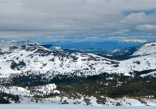
Looking north at Tahoe, the pack is pretty thick still.
It is not giving up too easily, that if for sure.  Winter wants to continue its hold on the weather, and is coming in with some brute force tonight.  First things are going to get cold.  And soon after, it looks like it will get wet.  And while this system will move through pretty quickly, there seems to be at least two other storms on its heels.  Winter, for certain, is not over.  Spring is going to have to do a little more than throw out a few random 80F plus days, it is wants to pull ahead.

I think the real big news here is that it is going to get cold tonight, and stay chilly over the next few days.  Sure, when the sun actually does poke out, it will warm things up a bit.  But it is still going to be chilly.  Today is pretty nice with warmer areas reaching about 70F, and sunny through most of the day.  This evening, the clouds build in pretty quickly and a cold front will pass through.  Freezing levels may briefly drop as low at 1500 feet over night.  Now that is January (well, in a normal year) cold with coastal highs in the mid to high 50s.  It looks like some time past midnight, we may see some rain, but the heaviest stuff will remain to our east.  And will mostly fall as snow.  Clouds and drizzle stick around for the rest of the work week.  Some clearing for the weekend, with partly cloudy skies and mid 60s ahead of the next system to arrive late Sunday.  Two storms for next week.

Melt water streaks Red Cliffs
The mountains may do pretty well from this system.  While it does not have a whole lot of moisture associated with it, the air will be very cold.  With increased snow to water ratios, a fair amount of fluff may fall.  And whatever does fall will be blower.  Along the crest we could see a total of a foot or two of new snow by Saturday morning.  The bulk of the snow will fall by noon on Thursday, with showers continuing into Friday.  Day time highs will peak early tomorrow morning in the mid 20s.  Lows in the teens are expected.  Things will warm up a bit by Saturday with a high of about 32F at 8000 feet.  So, until the sun gets on it, we have some powder in the forecast.  More snow in an already big year.  Someone appeased Ullr this season.

The snow pack has settled quite a bit over the past week.  A fairly decent pack can be observed at 5000 feet, with bare spots around south facing rocks.  It is receding quickly at lower elevations.  Once you get up to 6500 feet, there is still a lot of snow.  And while it has settled and burned out a lot at 8000 feet, there is still a tremendous amount of snow up there for April.  All the melt off has helped create significant runnels in the snow.  These can be observed both in the resorts and in the back country.  I was told to think of them as mini Alaska spines.  Regardless, they add a bit of texture to the snow pack, and it is good to know they will be under what ever new snow that falls.  This is what happens when you get 15 feet of snow in spring, followed by some very hot days.  Even the suncups are beginning to show.  Just the opposite of last year, when we did not see deformation in the snow surface until mid June.  Perhaps additional, lighter, but regular snow storms will slow the process.

Signs of spring are all around.
Remember how I said spring was here and you could put out your tropical plants like tomatoes.  Well, er, um.  Okay, they will be fine for the most part below 1500 feet (which is what I claimed), but it will get cold.  If you have some tender plants in the ground, and you live more than a few miles from the coast, it would be a good idea to get out some protection tonight.  A floating row cover or even just a card board box.  The good news is that we will have cloud cover, and it will be humid.  Cold clear nights are the worse.  And we will have the April sun to quickly warm things up in the morning.  At higher elevations, expect a bit of a freeze and perhaps some light snow.  This will be a cold April storm.  Also, expect a break in the strawberry production.  But don't fret, spring is fighting for its place.

Next week looks turbulent as well, with systems arriving both on Monday and Thursday.  We see a little back and forth over the next 10 days, then expect the jet to shift more to the north.  This would suggest warmer and dryer weather to finish out the month.  But as usual, it is too early to tell, and this time of year, things can change pretty quickly.  Sun today, clouds, cold and some rain tomorrow.  Friday is gloomy, with a little sun and a bit of warming for the weekend.  More storms next week.

Sunday, April 3, 2011

That Was Rough, Eh. Rebound Today Through Mid Week.

It almost rained yesterday.  Actually, it did rain yesterday at 8500 feet, in areas along the Sierra Crest.  Down here in Santa Cruz, it was mostly muggy through the middle part of the day.  Blue skies broke for a few hours in the late morning.  And it was crisp.  Especially when compared to Friday.

Today should have a bit of chill in the air as well, but we will have plenty of sun to help warm the soul.  Things started off in the low 40s for the most part and will rise through the mid 60s and even hit 70F in some areas.  Again, Santa Cruz is looking to be a toasty location.  The south bay is starting to warm up and looks to be the warmest area on the water.  SF keeps its cool, as usual.  The central valley is also starting to gain some warmth, and does a great job of retaining it through the week.  In general mid to high 70s on Monday, mid 50s to low 60s on Thursday - and a slow transition in between.  We start off the week sunny and see clouds coming in by later in the day Wednesday.

Thursday brings with it a very slight chance of rain and mountain snow.  And a bit of cooling.  Freezing levels may drop below 4000 feet during the coldest periods, but it will be short lived.  More likely we will see snow up above 5500 feet and mostly rain below.  While is does look like the mountains will receive a few inches of snow, this is not a very wet system.  And the rain looks like it will miss the coastal region with this one.  That is not bad news.  Still, we should expect clouds.  Also, winds look to increase on Tuesday and Wednesday as this system moves into the area.

Surf outlook is decent for spring.  Friday was pretty spectacular with no wind in the morning, a solid swell and mid day temps in the 80s.  By Saturday morning a stiff NW picked up, shutting down all but the most protected Santa Cruz breaks.  Winds continued today as the swell dwindled.  Monday should be smaller wind swell, but the mid period swell begins to pick up out of the NW on Tuesday and gets into the decent size on Wednesday.  The best breaks will see waves in the over head to double overhead range mid week, slightly easing toward the end of the work week.  The concern right now is over winds, which look to be strong (out of the NW) as the swell peaks.  Still, for April, this looks like a fun week of surf.

Tonight we expect a solid freeze in the mountains, setting us up for some good corn skiing Monday.  Over the weekend, things were a bit sticky, as warm nightly temperatures kept the mank factor high.  Early in the week, with the cold nights, and sunny days, should see some good skiing.  Thursday looks to be a bit of a storm day, with a frozen surface, and little fresh snow.  Friday looks to have similar conditions, but a little fresh snow may begin to build up.  More of the same for Saturday, and clearing begins by Sunday.  This coming weekend will be a mixed bag, with Sunday looking to be the best day.  Still, it will be cool, and not so much for T-Shirt days.

So, this week starts out pretty nice, with tomorrow being the warmest.  Breezy conditions, and cooling begin Tuesday.  Clouds come in late Wednesday night and stick around for a few days.  Some chilly weather for the end of the work week.  Saturday we begin to see a transition late, and Sunday looks fair. More clouds and precipitation as you head east.  And again, Santa Cruz looks like it may be spared too many clouds, thanks to our facing south into the bay.

Friday, April 1, 2011

Just a Taste. Bikinis Today, Sweaters Tomorrow.

Chillin'
OMG.  It is so nice out there today.  Yesterday was warm, but this is off the hook.  This morning began cool, with morning lows in the mid 40s.  By lunch time we broke 80F, and peaked at close to 90F earlier this afternoon.  Some records probably were broke today, and if were not for an afternoon sea breeze kicking up, it would have been a sure thing.  That breeze helped cool things down quickly this afternoon along the coast, and we will see a lot of cooling by tomorrow.

This was a nice taste of what we can hope to get as spring churns on.  If we are lucky.  For those of you in the valley, you can expect weather like this to come within the next few months and stick around for a while.  For those of us on the coast, this is a rare treat.  Still, I hope you got to enjoy a bit of it today, as it will be at least a few weeks before we get another few days like these.

Saturday will be cloudy and much cooler.  Across the region we can expect high temperatures in the mid 60s.  That will feel pretty cold when compared to today.  The storm that is forecasted for our area looks like it will remain well north, and slide south just to our east.  That means it will most likely be dry tomorrow, with perhaps a passing shower or two.  But it also means that it will usher in even cooler air.  Some locations will not break 60F.  Also, the day's high will likely occur earlier in the day, with the passing of a cold front in the afternoon.  The evening will be breezy and Sunday, while offering up more sun, will start off cold. Some valleys in the Santa Cruz mountains may see over night lows dropping into the high 30s.


As a note, the ground out there is still very wet.  With the winds tomorrow night, there is a chance of trees toppling, as well as power lines being downed.  Use caution, and keep an eye out.  Speaking of wetness, we do have some good news to report.  Every major reservoir in the state is currently listed at above historical average, and several are over 80% of capacity.  With the deeper than average snowpack still sitting up in the Sierra, we are looking at an excellent water year.  And on Wednesday, our Governor declared the drought (that was declared 3 years ago) to be over.  And the snowpack was also reported at 165% of average, but official reports will be released next week.

Next week will see some warming, but nothing like the past few days.  60s in the city, and low 70s for Santa Cruz are expected on Monday and Tuesday.  Wednesday sees a little cooling, with a chance for rain and mountain snow to end the week.  The system for next week may stick around a bit longer and bring showers for the weekend.  More on that as we get closer.  The following week looks like a similar pattern with a few nice days to start and a few not so nice days to end.  It is spring, so this is to be expected.  While it may feel like it today, it is not summer yet.