 |
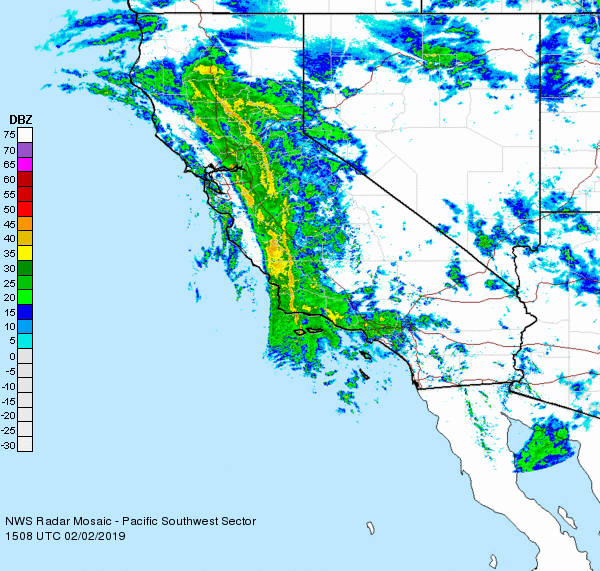
| Impressive band of moisture arcing across the state. |
It is currently 50F out there and not expected to get much warmer than that over the next few days. In fact, the big news is the colder air filtering in with each new wave of storms. By Wednesday morning, we could be looking at morning temperatures in the mid to low 30s. Freezing levels are expected to drop down to between 2000 and 1000 feet above sea level. That would mean we would see snow on the top of Route 17. And on the top of the mountains around the Bay. Anyone want to hike for some turns or a snowball fight? Tuesday and Wednesday are the days.
This storm is just now reaching the Sierra. A few inches on the ground already, but a lot more to come in the next 24 hours. And then, sort of a break Sunday morning to mid day, then colder air and lot more snow. Forecast models last night were calling for up to 6 feet at lake level with a to more at the peaks. Like u to 10 feet, with localized amounts of 13 feet. This is a Tahoe storm.
A grey sky and winds are the name of the game today. Rain this morning, with showers by afternoon, and maybe a big enough break to get out for a hike.
No comments:
Post a Comment